Grand Canyon: two different clocks
By Natural wonders · myAudience
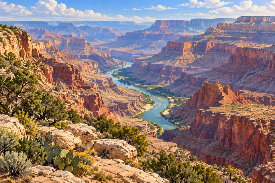
myAudience · original AI-generated landscape illustration · Original generated illustration; no documentary accuracy, current-condition or exact-viewpoint claim
The Grand Canyon lets you look down through an enormous stack of geological history. Its exposed rocks preserve a record reaching roughly two billion years into the past. That does not mean the canyon itself is two billion years old: the rocks and the gorge have different ages.
The Colorado River cut into an uplifted landscape, revealing layers that were previously buried. From the rim, the broad shelves and narrow spires make a useful visual distinction: the landscape is an excavation through rock, not a collection of mountains rising from an otherwise flat floor.
Height also changes the living landscape. Forested plateaus, dry slopes and river-edge habitats exist within a relatively compact horizontal distance. The canyon therefore holds ecological transitions as well as geological ones, and its springs and river are important parts of the wider system.
Human history belongs in this view too. Indigenous communities retain ancestral relationships with the canyon, and archaeological evidence records long adaptation to its terrain. A sweeping panorama can reveal the scale, but neither an empty-looking photograph nor a geological diagram represents the whole story.
Image: illustration, not a documentary photograph.
Further reading
The Grand Canyon opens two histories at once. The walls expose rock assembled over a very long interval, while the canyon is the later space cut through that material. A band of stone and a valley carved into it are not the same object and need not have the same age. Start with the river in the image, then follow the terraces and cliffs upwards. The river helps explain excavation; the layers tell stories about environments that existed before that excavation began.
The National Park Service organises the broad explanation around deposition, uplift, downcutting and erosion. Sedimentary layers were formed over older basement rocks, the region was raised, and the Colorado River subsequently incised the plateau. Tributaries and slope processes contributed to widening. The distinction matters because a young river can expose much older material without having created that material. The park's account also separates the fairly well-understood processes of erosion from less settled questions about how the river acquired its particular route and how different drainage sections became connected.
UNESCO identifies the canyon's unusually extensive exposed geological record and the range of habitats associated with its changing elevations. The landscape therefore rewards both a long view and a closer reading. Cliffs, slopes and terraces are clues to differing materials and responses to weathering, while a rock sequence can preserve evidence of changing environments. A layer is not automatically a complete record of every moment between two dates. Deposition can stop, material can be removed, and later rock can cover an interrupted surface. The visible succession needs to be interpreted rather than treated as a continuously running clock.
The principle of superposition gives a useful starting rule: in an undisturbed sedimentary sequence, a lower layer was deposited before the layer above it. The qualification is essential. Later faulting, tilting or overturning can change the arrangement, and an intrusive body requires another line of reasoning. A geological explanation therefore combines several observations. Order can establish a relative sequence, while fossils and suitable dating evidence can add other constraints. Colour alone does neither job: two differently coloured bands do not announce their exact ages or identify their formation names.
Use a fictional cross-section to practise that reasoning. An undisturbed sequence has layer A beneath B, and an erosional surface cuts the top of B before C is deposited above it. The supported order is A, then B, then erosion, then C. The interruption is part of the history even though it is represented by a surface rather than a thick layer. We cannot calculate its duration from this arrangement alone. A drawing can show a relative relationship clearly while leaving the absolute ages and the length of missing time open.
A separate fictional river calculation illustrates gradient. A channel losing sixty metres of elevation over forty kilometres has a mean gradient of 1.5 metres per kilometre, or 0.0015 when both lengths use metres. That ratio does not make every short section identical. The canyon also has human histories that are not captured by a slope calculation. The National Park Service describes eleven contemporary tribes with cultural links to the area and Native guides contributing to later explorers' journeys. Geological interpretation and living relationships answer different questions. Reading both prevents an apparently empty scenic panorama from being mistaken for a place without people or history.
In the illustration, the river provides a continuous guide through a succession of stepped walls. Compare the broad benches with the steep faces and notice that the foreground vegetation occupies a different visual level from the water. The rendering makes layered terrain easy to inspect but is not a stratigraphic log or survey of a named viewpoint. Its colours cannot be used to assign formation ages, and its apparent distances are not a scale for calculating gradient. The picture introduces questions that field observations and geological records can answer.
Check: A guide says that the fictional erosional surface between B and C lasted exactly one million years and that the reach's gradient is 1.5 per cent. Evaluate both claims. Answer: The cross-section establishes that erosion occurred after B and before C, not its duration; dating constraints would be needed. The gradient is 60 divided by 40,000, giving 0.0015 or 0.15 per cent, not 1.5 per cent. Keep relative order, elapsed time and slope in their correct units. These fictional results explain reasoning methods and do not date a Grand Canyon unconformity or measure the actual Colorado River.