Iguazú: a waterfall with a forest around it
By Natural wonders · myAudience
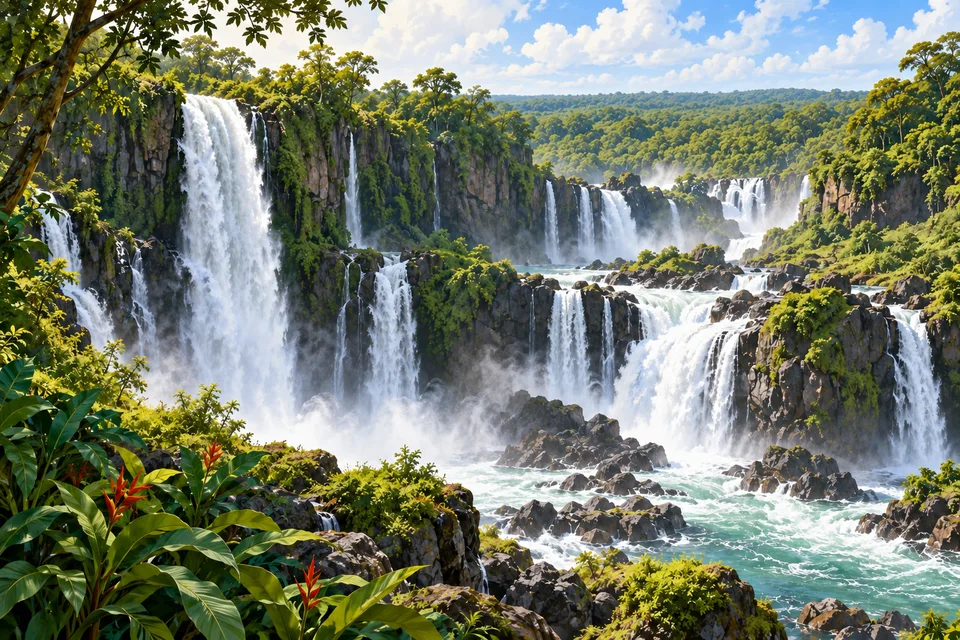
myAudience · original AI-generated landscape illustration · Original generated illustration; no documentary accuracy, current-condition or exact-viewpoint claim
Iguazú is a system of cascades rather than a single narrow waterfall. Along the border between Argentina and Brazil, the river breaks into a broad, curved succession of drops. Its Portuguese name, Iguaçu, appears in the Brazilian park; Iguazú is used in Argentina.
Water, rock and spray create the spectacle together. Forested islands interrupt the flow, while mist repeatedly obscures and reveals the cliffs. The changing boundary between river and air is as important to the view as any individual cascade.
The parks on both sides protect substantial remnants of the interior Atlantic Forest. These are habitats for animals including jaguars, tapirs and giant anteaters, not simply ornamental greenery behind the falls. A species occurring in the forest is not a promise that a visitor will see it.
The surrounding landscape has been heavily altered by agriculture, forestry and settlement. Connections between protected areas matter because wildlife and water do not stop at a park boundary. The falls are the visual centre of the scene, but the forest helps explain why the place is ecologically significant.
Image: illustration, not a documentary photograph.
Further reading
Iguazú's waterfalls appear as many separate curtains rather than one simple line. Islands, channels, exposed rock and forest create a landscape of repeated movement, with spray connecting the water to surrounding vegetation. The falls lie between Argentina and Brazil, and the protected forests on both sides matter to their ecological story. A view concentrating only on the tallest drop misses the river's broader arrangement and the habitats beyond it. The useful starting question is how water, rock and living communities form one connected system.
The Iguazú River drops through a basalt gorge before continuing to the Paraná. UNESCO recognises the Argentine Iguazú National Park and the neighbouring Brazilian Iguaçu National Park as distinct properties protecting an interconnected landscape. Argentina established its national park in 1934; the two World Heritage inscriptions followed in 1984 and 1986 respectively. These dates concern different forms of designation. An international border divides administration, but flowing water and animal movement do not stop at that line. Conservation consequently needs cooperation across more than one jurisdiction.
Spray changes conditions beside the falls. Droplets wet nearby surfaces and vegetation, producing a humid environment that differs from areas farther from the river. This helps explain why the scene includes dense greenery close to turbulent water. A microclimate is a local pattern of conditions within a wider climate, not a claim that every part of the park stays equally wet. Exposure, distance, shade and wind affect where moisture goes. Comparing vegetation near the spray with a sheltered or higher site asks a testable ecological question rather than assuming one photograph represents the whole forest.
Argentina's park authority distinguishes dense forest on higher, flatter ground from lower, more open forest and cane growth on slopes or beside streams. Riverbanks and islands support another arrangement of vegetation. Soil, relief and water regime therefore help create several habitats within an area that looks uniformly green from a distance. Different vertical forest layers provide different opportunities for animals. A broad canopy view conceals that organisation: feeding near leaves, moving across the forest floor and using river margins involve different resources and risks.
The park authority's emblem species, the great dusky swift, returns to roost behind curtains of falling water. This is a concrete example of wildlife using an environment that might seem inaccessible to people. It also shows why habitat cannot be judged only by whether it is comfortable for a human visitor. The surrounding Atlantic Forest supports many other species, but a picturesque rendering cannot confirm the presence of any named animal. Records of tracks, calls and observations have different strengths; finding one kind of evidence should not be expanded into an unsupported population estimate.
The parks protect a remnant of the Interior Atlantic Forest within a much more altered surrounding landscape. A protected patch needs attention to what happens beyond its boundary: habitat connections, runoff and nearby land use can affect its ecological function. Imagine two forest patches separated by cultivated land. A corridor may help some animals move, while its width, vegetation and disturbances influence which species can actually use it. This general example explains why an intact waterfall vista is not sufficient evidence that the surrounding ecosystem faces no pressure.
The illustration preserves the broad relationship among multiple cascades, rock steps, river channels, spray and forest. It is not a measured plan of the named waterfall system or a record of current discharge. The main and medium versions show more individual drops; the small thumbnail mainly communicates the overall watery, wooded setting. No visible leaf or rock shape should be treated as a verified taxonomic or geological sample. Use the picture to generate questions about water paths and habitats, then use actual field records to answer them.
Check: Two fictional forest plots contain the same number of tree species, but one is beside constant spray and the other is on higher, drier ground. Does equal richness prove identical habitat, and would one continuous waterfall photograph resolve the issue? Answer: No. Richness counts species without describing their identities, abundance, soils, moisture or structure. The plots could contain different communities or different proportions of the same species. A photograph may suggest a setting but cannot establish those measurements. Comparable surveys and environmental records are needed; apparent greenness and a single count do not fully describe ecological similarity.