Mosi-oa-Tunya: water cutting a path through basalt
By Natural wonders · myAudience
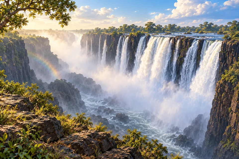
myAudience · original AI-generated landscape illustration · Original generated illustration; no documentary accuracy, current-condition or exact-viewpoint claim
At Mosi-oa-Tunya, also known as Victoria Falls, the Zambezi plunges into a deep basalt gorge on the Zambia–Zimbabwe border. The wide waterfall is only the beginning of the geological story: downstream, a succession of gorges records a river reshaping its route.
The falling water produces clouds of spray, mist and rainbows. These are physical features of the landscape, changing with flow and light, rather than a permanent arrangement guaranteed from every viewpoint. The river and the gorge create a scene that is always in motion.
UNESCO recognises a transboundary property spanning protected areas on both sides. Its value includes active land-forming processes as well as the spectacular curtain of water. A photograph of the front edge misses the branching relationship between the river upstream and the confined channel below.
Basalt cliffs, riverine vegetation and breeding habitat for birds belong to the same setting. Thinking of the falls as an evolving river landscape makes the view more interesting than treating it as a single height or width record. The scale is impressive, but the way flowing water works on resistant rock explains what you are seeing.
Image: illustration, not a documentary photograph.
Further reading
At Mosi-oa-Tunya, the river changes character abruptly. Broad water meets an edge, drops into a narrow gorge and rises again as spray. The scene brings together three forms of movement: the river's downstream flow, falling water and droplets carried into the air. It is also a meeting of river and rock. Understanding the falls means looking beyond the curtain to the channels above, the structure beneath and the gorges downstream, where earlier positions of the waterfall remain part of the landscape's history.
The World Heritage property crosses the border between Zambia and Zimbabwe and includes the falls, adjacent riverine areas and associated gorges. UNESCO describes a broad sheet of water entering basalt terrain, with spray helping sustain a humid forest near the falls. The spray zone connects river flow with a local habitat: the influence of the water continues beyond the visible channel. That relationship helps explain why conserving the waterfall is not only a question of protecting a viewpoint. River processes, vegetation and the surrounding space form an interconnected natural system.
Zambia Tourism's geological account explains retreat through weaknesses in the basalt. One prominent set of joints lies across the river's direction, while other joints provide narrower routes connecting them. Erosion can concentrate into a connecting passage and eventually reach another transverse weakness, establishing a new broad fall upstream. This repeated change helps explain the zigzag sequence of gorges. The account is a geological interpretation of patterns in rock and channel, not a claim that the present waterfall has occupied exactly the same edge throughout its history.
A river does not need to remove equally strong rock everywhere at the same rate. Flow can exploit a crack or less resistant material, enlarge that route and increasingly pass through it. This creates a feedback: concentrating water changes where erosion acts, and erosion changes where the water concentrates. The general principle helps us read the gorges as a history of changing pathways. It also explains why one neat retreat rate cannot simply be extended indefinitely. Conditions can change when the river encounters a different joint, material or channel geometry.
The falls offer a clear example of gravitational energy. In a fictional model, ten kilograms of water descends through one hundred metres. Taking gravitational acceleration as 9.8 metres per second squared gives a potential-energy decrease of 9,800 joules. During the descent and impact, that energy is redistributed through motion, turbulence, sound and heating. The calculation does not mean all of it could be captured as useful power. It describes a specified quantity of water and height, not the actual discharge or output of machinery at the waterfall.
The spray has an ecological consequence as well as a visual one. UNESCO describes a discontinuous riverine forest in the splash zone, supported by water and high humidity from the plume. The gorges also provide habitat used by birds, connecting the form of the river's path with living communities. The forest should not be confused with an entire region receiving the same moisture: the influence is spatially uneven. A comparison of vegetation near and far from the spray can introduce a question about local conditions, but demonstrating the cause of a particular plant distribution requires observations through time, not the colour of one scene.
The illustration emphasises the long edge, the narrow space below and a rainbow in the mist. Trace the line of water downwards, then notice how the vegetation stands outside the channel but near the spray. This composition is useful for connecting waterfall mechanics with the humid surroundings described in the sources. It is an illustration, not a measured cross-section, present flow report or safe-access guide. No position of a rainbow, river level or route through the gorge can be verified from it.
Check: For the fictional two-hundred-kilogram-per-second flow dropping one hundred metres, calculate ideal gravitational power. A caption calls that number the guaranteed output of any turbine installed there. Is the caption justified? Answer: Multiplying 200 by 9.8 by 100 gives 196,000 joules per second, or 196 kilowatts. It is an ideal energy rate for the stated model, not guaranteed electrical output. Real equipment, usable head, losses, changing flow and environmental constraints matter. Neither the calculation nor the illustration provides evidence for an actual installation or its permission to operate at this transboundary heritage site.