Plitvice: lakes built by moving water
By Landscapes worth protecting · myAudience
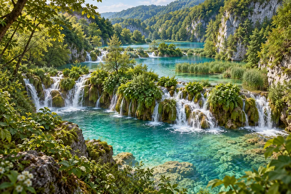
myAudience · original AI-generated landscape illustration · Original generated illustration; no documentary accuracy, current-condition or exact-viewpoint claim
Plitvice’s lakes are divided by natural barriers that continue to form as water flows. Calcium carbonate deposited from the water creates tufa, gradually building dams and shaping the connections between pools and cascades. The landscape is an ongoing process rather than a finished sculpture.
Living organisms participate in that process. Mosses, algae and aquatic bacteria interact with water and mineral deposition, showing how biological and geological activity can become inseparable. The waterfalls are not merely water passing over an unrelated rocky backdrop.
The upper and lower lakes occupy different geological settings. Broadly, the upper lakes lie in dolomite with gentler relief, while lower lakes sit within a limestone canyon. This helps explain changes in the shape of shores and the surrounding landscape.
Forests and meadows make up much of the national park and are important to the water system. Its conservation is therefore about more than preserving turquoise pools for photographs. The wider habitat supports wildlife, while the delicate barriers depend on conditions throughout the connected landscape. Every cascade belongs to a network of water, rock, vegetation and living surfaces.
Image: illustration, not a documentary photograph.
Further reading
At Plitvice, a waterfall is part of a changing system rather than an ornament placed on a finished landscape. Water crosses barriers and enters connected pools, while the barriers themselves can grow or break. To read the scene, follow both movement and formation: where does water pass, and how did the structure across its path develop? Those questions join geology with living surfaces. They also prevent a static image from becoming an assumption that every lake and cascade will always remain the same.
The water's dissolved cargo helps explain why rock can grow where water spills. Plitvice's park authority identifies calcium bicarbonate in the mineralised water and calcite crystals deposited at riffles and barriers. A useful general carbonate reaction is Ca²⁺ + 2 HCO₃⁻ ⇌ CaCO₃ + CO₂ + H₂O. Losing dissolved carbon dioxide can favour calcite deposition; the National Park Service explains this mechanism for carbonate waters in caves. It provides the chemical principle, not a transfer of a cave's temperature, growth rate or groundwater measurements to Plitvice. At the lakes, mineralised water, biological attachment surfaces and suitable local conditions together make a solid barrier possible.
Living communities participate in that formation. The park's explanation describes small calcite crystals adhering to matter secreted by algae and bacteria, creating sites where further deposition can occur. Mosses and other organisms contribute to the forms that develop. This is not a claim that moss manufactures all the rock by itself. It is an interaction between water chemistry, mineral deposition and biological surfaces, which helps explain why conserving a waterfall involves conditions beyond its visible edge.
Connections between barriers and pools matter as well. The authority explains that barriers do not all grow at the same rate and that changes downstream can affect a barrier or pool farther upstream. A rise in one structure therefore cannot be translated automatically into an equal rise in every lake. To understand a change, we would need information about connections, water movement and the particular geometry. The relevant unit of explanation is often the network rather than one attractive cascade.
For a simple fictional calculation, suppose a monitored barrier has a stipulated net rise of four millimetres per year for three years. Under that constant-rate assumption, the model gives four times three, or twelve millimetres. 'Net' already describes the combined result rather than proving that nothing was removed. This is an arithmetic example, not a measured Plitvice rate. Extending it to a different barrier would require evidence that the conditions and response were sufficiently comparable.
The park distinguishes sixteen larger named lakes, alongside smaller unnamed ones, linked by waterfalls. They formed as growing tufa barriers interrupted a former river valley, creating places where water could accumulate behind the barriers. This is a feedback between material and flow: a deposit changes an outlet or water path, and water continues delivering dissolved material to surfaces along that path. Living forms also shape the deposits. The authority describes moss becoming encrusted while its form remains in the porous rock, and other moss growth continuing above mineralised lower parts. Tufa is therefore a record of interactions at many scales, from crystals and living surfaces to the connected pools visible in the scene.
In the illustration, compare the low vegetation-covered lips of the cascades with the larger rock walls, and trace water between the pools. These visible relationships support discussion of a connected landscape. The chemistry and microscopic communities are not shown, so they come from the source explanation rather than identification in the pixels. The image is an interpretation of the setting, not a measured barrier profile, a map of named lakes or proof of current growth at any pictured edge.
Check: A fictional model stipulates net growth of four millimetres per year for three years. A guide applies twelve millimetres to every barrier and guarantees the same rise in every lake. Evaluate it. Answer: The stipulated calculation is four times three equals twelve millimetres for that model. It does not establish equal growth across barriers or a universal water-level response. Connections, outlet relationships and changing conditions matter. Distinguish a measurement, the constant-rate assumption and its possible hydrological consequences before extending the result.