Fiordland: ice-shaped valleys opened to the sea
By Landscapes worth protecting · myAudience
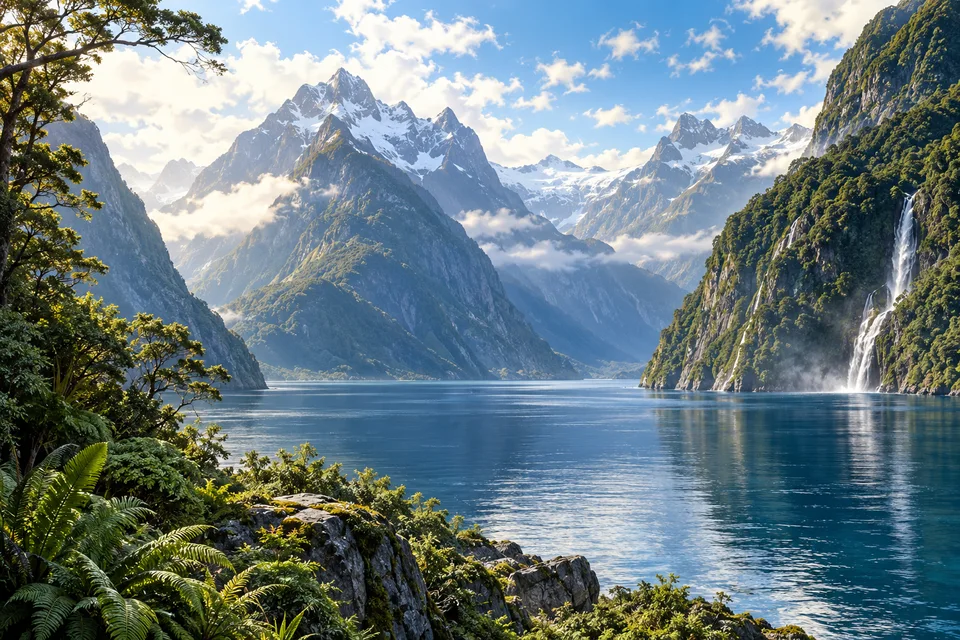
myAudience · original AI-generated landscape illustration · Original generated illustration; no documentary accuracy, current-condition or exact-viewpoint claim
Fiordland forms part of Te Wahipounamu, the large World Heritage region in southwestern New Zealand. Deep coastal inlets, steep mountains, forests and waterfalls reflect the combined influence of tectonics, climate and repeated glaciation.
Glaciers reshaped valleys and left troughs that became lakes or sea-filled fiords. The resulting forms help explain the dramatic contrast between near-vertical slopes and narrow waterways. Waterfalls and forested shores occupy a landscape whose large-scale geometry was strongly influenced by moving ice.
The wider property also includes the Southern Alps and the Alpine Fault, where major tectonic plates meet. Mountain building and glacial erosion operate at different timescales but contribute to the same region. The visible scenery is a meeting point between uplift and the removal of rock.
Its forests and wildlife preserve important connections to New Zealand’s long biological history. Changes in vegetation after glaciation can be studied across altitude, climate and surface age. A fiord panorama is therefore more than a dramatic coastline: it links the history of ice, the structure of the land and the development of ecosystems on newly exposed ground.
Image: illustration, not a documentary photograph.
Further reading
Fiordland connects mountains and sea through deep, steep-sided valleys. A distant view can make the water seem like a quiet lake, but a fiord is a coastal inlet shaped by a history of ice and flooded terrain. The surrounding forest, waterfalls and exposed slopes provide clues to relationships between land and water. The most rewarding question is not simply how high a cliff looks, but how a valley's shape, its rock and the water entering it help create different environments above and below the surface.
New Zealand's Department of Conservation identifies granite, gneiss and schist among Fiordland's rocks and explains that glaciers carved its valleys. Rock formation and landscape carving are separate processes. A glacier does not manufacture granite by scraping a mountainside; it acts on material already present. UNESCO places Fiordland within the broader Te Wāhipounamu South West New Zealand World Heritage property. That designation also includes other landscapes, so the name of the larger property should not be used as though it described a single inlet or one national park alone.
In a general glacial valley model, moving ice can erode material along its bed and sides. The resulting broad cross-section differs from the narrow V commonly used to illustrate river incision, although real valleys inherit complicated earlier histories. When a coastal valley becomes occupied by seawater, its shape continues to influence the enclosed marine environment. Draw a cross-section with a deep inner basin and a shallower entrance to ask how exchange with the open sea might differ from that of an exposed coast. This is explanatory geometry, not a surveyed profile of a named fiord.
DOC describes a distinctive surface layer formed by rainfall runoff over seawater. Tannins washed from vegetation darken this freshwater and reduce the light passing through it. The thickness varies, so a fixed depth should not be assumed everywhere. This links a forested catchment with an underwater light environment: material transported from land can affect conditions in the sea. The marine reserve account describes communities including corals and sponges below that surface layer. Their presence cannot be established from an above-water image, however detailed its mountains and waterfalls appear.
An original light model helps clarify the mechanism without reproducing a measurement. Suppose a clear surface layer transmits eighty of every hundred incoming light units, while a darker layer transmits forty under otherwise identical conditions. The second model delivers half as much light to the water immediately beneath it. This simplified comparison ignores scattering, wave motion and changing depth; it isolates transmission through the surface layer. It does not prove that all organisms below receive the same illumination or that those fictional proportions describe Fiordland's actual freshwater layer.
Protection also depends on boundaries and activities. DOC identifies marine reserves bordering Fiordland National Park and particular areas where anchoring can damage fragile marine life. A land park boundary and a marine reserve boundary perform different jobs, even where their edges meet. For a classroom map, place the catchment, shoreline and marine protected area on separate layers, then consider what each layer can and cannot control. Local conservation involves current rules, scientific observations and tangata whenua relationships; the illustration offers neither permission to collect material nor a substitute for those sources.
The illustration shows a forested water edge, steep rocky mountains, snow-like high areas and a waterfall descending on the right. All three responsive versions retain the mountain-water relationship, while the smallest suppresses fine vegetation detail. It does not authenticate a particular Milford or Doubtful Sound viewpoint, identify exposed rock types or reveal the freshwater layer. The pale water reflections are a composition feature, not an underwater habitat survey. Use the scene to connect a catchment with a marine basin, then turn to mapped and measured evidence for specific claims.
Check: In the fictional transmission model, one layer passes eighty light units and another forty from the same hundred incoming units. Calculate the relative change, then explain why the image cannot establish black coral abundance. Answer: Transmission falls by forty units, or fifty per cent relative to eighty; forty is half of eighty. Those invented values describe only the simplified light boundary, not real conditions at depth. An above-water rendering contains no underwater colony counts or survey method. Glacial carving, existing rock, runoff and marine communities require different evidence, even though they belong to one connected landscape.