Cotswolds: the limestone beneath the postcard
By Landscapes worth protecting · myAudience
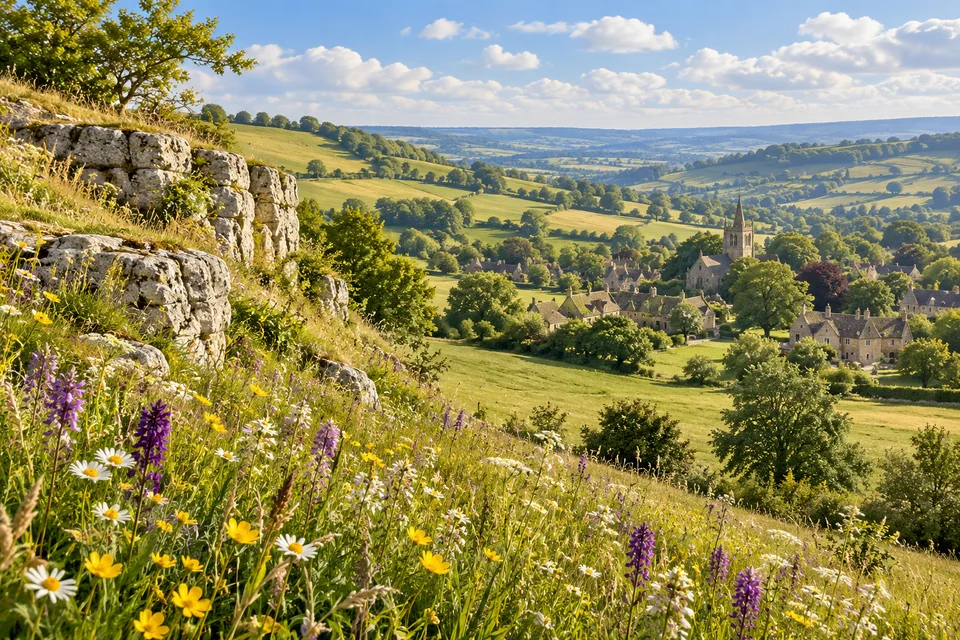
myAudience · original AI-generated landscape illustration · Original generated illustration; no documentary accuracy, current-condition or exact-viewpoint claim
The Cotswolds’ underlying Jurassic limestone ties together its escarpment, grasslands and many familiar buildings. A village street and an open hillside may look like different subjects, yet their materials and forms belong to the same wider landscape.
The Cotswolds National Landscape remains a designated Area of Outstanding Natural Beauty, or AONB. The modern public-facing name does not mean that the statutory designation has disappeared. Nor does it make the area a national park: protected landscapes have different legal and management arrangements.
Wildflower-rich limestone grassland is a particularly important habitat. Conservation work includes restoring it and securing long-term management through farming and community involvement. Attractive open grassland is not automatically ecologically rich; management and the variety of plants make a difference.
The official landscape assessment distinguishes nineteen character types, including enclosed limestone valleys. That diversity makes the area more interesting than a single image of honey-coloured cottages. Broad hills, valleys, wooded areas and settlements create a changing pattern, while protection has to connect landscape character with livelihoods and the recovery of habitats.
Image: illustration, not a documentary photograph.
Further reading
The Cotswolds reward a slow comparison between hillside and village. Pale rock appears in the foreground, plants grow beside it, and masonry repeats similar tones farther away. Instead of treating this as one familiar style, ask how materials, water and people became connected. The scene opens several histories at once: rocks supplied resources, settlement responded to conditions, and land management shaped habitats. None of those connections means that every building has the same origin or that all green fields contain the same wildlife.
The pale building stone began in a very different setting from today's villages. The British Geological Survey explains that the Cotswold Hills include oolitic limestones and mudstones: the rounded calcium-carbonate grains in oolitic limestone formed in warm tropical seas. Resistant limestone helps support the high ground, while changes to less resistant rock contribute to differences in relief. Around Bath, stone was extensively quarried, including shallow mines near Combe Down and Box. This links a marine sedimentary history with later construction. The same source also identifies limestone as an aquifer, showing that the rock's significance extends from walls and roofs to the storage and movement of groundwater.
A regional description must leave room for variation. The official landscape strategy distinguishes nineteen character types, including valleys, slopes and plateau landscapes. These are an assessment framework, not nineteen separate parks and not a claim that each place is internally uniform. A proposal suited to one setting may not suit another. Comparing settlement pattern, enclosure, relief and vegetation is more informative than assuming that a single village photograph represents the entire designated area.
Habitat quality raises a different kind of evidence problem. A field can look pleasantly open while supporting a narrow range of plants, and a flower-rich illustration cannot establish an actual species list. The National Landscape's grasslands programme describes restoration using locally sourced seed and continued management. Such an intervention concerns composition and future care as well as appearance. To judge its outcome, we would need comparable observations through time, with attention to season and recording method, rather than infer recovery from one bright surface.
The programme's public account reports that restoration work was initiated on nearly five hundred hectares during 2019–2025. Notice the wording: initiating work is not the same measurement as demonstrating an ecological outcome on every hectare. A fictional report that replaces that statement with 'five hundred hectares fully recovered' changes the claim. It would need evidence of the criteria for recovery, monitoring and differences between sites. Recognising this distinction lets us acknowledge meaningful work without overstating what its area figure establishes.
The region's flower-rich grasslands need continuing care as well as a suitable substrate. Glorious Cotswold Grasslands describes collecting local seed with brush harvesters and using it to increase plant diversity in existing grassland or former arable land. The programme connects practical restoration with farmers, landowners and community organisations so that management can continue beyond the initial sowing. A locally gathered mix carries a different provenance from an unspecified packet of ornamental flowers. Establishment and later maintenance are also separate stages: seed introduces potential plants, while subsequent conditions affect what persists. This is why the flowers beside the pictured rock can introduce habitat processes without serving as a real species inventory.
The illustration brings an exposed rock edge, flowers, open fields and a stone-built settlement into the same view. That is a useful visual prompt for following a material from landscape into construction and for noticing changes of scale. The plants are part of an interpreted scene, not a botanical survey, and the village is not a certified location. We can use the image to practise comparison while keeping real habitat assessments, quarry identities and building histories grounded in observations and records.
Check: Two fields are equally green in a photograph. Restoration work has begun in one, and a caption declares both equally species-rich with recovery completed. Evaluate the claim. Answer: Colour cannot measure species composition or completed ecological recovery. Obtain comparable species records, management histories and monitoring over time, accounting for season and method. Starting work is not an outcome measurement. The photograph supports a limited statement about visible appearance; it does not provide a species census or establish that the two fields have reached the same ecological condition.
Author source references
- Cotswolds National Landscape: geology and AONB designation
- Glorious Cotswold Grasslands: restoration approach
- Landscape strategy: nineteen character types
- Natural England: AONB designation and management
- Cotswolds National Landscape: geology and AONB designation
- Further reading reference
- Further reading reference