Uluru: geology within a living cultural landscape
By Landmarks and their stories · myAudience
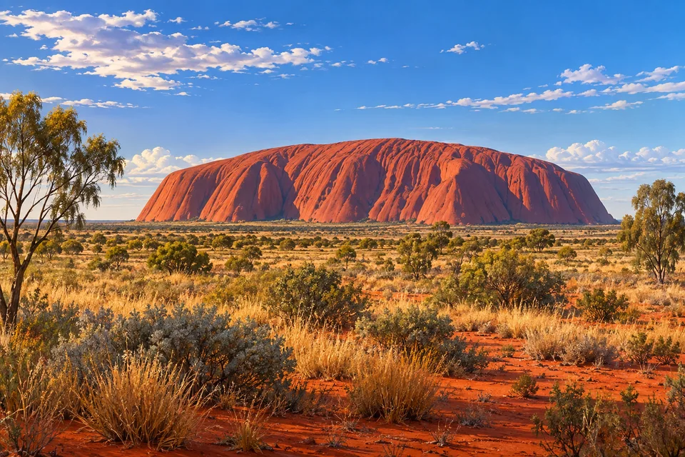
myAudience · original AI-generated landscape illustration · Original generated illustration; no documentary accuracy, current-condition or exact-viewpoint claim
Uluru and the domes of Kata Tjuta rise from the red plains of central Australia. Their forms make an immediate visual impression, but this is also a living cultural landscape belonging to the Aṉangu traditional owners.
The World Heritage property is recognised for both natural and cultural values. Those categories meet in the land itself: formations, places and relationships are not interchangeable with an outsider’s scenic interpretation. A geological account alone cannot explain all the site’s significance.
Uluru’s massive shape and Kata Tjuta’s separate domes offer different silhouettes within the same regional setting. Treating them as identical landmarks would lose that distinction. Their surrounding plains also contribute to the scale and visual character of the landscape.
A broad illustration can acknowledge the visible forms without pretending to represent restricted cultural knowledge. It should avoid invented sacred motifs, fabricated ceremonies and claims that the picture reveals a complete traditional story. The useful starting point is recognition that the landscape has custodians and continuing cultural meaning, rather than presenting it as an empty object waiting for visitors to discover it.
Image: illustration, not a documentary photograph.
Further reading
Uluṟu rises from a broad plain, but its visible outline is only one way into the place. The rock has a geological history, its surface changes with light and weather, and it belongs within Aṉangu Country and knowledge. These perspectives need not be collapsed into a single explanation. Looking at the formation can begin a scientific question about sediment and deformation; learning from the public cultural account begins another question about relationships, responsibility and appropriate ways of encountering the land.
Parks Australia's geology account traces material from eroding mountains into large sediment fans, followed by burial, consolidation and later deformation. The sandy material became the arkose of Uluṟu, while coarser material contributed to Kata Tjuṯa's conglomerate. Arkose is a sedimentary rock; a large exposed rock formation is not automatically a volcanic plug. This sequence connects present form with material that was transported and deposited before it was raised and exposed. The visible landform is therefore a later expression of an older rock history.
The same public account describes strongly tilted layers at Uluṟu and the weathering of iron-bearing minerals contributing to its red surface. The relationship between red surface and grey rock provides a useful distinction between appearance and composition. A surface can record chemical change while the underlying material retains another colour. Light and wetness can also alter what the eye sees. A sunset image alone cannot tell us how much iron a rock contains or whether a darker patch has a different geological origin; those questions need observations and material analysis.
Consider a general model of tilting. Sediment is deposited in approximately horizontal beds, then a later deformation rotates those beds. Once the package is tilted, an exposed vertical face can display stripes that are not annual growth bands or separate modern constructions. Orientation is evidence about arrangement, not a complete date. A diagram can make the sequence of deposition before deformation clear without supplying the tectonic forces, full duration or every intermediate event. The model helps separate how rock formed from how its layers came to stand in their present position.
Parks Australia's public account of Tjukurpa describes a foundation for Aṉangu life connecting law, relationships, ancestors and the environment. It is not presented as an entertaining story detached from daily responsibilities. The account also explains that knowledge is passed to people with appropriate rights and that some sacred information remains protected. Learning from publicly shared material therefore involves respecting the boundary of what has been shared. An educational post can describe that principle without inventing ceremonies, reproducing restricted designs or pretending to speak on behalf of the custodians.
UNESCO recognises both the formations and the living cultural relationship with the place. Conservation can consequently involve more than holding a shape fixed for distant viewing. How a place is interpreted and how visitors behave can matter alongside care for its physical features. A geological account of sediment does not cancel a cultural account of responsibility; they answer different questions about the same Country. Treating them together requires being clear about whose knowledge is being presented and avoiding the assumption that every meaningful feature is available for unrestricted display.
The illustration uses warm light to separate the rock from the plain, with vegetation creating a foreground scale. It shows an exterior landscape rather than invented sacred imagery. The visible grooves invite questions about weathering and rock structure; the park’s geological account, rather than the rendered lines, establishes the tilted bedding. The rendered geometry should not be used as a measurement. The colour is an artistic choice, not a laboratory result, and the viewpoint is not certified. Public geological and cultural sources supply the context that a striking silhouette cannot contain by itself.
Check: A fictional guide calls Uluṟu a volcanic plug because it is one large rock, and says public access to a landscape makes every associated story free to reproduce. Assess the two arguments. Answer: Size and outline do not identify rock origin; the park's geological account identifies sedimentary arkose and a sequence of deposition, consolidation and deformation. Public visibility also does not grant authority over protected cultural knowledge. Use material evidence for geological claims and the custodians' publicly shared guidance for cultural interpretation. The rendering supports neither a volcanic classification nor permission to invent or publish restricted stories.