Istanbul: a city organised by water and empires
By Cities to get lost in · myAudience
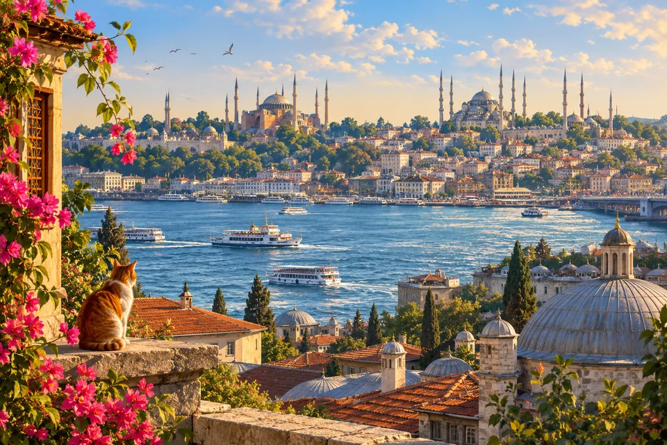
myAudience · original AI-generated landscape illustration · Original generated illustration; no documentary accuracy, current-condition or exact-viewpoint claim
Istanbul’s historic peninsula lies between the Golden Horn, Bosphorus and Sea of Marmara. This geography helped give the city strategic importance and continues to shape its skyline. Water is a framework for understanding the city, not simply a scenic background.
The city was a capital of the Eastern Roman and Ottoman empires. Its historic areas contain buildings from both periods, including Hagia Sophia, surviving fortifications, palaces, mosques and cisterns. Different architectural traditions accumulated rather than producing one uniform city.
Hagia Sophia’s sixth-century dome and the sixteenth-century Süleymaniye complex illustrate different moments in that history. Ottoman complexes could include educational, charitable and other facilities alongside worship spaces, showing how monumental architecture related to everyday urban institutions.
The World Heritage inscription covers four historic areas, including neighbourhood fabric as well as major buildings. Timber houses, streets and the setting of monuments contribute to the picture. A skyline illustration should preserve those relationships instead of assembling every famous dome into an impossible arrangement. Istanbul’s visual richness comes from successive structures responding to a real peninsula and its waterways.
Image: illustration, not a documentary photograph.
Further reading
Istanbul's historic peninsula can be read through three different relationships with water. The Golden Horn and the Sea of Marmara define edges of the land, while the Bosphorus connects wider seas and routes. Together they help explain why this setting mattered to successive capitals. Yet being surrounded by water is not the same as having a reliable supply for households or institutions. The city also needed systems to bring usable water to where people lived. That distinction connects the broad waterfront view with a less visible history below the streets. Boats, quays, reservoirs and pipes perform different tasks. Understanding those tasks makes the setting more interesting than simply calling it a meeting point between two continents.
The Basilica Cistern is a striking example of the hidden part of that history. Istanbul's municipal account associates it with Justinian in the sixth century and describes water supplied to the Great Palace and nearby structures. Its forest of columns was therefore part of useful infrastructure, not originally a theatrical underground attraction. A reservoir separates the time when water arrives from the time when it is needed: storage can keep a supply available between those moments. That is the basic purpose of a cistern, even though the quantities, sources and arrangements differ between places. Thinking about storage turns a seemingly mysterious interior into a response to a familiar urban need. The impressive space supported the life of buildings above it.
The municipal guide describes 336 columns arranged in a grid of twenty-eight by twelve. It also treats the reuse of columns from older buildings as a historical inference, rather than giving each one a fully known origin. Reuse puts different histories into one new structure. A stone component can retain signs of an earlier design while being given another job, and visual variety need not mean that an interior was assembled without an organising plan. The grid provides repetition and orientation; the differing components complicate the story within that order. A reader can appreciate both. The building becomes evidence of material being selected and reassigned, not a store of objects whose provenance can always be recovered from appearance alone.
Above ground, Hagia Sophia reveals a different kind of building problem. Justinian's sixth-century church joined a large central dome to an arrangement of arches, vaults and semi-domes. A dome is not held up by its visual lightness: its weight must pass through supporting elements towards the ground. The Metropolitan Museum's historical account records the collapse of the first dome in 558 and its reconstruction at a greater height in 562. That sequence matters because the achievement included revision after failure. An immense space could be realised, but its behaviour under load and disturbance still imposed limits. The result should be admired as engineering developed through experience, rather than imagined as a perfect solution that never needed correction.
The materials add another layer to that story. The museum describes coloured marble surfaces, ornamental stonework and reused columns in Hagia Sophia's interior, while recording later changes in decoration and use. Structural function and visual effect can coexist: a surface can direct attention without carrying the same load as the support behind it. Changes in religious use also changed how the building was presented and understood. Those histories are related, but not interchangeable. A sixth-century design, a later alteration and a modern arrangement of access belong to different moments. Our reading concentrates on the documented historical sequence rather than carrying an older museum essay's endpoint into a claim about today's arrangements. The building's continuing life requires its own current guidance.
The Süleymaniye complex offers another way to connect a skyline with everyday institutions. UNESCO dates the mosque to 1550–1557 and associates it with Sinan, but also describes the surrounding educational and service buildings. The ensemble included facilities such as schools, a library, baths and accommodation for travellers. A large religious building could therefore organise an area through activities beyond the main worship space. Different users arrived for different reasons, and the connections between those functions mattered to the neighbourhood. From a distant view, domes and minarets create a legible silhouette. At street level, doorways, courtyards and routes explain how the institution worked as a place. Both scales belong to its history.
UNESCO's historic property includes four areas, so it is not a claim that every part of Istanbul belongs to one enclosed collection of monuments. The archaeological area, Süleymaniye, Zeyrek and the land walls introduce different forms of evidence: prominent buildings, neighbourhood fabric and defensive boundaries. A wall addresses separation, a reservoir addresses supply and a public institution gathers people. These functions help explain a city's organisation more clearly than a sequence of rulers' names alone. Looking at our waterfront illustration, the ferries and dense shore suggest movement and settlement, while the domed skyline introduces monumental architecture. The scene is an interpreted composite, not a diagram locating each protected component. Its value is as an invitation to follow those connections into the city's layered history.