Follow the chain from shaking to disruption
By UK GCSE Geography · independent study · myAudience
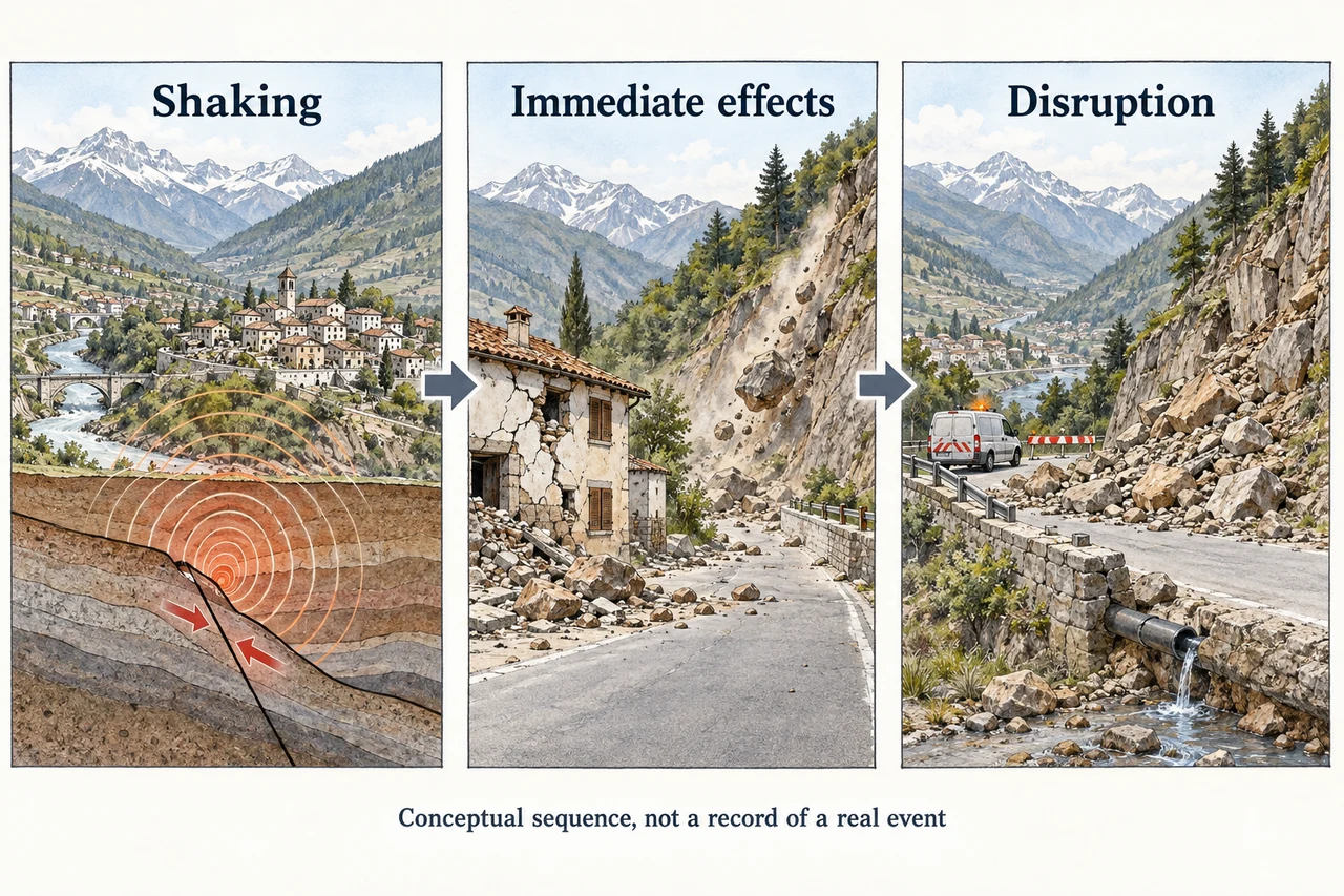
Image: illustration, not a documentary photograph. Original teaching model created for myAudience. · Original generated teaching illustration; no source textbook artwork reproduced.
Follow the chain from shaking to disruption
Earthquake shaking can directly damage a building, road or pipe. Those initial impacts can then trigger further problems: a damaged road may delay deliveries, while an interrupted water supply can close a clinic. Describing a causal chain is more useful than memorising two lists of effects. The illustration shows an imaginary mountain town so that its sequence is clear; it is not a photograph or reconstruction of the 2015 Nepal earthquake.
Classification needs explanation. A landslide triggered by shaking is a secondary physical hazard in the event sequence. A blocked road is an effect of that landslide; delayed access to medical supplies is a further consequence. Some immediate damage and later disruption occur at nearly the same time. “Primary” and “secondary” describe causal relationships, not a universal stopwatch dividing the first hour from the second.
A real evidence example is the 25 April 2015 Gorkha earthquake in Nepal, which USGS records as magnitude 7.8. A satellite-based research team mapped 4,312 earthquake-related landslides from the mainshock and aftershock sequence. That count describes mapped features under the study’s methods, not a count of destroyed villages or all slope failures everywhere. The investigators examined relationships with slope, shaking and rock types. Such evidence helps explain why steep terrain can complicate access after an earthquake.
Immediate responses concentrate on urgent needs such as search and rescue, safe shelter and restoring essential access. Longer-term responses include repairing infrastructure, improving building practices and planning recovery with affected communities. A road repair can be urgent and also support long-term recovery; justify a classification by its purpose. To compare two countries, use named events and checked evidence about impacts and capacity. This introductory lesson supplies only one real event and does not yet satisfy the specification’s contrasting-wealth comparison.
Worked example: A fictional assessment team records 20 damaged water mains;8 prevent water reaching clinics. A post claims “60% of damaged mains stopped clinic supplies.” Check the claim and explain one limitation.
Use the damaged mains as the denominator:8 divided by 20 equals 0.4.
Multiply by 100 to obtain 40%;60% is the share that did not have the stated effect.
The count does not measure affected people or the length of interruption; it cannot establish total humanitarian impact.
Answer: The stated share is 40%, not 60%. These fictional counts do not show how many people were affected or for how long.
Check your understanding: Why should a satellite inventory of landslides not be described as an exact total of all earthquake impacts?
Answer: It records one category of observed feature using defined methods, not every damaged service, injury or loss.
Why: Detection limits, image coverage and the category being measured constrain what a source supports. Reliable geographical analysis keeps its claims within those boundaries.