How circulation connects wet tropics and drier subtropics
By UK GCSE Geography · independent study · myAudience
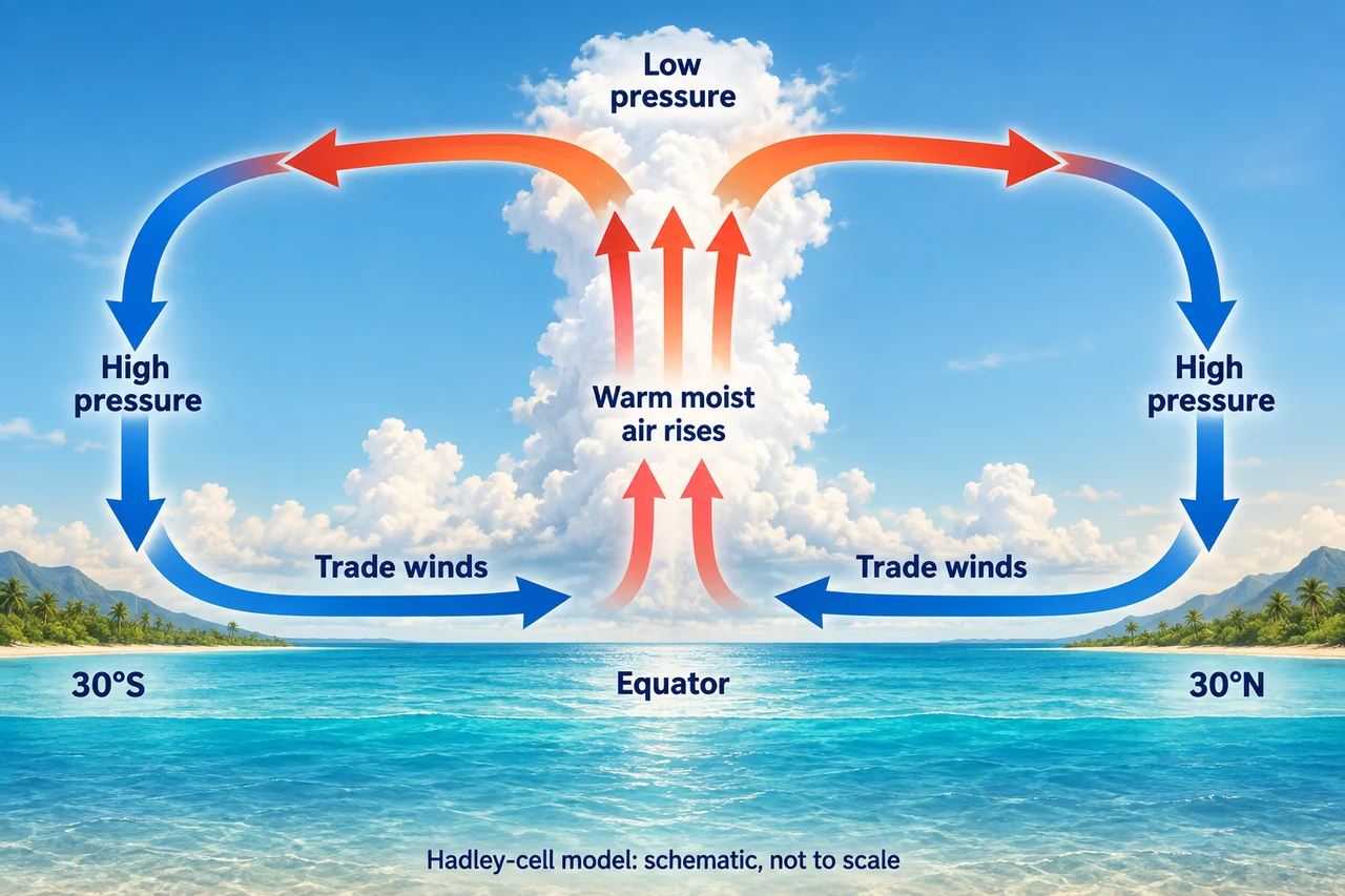
Image: illustration, not a documentary photograph. Original teaching model created for myAudience. · Original generated teaching illustration; no source textbook artwork reproduced.
How circulation connects wet tropics and drier subtropics
The Sun heats Earth unevenly. Broad atmospheric circulation redistributes energy and moisture; it is an average pattern across many weather systems, not a fixed track followed by every air parcel. In a simple Hadley-cell model, warm tropical air rises near the equatorial convergence zone, moves outward aloft and descends in the subtropics. Surface flow returns toward the convergence zone. The diagram shows this meridional loop, not east–west wind direction.
Rising moist air cools as pressure falls; condensation can produce clouds and heavy rain. Descending air warms by compression and often discourages cloud formation. This helps explain broad rainforest and desert belts without implying that latitude alone determines a place’s climate. Ocean currents, relief and seasonal circulation shifts also matter. The equatorial convergence zone moves seasonally rather than remaining exactly on the geographic Equator.
The simplified three-cell model adds Ferrel cells in middle latitudes and Polar cells nearer the poles. Around 60°latitude, converging air and fronts support unsettled conditions; near the poles cold air tends to descend. Earth’s rotation deflects moving air to the right in the Northern Hemisphere and left in the Southern Hemisphere. This helps produce trade winds, mid-latitude westerlies and polar easterlies. The new image isolates Hadley circulation rather than pretending to show every cell.
A model becomes useful when you can test its limits. If one town at 30°latitude is wet, that observation does not by itself disprove subtropical sinking-air tendencies: coastal winds and mountains may create local rainfall. Explain the scale of your claim. A global average can guide a hypothesis; local observations, seasons and physical setting decide whether it explains a particular location.
Worked example: Two invented stations are at the same latitude. One is on a windward mountain slope and receives much more rain. Why is latitude alone an incomplete explanation?
The global model describes broad circulation tendencies.
Air forced up a mountain can cool and condense locally.
Compare elevation, prevailing winds and season before claiming that one cause determines rainfall.
Answer: Relief and airflow can alter local rainfall within a broad latitude belt.
Check your understanding: Does the meridional diagram show the exact compass direction of trade winds?
Answer: No; it shows flow toward the convergence zone in a vertical north–south model.
Why: Earth’s rotation adds an east–west component; a two-dimensional cell sketch should not be mistaken for a complete wind map.