Global biomes: explain a pattern, then find its limits
By UK GCSE Geography · independent study · myAudience
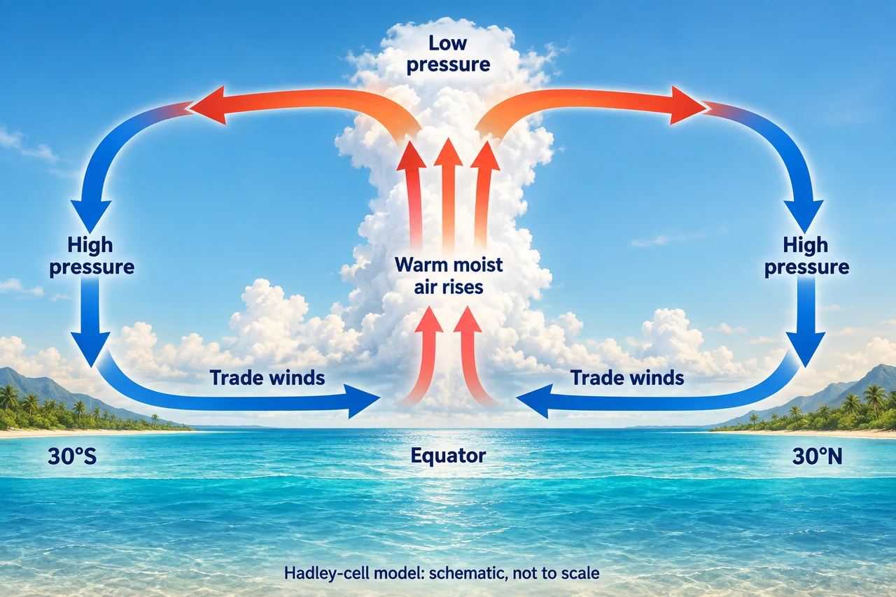
Image: illustration, not a documentary photograph. Original teaching model created for myAudience. · Original generated teaching illustration; no source textbook artwork reproduced.
Global biomes: explain a pattern, then find its limits
A biome is a broad grouping of ecosystems with characteristic vegetation and climatic conditions. Tropical rainforests tend to occur in warm, wet regions near the Equator. Tropical grasslands have stronger seasonal contrasts in rainfall; many hot deserts are dry enough to limit vegetation. Temperate forests, boreal forests and tundra occupy different combinations of temperature, rainfall and growing season. These are broad patterns, not exact boundaries drawn by latitude alone.
Global circulation helps explain some patterns. Air rising near the Equator commonly cools and produces rain, while descending air in subtropical belts tends to be drier. The earlier Hadley-cell illustration can be reused for this mechanism. It represents a simplified circulation model, not a complete biome map. Ocean currents, distance from the sea, altitude, mountain barriers and seasonal circulation can all change the climate experienced at a place.
When reading a climate graph, consider both the total and its distribution. Two places can have the same annual rainfall but one has a long dry season. Temperature differences affect evaporation and plant growth. A biome label is a first guide to likely vegetation, while the monthly pattern helps explain adaptation. Soil, disturbance and land use add further differences within the same climatic region.
Useful geographical reasoning links evidence to a mechanism. A cooler high-altitude site near the Equator is not an error in the global pattern: altitude provides an explanation for an exception. A cleared field within a rainforest climate does not become evidence that the climate is naturally grassland. Distinguish the broad climate-based expectation from the actual ecosystem and human alteration at a site.
Worked example: Two fictional places each receive 1,200 mm annually. Site A receives 100 mm every month. Site B receives 200 mm in each of six months and none in the other six. Why is the annual total insufficient?
Check that 12 × 100 and 6 × 200 both equal 1,200 mm.
Site B has a six-month dry period, unlike Site A.
Seasonal water stress depends on distribution, temperatures and stored water, not just the sum.
Answer: The equal annual totals conceal a major difference in seasonality and potential water stress.
Check your understanding: Must every location near 30° latitude be a hot desert?
Answer: No.
Why: Descending-air tendencies help explain many subtropical deserts, but oceans, mountains, seasonal weather and local conditions alter the result.