Amazon forest loss: compare the right dates and definitions
By UK GCSE Geography · independent study · myAudience
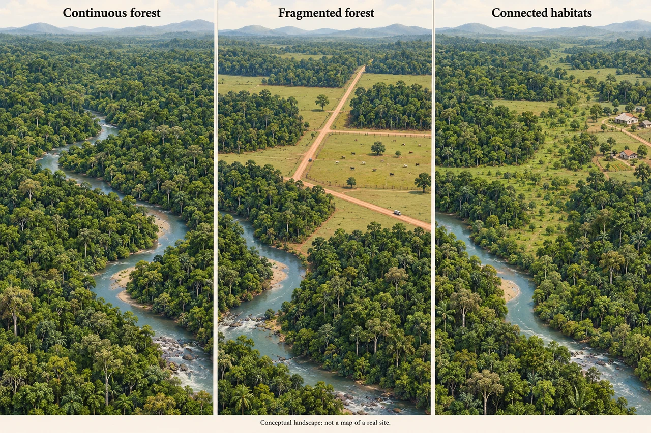
Image: illustration, not a documentary photograph. Original teaching model created for myAudience. · Original generated teaching illustration; no source textbook artwork reproduced.
Amazon forest loss: compare the right dates and definitions
A rainforest case study needs a location and a measure. The Brazilian Legal Amazon is an administrative region spanning nine states; it is not identical to every part of the Amazon basin or every tropical forest in Brazil. INPE’s PRODES system uses satellite observations to estimate annual clearing. Its technical definition and observation period matter when comparing figures, especially when a preliminary estimate is later consolidated.
The official 2025 estimate reports 5,796 km² cleared during 1 August 2024–31 July 2025. The same technical note compares this with a consolidated 2024 rate of 6,518 km², a fall of about 11.08%. These are areas of annual loss, not the total forest area. A lower loss rate still means forest was cleared; it does not mean an equivalent area grew back. The estimate has a stated sampling and mapping method and should not be relabelled as a survey of all degradation or every fire.
Land conversion can be driven by demand for cattle pasture, crops and timber, with roads enabling access to previously less accessible areas. Mining, settlements and other infrastructure can also remove vegetation or influence access. Causes interact with markets, tenure, public policy and enforcement. A satellite record shows where clearing occurred; attributing every polygon to one economic activity requires additional evidence.
The conceptual image shows continuous forest becoming divided by a road and pasture. It is useful for interpreting possible mechanisms, but it is not a satellite image of a named Amazon clearing. For a stronger case analysis, compare consistent PRODES periods, locate affected areas and combine imagery with land-use evidence. A national decline cannot show that every state or community experienced a decline, nor can two annual values alone prove which policy caused a change.
Worked example: Using the official note’s consolidated 2024 value of 6,518 km² and 2025 estimate of 5,796 km², calculate the absolute and relative decline. What remains important about the labels?
Subtract 5,796 from 6,518 to obtain 722 km².
Calculate 722 ÷ 6,518 × 100 ≈ 11.08%.
Retain the 2025 estimate status, August-to-July reporting period and Brazilian Legal Amazon scope.
Answer: Annual clearing is 722 km² lower, approximately 11.08%; the comparison is a loss-rate decline, not forest regrowth.
Check your understanding: Can the 2025 PRODES figure be called the deforestation total for all Amazon countries?
Answer: No.
Why: The stated geographic scope is the Brazilian Legal Amazon. Extending it to another territory changes what the number claims to represent.