Edinburgh: two ways of building a city
By Places and their stories · myAudience
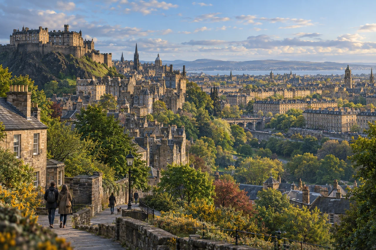
myAudience · original generated illustration · Original generated illustration; interpreted architecture and setting, not documentary evidence or an authenticated viewpoint.
Edinburgh makes the shape of a city unusually legible. The Old Town follows a high ridge from the castle towards Holyrood; narrow lanes branch from its main spine. Across the intervening valley, the New Town presents a different idea: planned streets, terraces and squares. Their contrast, rather than one celebrated building, is central to the UNESCO property.
In the Old Town, narrow plots helped produce tall buildings and densely packed frontages. The Georgian New Town expanded from the later eighteenth century through successive planned developments. Compare a roofscape with a street plan: similar stone can belong to very different ways of organising access, space and outlook. Old and new are useful names here, but neither district was built in a single moment.
The closes are still part of an inhabited city. Edinburgh World Heritage's Twelve Closes project treats them as places needing care, lighting and community participation, rather than merely picturesque shortcuts. Conservation includes repeated maintenance and decisions about everyday use. Keeping a building does not mean preventing all change; the harder question is how change can support residents while retaining the character that makes the place distinctive.
Look at the illustration's irregular roofs and orderly terraces. Which clues suggest accumulated building, and which suggest a coordinated plan? You can propose a reading from those patterns, but the picture cannot prove a street's date, property ownership or exact alignment. A real map, building record and local explanation would test the idea. The scene deliberately compresses an interpreted panorama rather than offering directions.
If you visit, remember that an inviting lane may also lead to someone's home. Leave entrances clear, ask before photographing people and keep your attention on the place beyond the camera frame. This is background reading, not a walking route or accessibility assessment; consult the destination's current official information for access.
Image: illustration, not a documentary photograph.
Further reading
A useful way to read this contrast is to separate the ground, the plot and the building. A ridge constrains where routes can run; a narrow plot constrains the width of a frontage; building upwards creates more floor space without widening that plot. These are connected explanations, not a claim that geography dictates every decision. A planned terrace instead coordinates several frontages and their relationship to the street. Both forms can contain later repairs, subdivisions and changes of use. Calling one organic and the other planned describes a pattern of development; it does not mean that the Old Town had no rules or that every New Town inhabitant had the same experience.
The contrast also changes the questions a visitor can ask. From a panorama, repeated roof lines might suggest coordinated construction, while irregular heights might suggest several building episodes. Neither observation dates a wall. To test the interpretation, compare a dated street plan, a building record and the current structure. Agreement between them strengthens a claim; disagreement might reveal alteration rather than an error in every source. UNESCO's account places the New Town's successive developments between 1767 and 1890. That span is a warning against presenting the whole district as one finished eighteenth-century project. The generated image is an invitation to notice patterns, not another independent historical record confirming them.
Consider an imagined proposal to improve a poorly lit close. One option replaces the lane's surfaces and fittings with a single modern design; another retains useful fabric while introducing carefully placed lighting. The second is not automatically better merely because it changes less. People need safe, understandable access, and inaccessible or failing materials can undermine everyday use. Equally, an attractive new design could erase evidence of the lane's character or make residents feel that a shared entrance has become a tourist display. A reasoned decision would compare maintenance needs, visibility, access and residents' responses, then explain why the chosen changes solve the identified problem. This is an original decision exercise, not a report of a completed project.
An answer worth keeping would therefore say: conserve the close as a working piece of the city, not just as a view. Start by asking the people who use it what needs improvement; distinguish a repair from a cosmetic replacement; record the fabric and assess changes before judging success. Edinburgh World Heritage's Twelve Closes account supplies a real example of community participation in public-space design, but its stated aims do not prove that every possible outcome has been achieved. Look again at the small figures among the roofs. They remind us of something a skyline cannot explain alone: a historic city remains valuable because people continue to live, work, meet and make choices within it.
The Old Town's street pattern has a recognisable backbone. From the castle rock, the main route follows a ridge towards Holyrood, with smaller lanes opening off it. Medieval burgage plots—strips associated with town property—help explain why so many frontages are narrow. Additional accommodation could be stacked above the same footprint rather than spread across a broad site. Gladstone's Land supplies a concrete example: UNESCO identifies the restored early-seventeenth-century merchant's house as six storeys high. Behind the skyline is a history of plots, access and building upwards, not simply a taste for picturesque roofs.
Across the valley, the New Town developed in seven planned extensions between 1767 and 1890. Its dressed-stone, or ashlar, facades present carefully worked faces in regular courses, giving terraces a more coordinated surface than irregular exposed rubble would. Streets, squares, gardens and building fronts were considered together. This helps explain the difference between a collection of impressive individual houses and a planned urban ensemble: repeated alignments can give many separately occupied buildings a shared spatial order. North Bridge and the Mound connect the two districts across the valley, making Edinburgh's contrasting forms part of one city rather than two isolated architectural exhibits.