Petra: the water behind the stone
By Places and their stories · myAudience
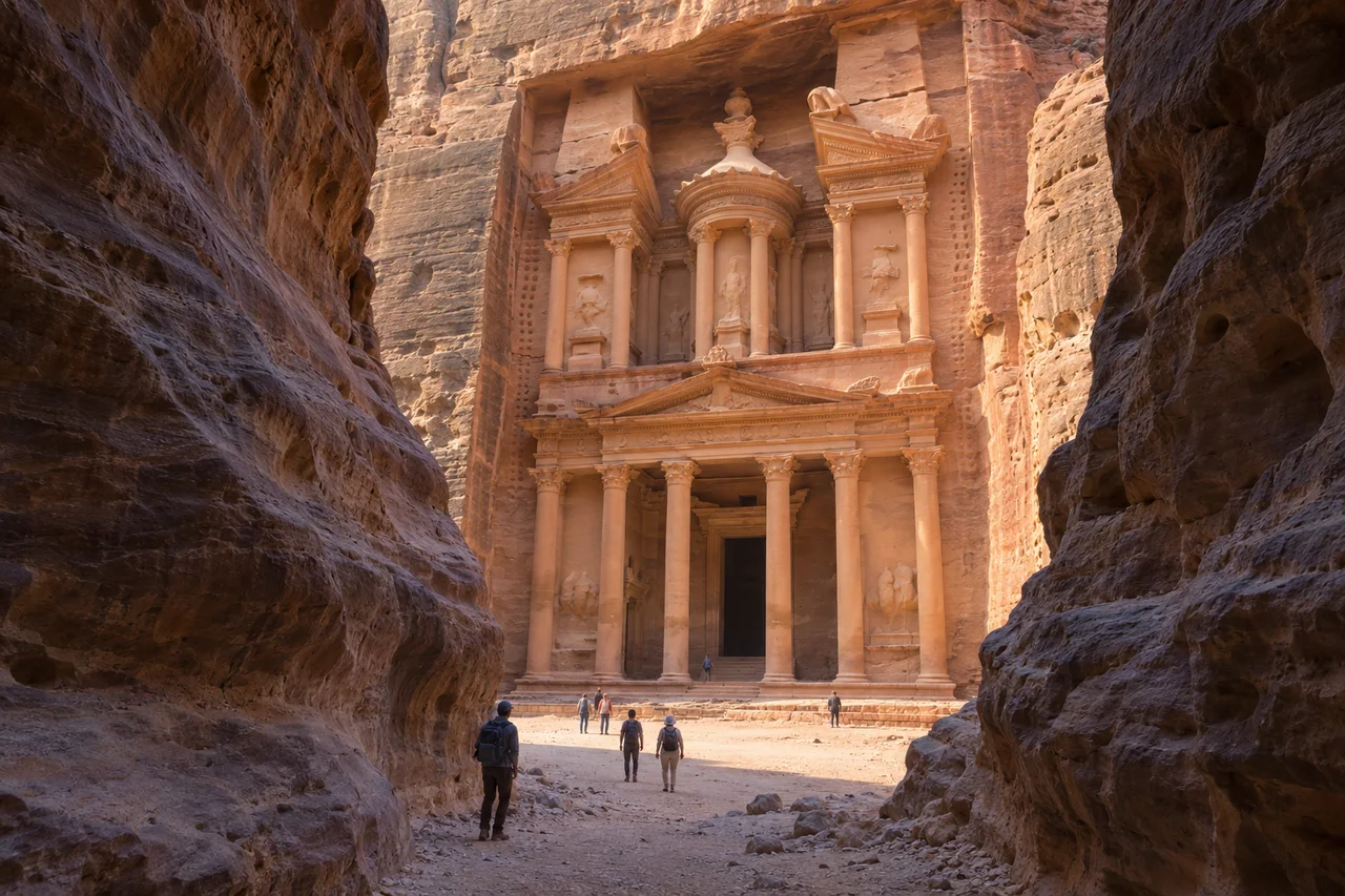
myAudience · original generated illustration · Original generated illustration; interpreted architecture and setting, not documentary evidence or an authenticated viewpoint.
Petra's carved facades are only one part of a much larger city. The Nabataean centre linked caravan routes across the region, and its remains include freestanding buildings as well as spaces cut into sandstone. Classical-looking columns on a rock-cut facade show architectural exchange; they do not turn the city into a Greek settlement or explain every building's purpose.
Water management helps explain how settlement could develop in an arid landscape. UNESCO describes channels, diversion dams, tunnels, reservoirs and cisterns that controlled and stored seasonal water. Collection, storage and flood diversion are related but different tasks. Rain arriving quickly is not automatically a dependable supply: a settlement needs ways to retain useful water while limiting damaging flows.
The official Petra account identifies the Siq as a natural gorge and describes surviving water works elsewhere in the site, including an aqueduct connected to storage. These details shift the question from 'How was a facade carved?' to 'What systems kept the settlement functioning?' A famous monument can be studied as craft and symbolism while quieter infrastructure reveals another kind of skill.
Our illustration looks towards a facade inspired by Al-Khazneh through a shaded cleft. Notice that the carved surface belongs to the cliff rather than standing independently in front of it. Then ask what the frame excludes: water routes, other buildings and successive periods of occupation. The image cannot certify a tomb's patron, reconstruct an intact ancient city or show where every surviving water feature lies.
Archaeological stone can be vulnerable even where it looks solid. Follow site staff and current official visitor rules; do not climb, touch carving or take fragments as souvenirs. Local people are part of the present region, not decorative survivors of an ancient narrative. This background reading is not advice about trails, heat, weather or access: those require current information from the site and relevant authorities.
Image: illustration, not a documentary photograph.
Further reading
An arid setting makes the difference between capturing water and controlling a flood especially important. Rain can arrive in a short event, while people need a supply over a longer interval. Collection directs useful water towards storage; diversion changes where potentially damaging flows travel; distribution moves stored or collected water towards uses. A single structure may contribute to more than one task, but the tasks are not interchangeable. A dam does not automatically supply every building, and a cistern does not explain the entire catchment. UNESCO's description of surviving channels, tunnels, diversion dams and storage provides the archaeological starting point for this connected explanation, not measured quantities for a reconstructed network.
A facade and a water system also reveal different kinds of evidence. The visible columns and carved surfaces invite questions about craft, patronage and architectural exchange. Infrastructure invites questions about repeated maintenance and the conditions that made settlement possible. Neither should displace the other. A story told only through monuments might miss how the city functioned; a story told only through engineering might overlook the meanings people gave its buildings. Petra contains rock-cut and freestanding remains from successive periods. Their coexistence warns against imagining one complete, unchanging city at a single date. To assign a feature to a period or purpose, consult the particular archaeological evidence rather than giving every ruin the label suggested by the most famous frontage.
Suppose a caption claims that the sandstone cleft was excavated solely to frame a dramatic approach. What would test that claim? The official heritage description identifies the Siq as a natural rocky cleft, so a claim of entirely artificial excavation conflicts with that evidence. Human interventions and natural topography can still interact; recognising a natural gorge does not imply that people never modified access or water routes. This is an original source-checking exercise. Its answer illustrates a wider habit: test a vivid explanation against a source that can address the mechanism, and avoid replacing one overstatement with its opposite. A generated view cannot settle the question simply by looking convincing.
The carved frontage in the image is weathered, but its individual decorative details and the people before it are invented. It is not a survey of erosion, a reconstruction of original colour or a record of a particular day's access. UNESCO discusses erosion and the importance of continued maintenance of water-diversion features; that gives grounds to understand preservation as ongoing work. It does not permit a reader to assess today's weather or choose a safe route. In judging a proposed visitor facility, ask how it might affect fragile fabric, access and local livelihoods, and which stakeholders could supply evidence. Archaeological places are part of a present region. Studying the ancient achievement carefully also means giving the present community more agency than the role of background scenery.
Petra linked long-distance trading worlds. UNESCO describes Arabian incense, Chinese silk and Indian spices moving through a caravan centre between Arabia, Egypt and Syria-Phoenicia during Hellenistic and Roman times. That position helps explain why its architecture drew on more than one tradition. Classical-looking facade elements were combined with Nabataean rock-cut tomb and temple forms. Carving a frontage into a cliff differs from assembling every part of a freestanding building: the rock is both setting and material. Yet Petra also contained freestanding structures, streets and public buildings. Its achievement cannot be reduced to a row of decorated cliff faces.
Water works made that concentration of people possible in an arid setting. The surviving combination includes the Muthlim tunnel, diversion structures, channels, aqueducts, cisterns and reservoirs. Different components addressed the movement and retention of water, including seasonal rain. Storage created a reserve; a channel conveyed water; diversion could redirect a flow away from a vulnerable route. These roles together explain why a spectacular entrance and an extensive settlement depended on infrastructure beyond their visible monuments. Later remains—including a colonnaded street, baths and Byzantine churches—record continuing changes in civic and religious life. Petra's archaeological landscape contains successive settlements and adaptations rather than one frozen Nabataean moment.