Quito: a city fitted to the Andes
By Places and their stories · myAudience
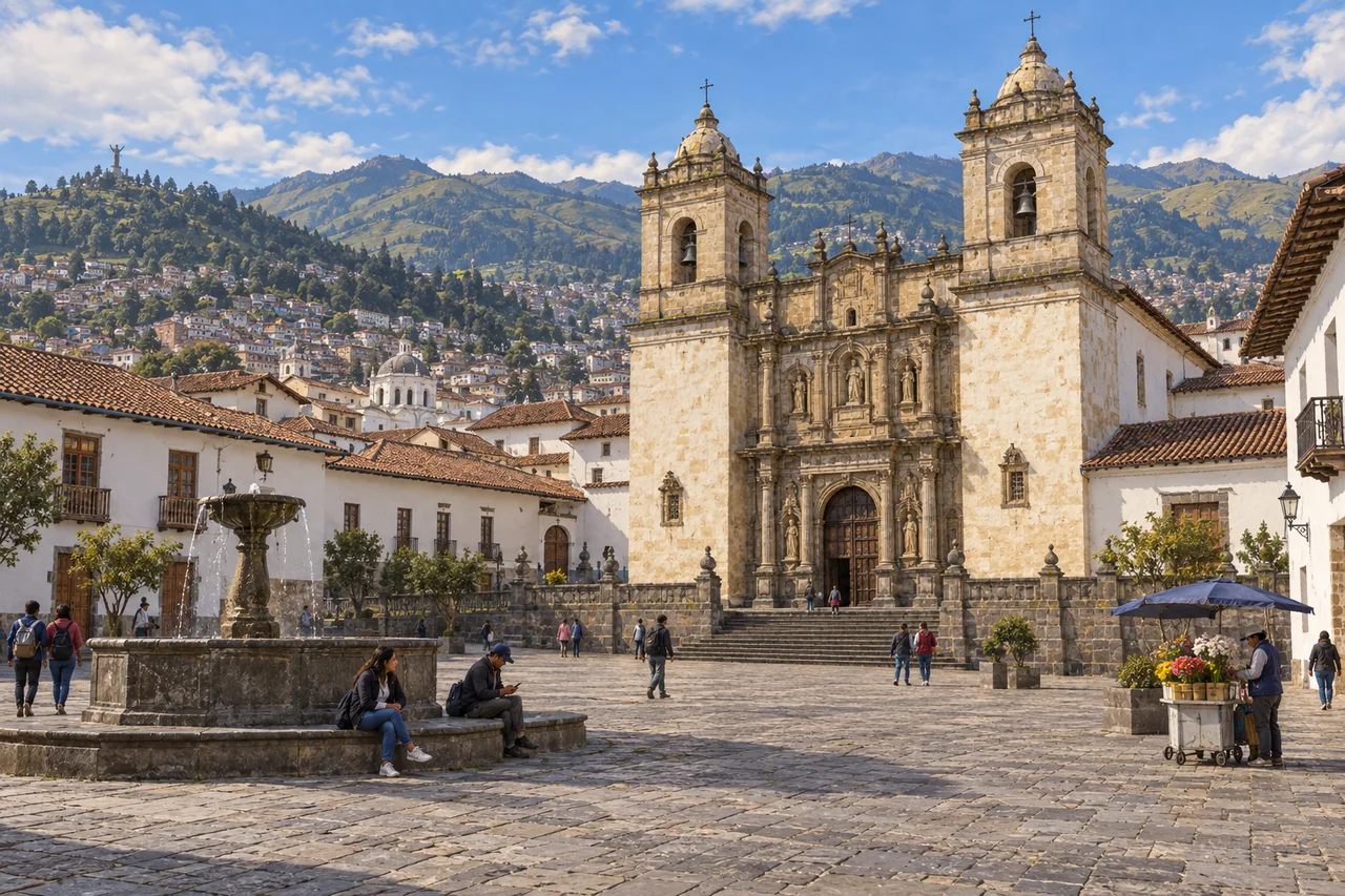
myAudience · original generated illustration · Original generated illustration; interpreted architecture and setting, not documentary evidence or an authenticated viewpoint.
Quito's historic centre lies within an Andean landscape. Its buildings and street spaces must be read against slopes and surrounding hills, rather than an imagined flat colonial plan. UNESCO's account describes the Spanish foundation of 1534 on the remains of an Inca city. That date marks a colonial foundation, not the beginning of human history in the place.
The religious complexes are important examples of the Quito school, bringing Indigenous and European artistic traditions into contact. Architecture, carving, paintings and altarpieces are different parts of that work. A church's exterior alone cannot represent the skills within it, and attributing the city's art only to European designers would miss the local contribution UNESCO identifies.
The historic centre also includes smaller houses, patios, streets and squares. Comparing a monumental frontage with modest buildings gives a more complete reading of the city than treating everything as one grand cathedral precinct. The illustration uses an interpreted church-and-plaza composition inspired by San Francisco; it does not identify each building, record precise heights or reconstruct an earlier cityscape.
Quito's municipal tourism account of its markets points towards another useful layer: food, produce, crafts and people at work. A city is sustained by exchange and routine as well as monuments. An account of a market helps broaden the picture, but it does not make an image a record of today's stallholders, prices or availability. No claimed culinary award or medical benefit is implied here.
Ask how a street plan might respond when it meets uneven ground. Straight alignments do not guarantee level journeys: steps, gradients and building thresholds can change the experience. The image cannot answer accessibility or health questions about a real visit. Use current official information for planning, respect religious activity and ask permission before photographing a person. The historic centre is a place of present life, not a stage that must look unchanged for visitors.
Image: illustration, not a documentary photograph.
Further reading
A street plan and a slope describe different aspects of a city. A plan records horizontal relationships between routes, blocks and squares; the ground determines changing levels along them. A grid can therefore remain recognisable while individual journeys involve gradients or steps. This distinction helps explain why a straight alignment in a map is not a promise of an easy, level walk. In the illustration, rooftops and distant hills suggest a setting, but their apparent angles cannot measure a real street's gradient. To move from a useful observation to a claim about physical access would require a surveyed route and current local information, neither of which this image supplies.
The same distinction between a useful label and a complete history applies to the Spanish foundation of 1534. UNESCO locates that event on the remains of an Inca city; it does not describe the beginning of human presence. Foundation dates can name a particular political or urban episode while concealing earlier histories if presented without explanation. The Quito school's combination of Indigenous and European artistic traditions also asks us to look beyond a single designer or visible exterior. Paintings, carving, altarpieces and architecture are different kinds of work. A convincing account identifies what an institutional source actually describes and avoids assigning authorship, consent or working conditions to unnamed people merely to make a tidy story.
Compare two fictional interpretations of the illustrated square. One says that the church alone explains Quito's heritage; another considers houses, public space, routes and everyday exchange as well. The second is stronger because it can connect a monumental frontage to a wider urban setting, but it must still separate observation from inference. A courtyard is not visible merely because a roof suggests that one might exist. A person carrying goods is not evidence about the city economy. To test the broader reading, combine documented building forms and street plans with sources that describe domestic and commercial life. The picture supplies questions; it cannot replace the records that would justify the answers.
A thoughtful conservation proposal would therefore consider how a building works within its street, not just how it appears in isolation. Imagine repairing a damaged frontage while residents continue to enter, trade or worship nearby. The repair's success would involve documented materials and design as well as usable access and communication with affected people. This is an original evaluation exercise, not a report of a Quito project or a structural repair recommendation. The UNESCO account notes continuity through both change and maintenance, but its legal and management details are not necessarily today's complete position. Reading the city carefully means respecting those dates, preserving uncertainty where evidence is missing and remembering that a historical centre also supports present lives beyond the monument in the foreground.
Quito's historic centre combines a planned street pattern with steep Andean terrain. Its routes include a grid aligned to the compass, with principal and smaller squares, but the buildings occupy a complex sloping setting. Domestic architecture is an important part of that achievement. UNESCO describes houses of one or two storeys, often with one or more patios, earthen-brick walls and stucco coverings. A courtyard introduces an open space within a building plot; a street-facing wall need not reveal it. The centre's character therefore depends on the arrangement of ordinary houses and open spaces as well as the scale of its churches.
The Quito school developed a rich artistic language through Indigenous and European traditions. Architecture, sculpture, painting and altarpieces contributed different crafts to religious complexes such as San Francisco and La Compañía. Their interiors matter as much as the silhouette of a church tower: a building could gather carved, painted and constructed work into an elaborate setting. The Spanish foundation of 1534 on an earlier Inca city places that development within colonial history, rather than making the location an empty canvas. Records of stone, lime, earth and timber crafts also connect decorative achievement to material work. The result invites a closer question than 'Which church is tallest?': how did many forms of making shape a whole urban environment?