Banff and the Rockies: scenery records processes
By Places and their stories · myAudience
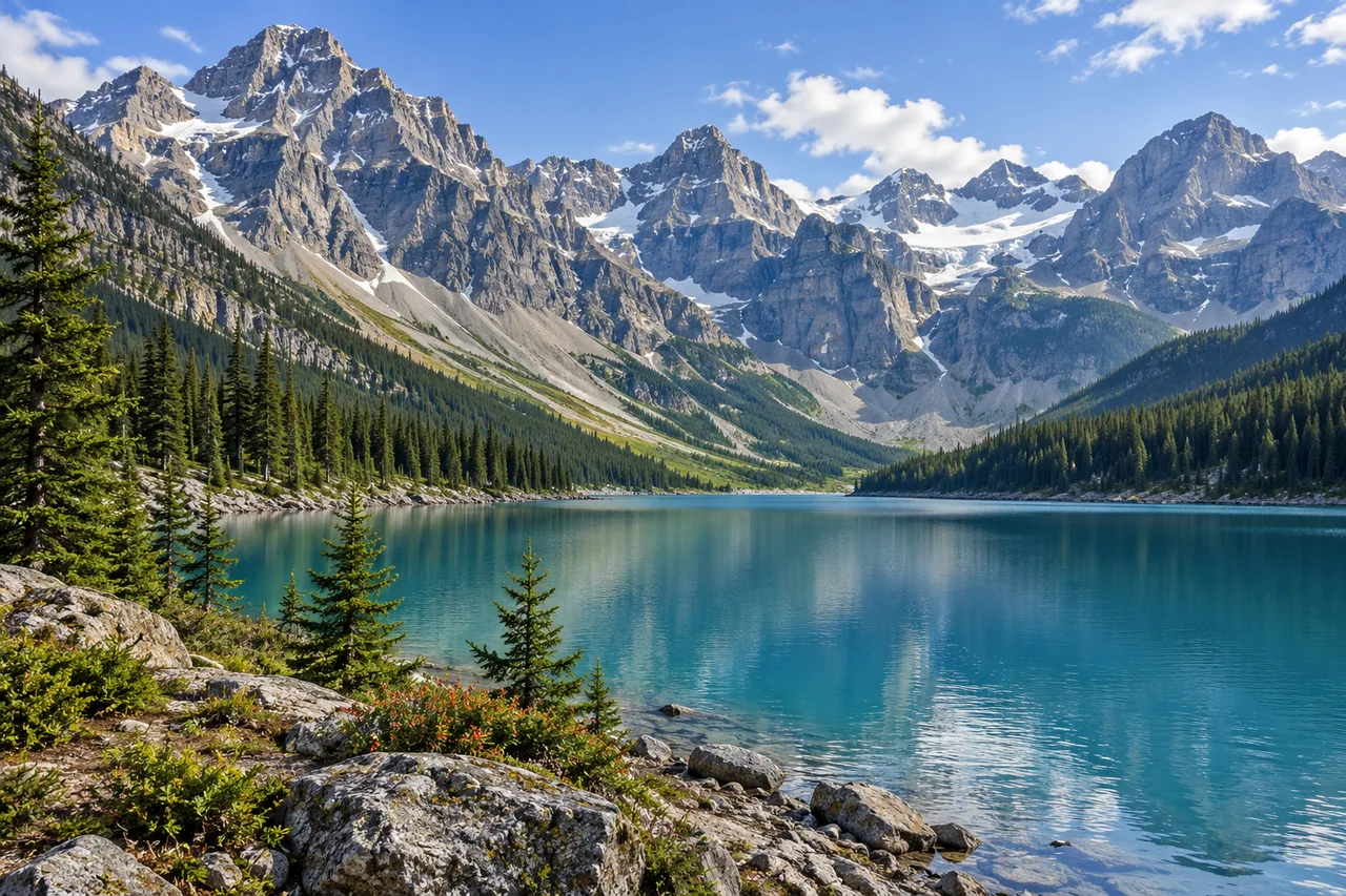
myAudience · original generated illustration · Original generated illustration; interpreted setting, not documentary evidence, current conditions or an authenticated viewpoint.
Banff belongs to the larger Canadian Rocky Mountain Parks World Heritage property, which includes national and provincial parks. Their mountain scenery carries a geological history: sedimentary rocks were folded, faulted and uplifted, and glacial processes later shaped and continue to shape parts of the landscape. The peaks, valleys and lakes are related features, not separate decorations placed beside each other.
Erosion removes material; deposition leaves it elsewhere. A broad valley and a heap of sediment therefore invite different questions about what ice and water have done. UNESCO highlights both kinds of evidence in the wider property. The Burgess Shale fossil sites add a much older marine record, but a mountain-lake image does not locate those sites or make their fossils part of the illustrated shore.
The landscape is not finished. UNESCO records glacier recession in the property, while Parks Canada's 2022 Banff management plan includes climate challenges, ecological integrity, cultural resources and Indigenous participation. A dated plan states intentions and direction; it does not prove that every target has been achieved. Protected status also does not erase the relationships and histories of Indigenous peoples whose perspectives belong in understanding the park.
Look from the shore towards the peaks in the illustration. Where do trees become sparse, where is bare rock exposed, and where does snow remain? Those contrasts support questions about elevation and terrain. They cannot establish today's glacier area, the age of a ridge or a safe route across a slope. This is an interpreted regional lake scene, not a documented Moraine Lake or Lake Louise viewpoint.
Appreciating the setting includes allowing wildlife and habitats to function without disturbance. Use current park information for permitted access, closures and activities; an image is not guidance for hiking or entering cold water. Conservation decisions may need to balance public experience with ecological limits, and a quieter or restricted area can be part of protecting the landscape people came to see.
Image: illustration, not a documentary photograph.
Further reading
The mountain scene contains several clocks at once. Rocks can preserve evidence of an older environment; uplift and folding can alter their position; ice and water can later remove, move and deposit material. These processes need not have occurred at the same time. A sedimentary layer high in a mountain is therefore not evidence that the peak always stood at that height. UNESCO describes the wider park property's folded and faulted sedimentary rocks, ongoing glacial processes and important ancient marine fossil sites. Our shore image connects those ideas as a learning setting, but it does not place a particular fossil bed beside this lake or date any depicted ridge.
Distinguish erosion from deposition when reading a valley. Removal of material helps create an excavated form; deposited material is left somewhere after transport. In an original comparison exercise, imagine a broad valley and a nearby sediment ridge. The first invites questions about excavation, the second about where transported material accumulated. This is a useful explanation, not proof that a particular ridge is glacial or that ice was the only process involved. Testing it would require mapped landforms, sediment evidence and geological interpretation. A still image cannot measure the rate of change, and patches of illustrated snow do not establish the presence, area or health of a real glacier today.
Parks Canada's accessible 2022 management plan supplies an important human context. It sets a direction centred on ecological integrity, respectful Indigenous relationships, visitor experience and climate challenges; it also records how historic policies separated Indigenous peoples from lands and waters. These are not interchangeable with claims that the park has no human history or that consultation makes every issue settled. A plan's strategies and targets describe intended work. To decide what has actually happened since, a reader would need later monitoring and implementation evidence. Keeping intentions separate from measured outcomes makes conservation easier to discuss honestly. A commitment can guide future work without serving as a current scorecard of every result.
Now evaluate a fictional suggestion to widen access to a sensitive valley simply because visitors enjoy the view. A reasoned answer would compare the potential experience with impacts on habitats, ecological processes and people whose relationships with the place extend beyond tourism. It would ask about alternatives, evidence and which Indigenous nations or other affected communities should participate, without assuming that their positions are identical or speaking on their behalf. Restrictions can be part of protection rather than evidence that a scenic place is failing visitors. The generated landscape is deliberately inviting, but it supplies no trail conditions, wildlife promise or safe activity advice. Its best use is to encourage patient questions about how a beautiful scene functions and what caring for it requires.
A mountain can preserve the history of a sea. UNESCO identifies the Canadian Rocky Mountain Parks' sedimentary rocks as folded, faulted and uplifted. Sedimentary deposits originally accumulate in an environment; later deformation changes their shape and position. Folding bends layers, whereas faulting displaces rock along a fracture. Uplift helps explain why rocks formed at lower levels can appear high in the landscape. Glaciers subsequently erode and redistribute material, adding another stage rather than creating the original sedimentary layers. The mountains are a record of different processes superimposed through time, not a single event that produced peaks, valleys and lakes together.
The wider World Heritage property also includes the Burgess Shale fossil sites, famous for preserving soft-bodied marine animals. Such remains reveal organisms that a record dominated by hard shells might miss, expanding what can be learned about early animal life. They belong to the wider park system, not an asserted fossil bed at our illustrated lake. Banff's national-park history began in 1885, while Indigenous relationships with these lands and waters long predate that designation. The accessible 2022 management plan names habitat connectivity among its challenges. That adds a present ecological connection to the geological story: protecting a habitat involves the links through which organisms move, not only keeping an attractive patch of scenery intact.
Author source references
- UNESCO: Canadian Rocky Mountain Parks — geology, glaciation, fossils and glacier recession
- Parks Canada: Banff 2022 management-plan overview — ecology, cultural resources and Indigenous participation
- UNESCO: Canadian Rocky Mountain Parks — geology, glaciation, fossils and glacier recession
- Further reading reference