Machu Picchu: read the mountain, not only the ruins
By Places and their stories · myAudience
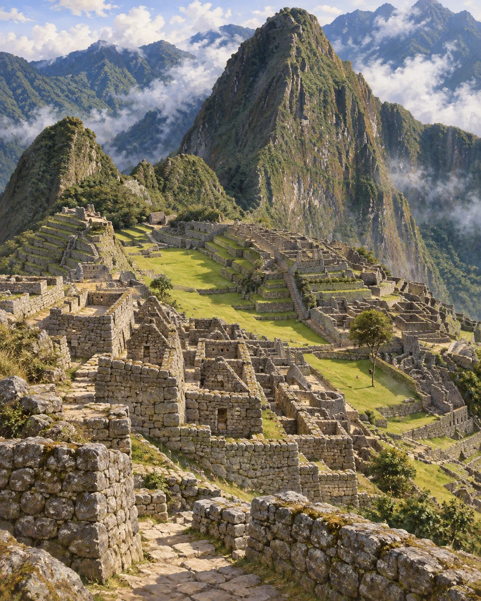
myAudience · reused approved original generated wonder illustration · Original generated illustration; interpreted setting, not documentary evidence, current conditions or an authenticated viewpoint.
Machu Picchu combines Inca construction with a steep mountain setting at the meeting of the Andes and the Amazon Basin. UNESCO recognises both cultural and natural values in the wider sanctuary. The archaeological buildings are its best-known image, but mountain slopes, habitats and connections beyond the central ruins also belong in understanding the property. A monument and its surroundings are not separate subjects here.
The fifteenth-century site includes terraces, buildings and paths distributed across demanding terrain. Their relationships suggest a more useful question than simply asking how a particular wall was built: how was a whole place organised? A retaining terrace, a route and a constructed room require different kinds of evidence. Looking at them together prevents a finely fitted stone surface from standing in for every aspect of settlement.
UNESCO's account notes irrigation canals and a wider trail system, as well as substantial habitat diversity across changing elevations. This links land use to water and landscape. Yet a photograph or illustration cannot establish the functioning of a buried drain or the original purpose of every room. Those explanations need archaeological investigation. Attractive labels such as fortress or mystical retreat should not replace an account of what is known and what remains unresolved.
Follow the terraces and paths in this interpreted view, then imagine rainfall moving through the scene. Which areas would you investigate to understand water management? Levels, outlets and material below the surface would matter; the image does not measure them. The reused illustration shows surviving ruins and mountain terrain rather than a fully rebuilt Inca city. It cannot authenticate each stone arrangement or identify every plant in the surrounding habitat.
The wider sanctuary faces conservation challenges connected with visitor use and environmental pressures. Treat access restrictions as part of caring for the site, rather than obstacles to a preferred photograph. Follow current official routes and instructions instead of using this scene to plan a crossing or climb. Source notes support the historical and landscape context; current visitor arrangements must be checked separately. The strongest view is a starting point for understanding, not the whole story.
Image: illustration, not a documentary photograph.
Further reading
Machu Picchu occupies a mountain setting where the Andes meet the Amazon Basin. Its fifteenth-century Inca buildings are part of a wider sanctuary recognised for cultural and natural values, rather than a monument detached from its surroundings. Terraces, paths and occupied spaces relate to gradients, water and available materials. Understanding the settlement therefore involves several scales at once: a stone joint, a constructed platform and a larger landscape can each answer a different question. None should stand in for the whole place.
Alicia Fernández Flórez's archaeological account, published in a 2020 volume hosted by Peru's Ministry of Culture, follows a spring collection channel into the settlement's water-supply system. Channels and phaqcha organise water provision within the built environment. This makes water a planning relationship, not merely an attractive feature: a supply must connect its source with places of use. The account supports domestic and ceremonial relationships, but it does not establish that every terrace visible in a panorama was irrigated or served one identical purpose.
Local terrain and granite matter to the construction story. Available stone does not automatically produce a stable or accessible settlement; builders must relate materials to where structures rest, how people move and where water goes. A retaining platform and a roofed room solve different spatial problems. Investigate their foundations, levels and connections before assigning a common explanation. Fine masonry is evidence of workmanship, while the organisation of routes and water supply reveals a wider system that a close-up stone photograph can miss.
The 2020 account identifies separated channel blocks between phaqcha 2 and 3 and discusses a secondary route supplying phaqcha 4. This is a located archaeological interpretation of modification, not a claim that all the original waterworks remained unchanged. A changed route can preserve a service even when an earlier connection is disturbed. To evaluate that interpretation, distinguish the observed blocks and channel arrangement from the proposed sequence explaining them. The cited account does not provide a universal earthquake-proof rating or quantify the capacity of every drain.
Supply and disposal are different functions. Bringing spring water to occupied space is not the same task as managing rain that falls across roofs, paths and slopes. The documented supply modification demonstrates adaptation in one part of the system; it cannot establish that every subsurface drainage route works. An investigation of rainfall disposal would need located routes, outlets, levels and maintenance observations. Keeping these questions separate avoids the tempting but unsupported conclusion that an impressive ancient water feature proves a complete modern performance assessment.
UNESCO's mixed-heritage account also concerns trails, land use and habitats distributed across changing elevations. Connections beyond the central buildings belong in the interpretation of the sanctuary. Ecological evidence has its own scale: an identified plant in one plot does not describe every habitat, and a green slope does not measure species diversity. Linking archaeological and ecological questions is valuable, provided the methods remain clear. Investigators can share an understanding of the landscape without pretending that a masonry survey substitutes for repeated habitat observations.
The reused illustration shows surviving terraces, paths and mountain terrain. It helps a reader notice relationships between built levels and the wider setting; it is not a measured hydraulic plan or an authenticated reconstruction of each stone. The sourced sequence of spring collection, supply and channel modification adds explanation that lies outside the image. Use the scene to frame questions about connections rather than to estimate flow, identify every room's purpose or plan a current route across protected ground.
Transfer question: A restored wall looks intact and a postcard shows green slopes. Does that prove subsurface drains work and the whole sanctuary’s habitats are conserved? Answer: Suppose a restored wall looks intact and a postcard shows green slopes. Neither establishes that subsurface drains function or that all habitats are conserved. The wall observation concerns visible fabric; drainage needs located routes, water and maintenance evidence; habitats need appropriately distributed and repeated ecological observation. The documented channel modification shows why visible continuity can coexist with a changed system. A stronger investigation combines the relevant evidence at each scale and states its limits, instead of turning one successful repair into a verdict on the entire sanctuary.