Chichén Itzá: a whole city beyond one pyramid
By Places and their stories · myAudience
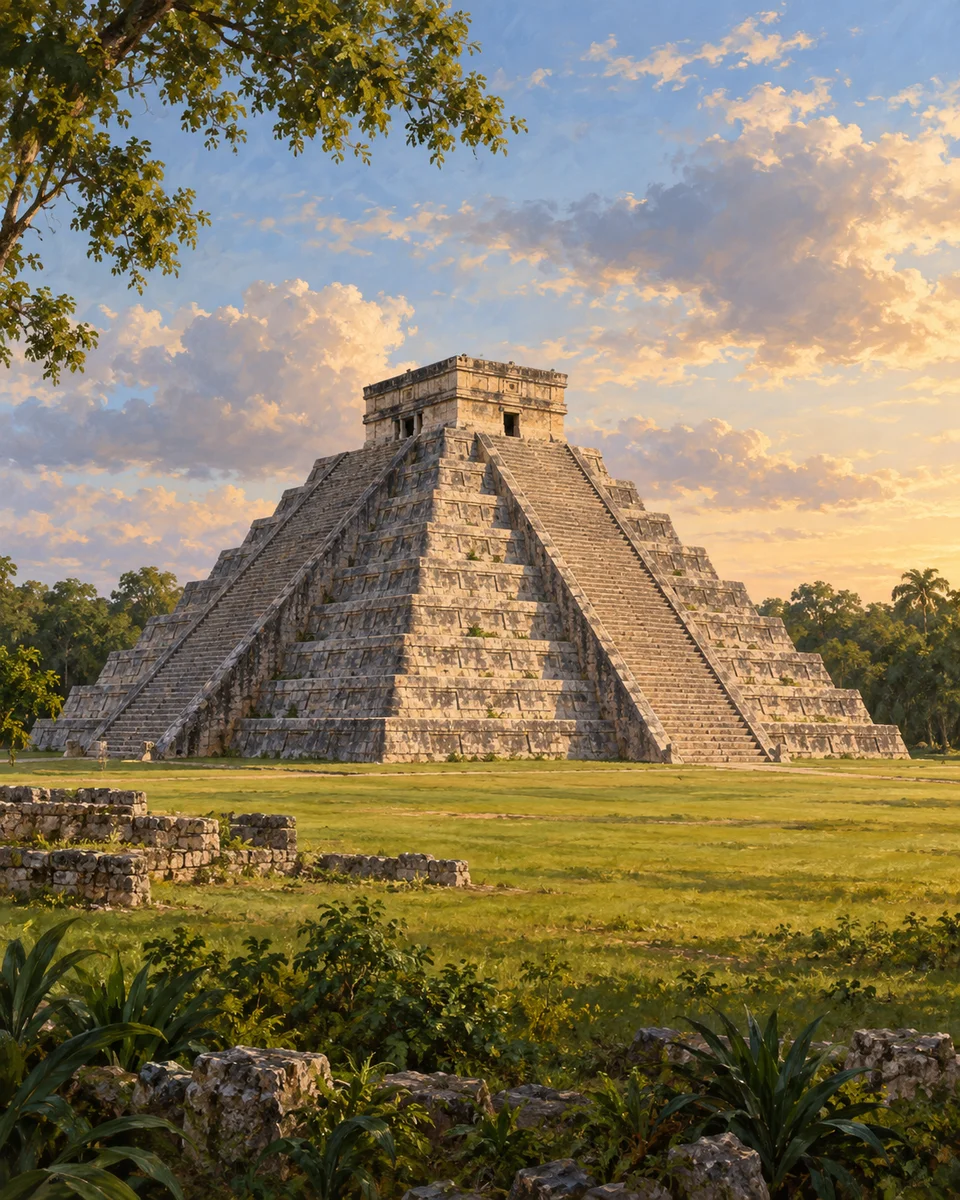
myAudience · reused approved original generated wonder illustration · Original generated illustration; interpreted setting, not documentary evidence, current conditions or an authenticated viewpoint.
Chichén Itzá is a major Maya archaeological site on Mexico's Yucatán Peninsula. El Castillo provides a recognisable silhouette, but it belongs to a larger built landscape. Ball courts, galleries, other temples and open spaces change the questions a reader can ask. Understanding a city requires relationships between places, rather than treating its most photographed monument as the entire settlement.
UNESCO's account connects the settlement with cenotes, natural openings that gave access to underground water. Water availability belongs beside architecture in the story of how a place could develop. It does not mean that every open space was a reservoir or that every building had the same function. A site plan and archaeological evidence would help distinguish routes, ceremonial spaces and water sources instead of guessing from one view.
The site's buildings reflect development and cultural interaction over time. The UNESCO description identifies important surviving structures including the Temple of the Warriors and the circular building known as El Caracol. Those different forms invite comparison, but a modern label or attractive astronomical story is not proof of each ancient intention. Specific interpretations require dated evidence, careful measurement and an explanation of competing possibilities.
Our existing illustration concentrates on El Castillo in its familiar surviving form. Compare the broad stepped mass, steep stair and smaller structure above. How might a site-wide view change your impression? It would introduce distances, adjoining spaces and other kinds of construction that this frame cannot show. The image is not a reliable count of steps, a record of an equinox event or an authenticated arrangement of every carved feature.
Conserving stone architecture involves repeated care, and visitor use can add pressure to fragile remains. Follow current site instructions and do not touch or climb structures merely because an illustration makes their surfaces look accessible. Maya history should also not be confused with the absence of Maya people today. This reading introduces an archaeological place, not a claim that one ruined city represents every community or brings a living cultural history to an end.
Image: illustration, not a documentary photograph.
Further reading
Chichén Itzá is a Maya city with a history of construction and change, not simply the pyramid reproduced in a familiar image. Water access, routes and organised monumental spaces connect buildings within a wider settlement. Ruined architecture also does not imply that Maya people or cultural life vanished. A responsible account distinguishes the history of this particular place from living Maya histories. Its aim is to understand relationships and phases using evidence, rather than to turn one silhouette into a complete account of a civilisation.
INAH describes the main plaza as an artificially levelled platform connected by a sacbé to the Sacred Cenote. Constructing a usable surface and connecting it to another significant place are different jobs within the urban landscape. A platform changes where buildings can stand; a route changes how places relate. These features encourage a spatial interpretation of the city beyond individual monuments. They do not, without further investigation, establish how many people used the route or quantify the labour required to build it.
INAH associates El Castillo with the Terminal Classic and identifies an earlier temple beneath it. The outer form therefore cannot represent every building phase at once. Covering or incorporating a predecessor produces relative chronology: one construction must precede the form built over it. Establishing a precise date still requires the appropriate archaeological evidence. This distinction is useful whenever a striking monument looks unified. An apparently coherent exterior may contain the material traces of several decisions made in different periods.
The Las Monjas group is discussed in relation to Puuc and Chenes forms, while the main plaza is described through a Maya–Toltec architectural label. Differences in forms can support investigation of cultural relationships, but a style label does not by itself prove one conquest event or identify every builder. Several mechanisms can transmit forms, including movement, exchange and selective adaptation. Assessing an historical explanation requires evidence beyond visual resemblance. Treat the archaeological interpretation as an argued account rather than an unqualified story of one group replacing another.
The Sculpted Columns palace provides a more specific example of changing space. Columns and galleries relate to the organisation of roofed areas, while later partitions can alter the circulation or use of those areas. A later wall is not merely decoration: it can change which spaces connect and how activities are separated. Plans and the relative placement of construction help investigate this sequence. The feature does not supply a commercial throughput or prove that every columned building served one identical economic function.
El Caracol's surviving form reflects repeated remodelling in INAH's account. Its association with astronomical observation remains an interpretation to investigate, rather than a precise measurement available from a generated view. Separate the evidence for alteration from claims about the alignment or purpose of a particular opening. A current shadow does not reconstruct every ancient observation, and a visually appealing step count is not sufficient proof of a calendar design. More demanding explanation identifies the physical feature, its phase and the evidence supporting its proposed use.
The reused El Castillo illustration introduces the pyramid within a wider landscape, but it cannot authenticate every carved detail, count all steps or demonstrate an equinox observation. The platform, sacbé, predecessor temple and remodelling examples supply a chronology beyond its frame. This is why the image is a useful starting point rather than the city's full history. A reader can follow a landmark into questions about how surfaces, routes and buildings were made and altered without expecting the illustration to resolve archaeological disputes.
Transfer question: An illustration shows a stepped pyramid with a shadow. Is that sufficient to call the entire city a single-purpose astronomical instrument built in one exact year? Answer: No. A shadow in an illustration cannot establish that the entire city had one astronomical purpose or was built in one exact year. The documented predecessor temple, remodelling and successive construction phases instead require a phased explanation. The shadow might suggest a question to investigate, but its depiction alone provides neither a secure construction date nor evidence for the uses of every building. Compare located, dated construction and stratigraphic evidence with proposed astronomical interpretations. Evidence for successive changes does not automatically establish a particular conquest narrative or the cause of every change. The justified conclusion rejects the proposed inference while keeping those distinct historical questions open.