Chicago: a river changed direction and purpose
By Places and their stories · myAudience
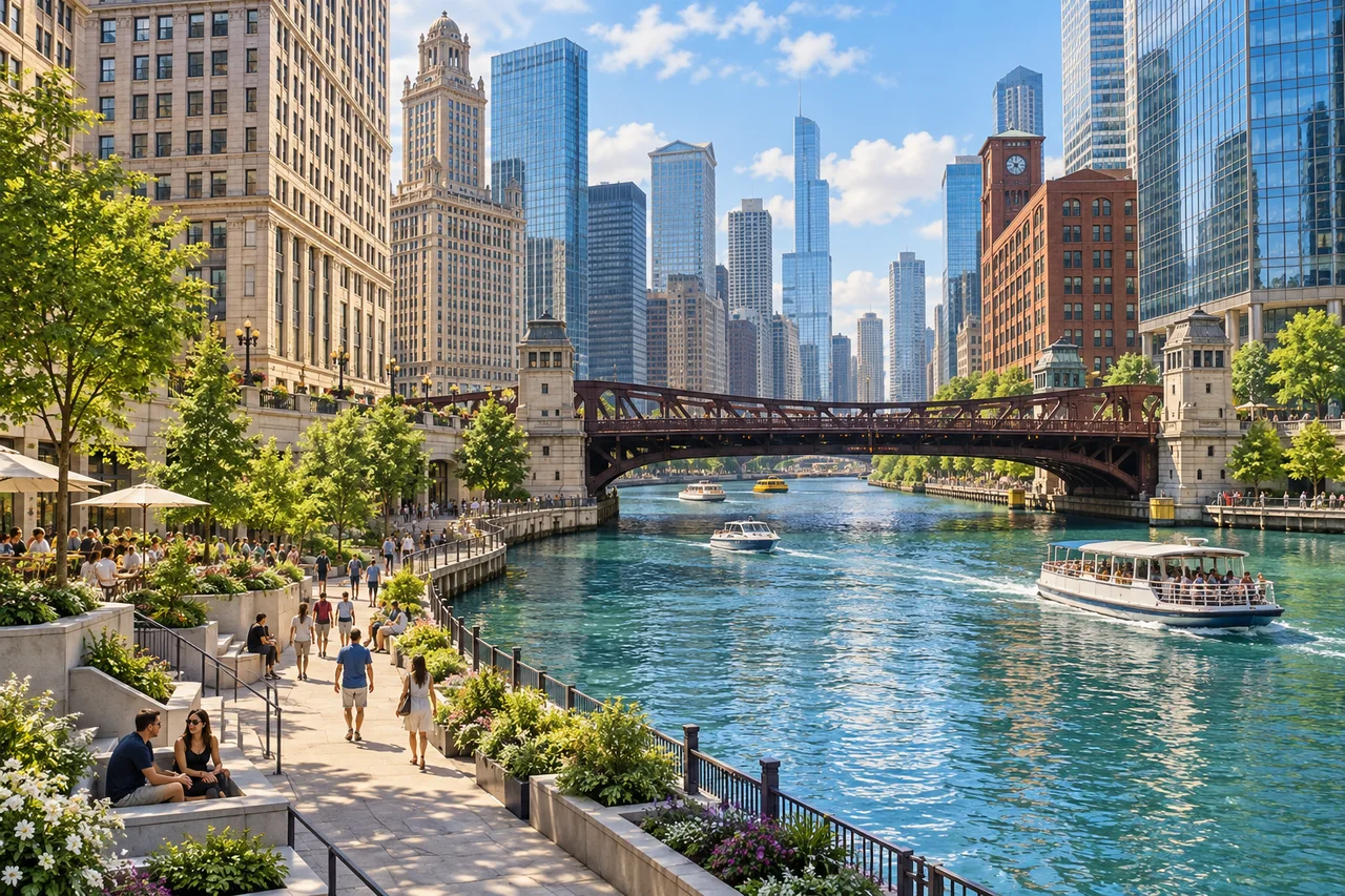
myAudience · original generated illustration · Original generated illustration; interpreted setting, not documentary evidence, current conditions or an authenticated viewpoint.
Chicago's riverfront brings different generations of buildings into a shared view. Masonry towers, glass surfaces, bridges and public spaces meet the water at different scales. This is more than a skyline backdrop. The river has served industry, transport and waste disposal as well as recreation, and those uses help explain why the city and its infrastructure took the forms they did.
The Chicago Architecture Center's historical account describes the 1900 reversal of river flow through the Sanitary and Ship Canal. Sending wastewater away from Lake Michigan addressed a problem connected with the city's drinking-water source. That achievement also changed relationships between watersheds. The account identifies continuing concerns involving freshwater diversion and pathways for invasive species, showing why an engineering solution can have consequences beyond the problem it was designed to solve.
The lesson is not that ambitious infrastructure is always good or always harmful. It is to define the problem, identify who benefits and follow the effects beyond the immediate site. A river can appear attractive while posing questions that its surface does not answer. A painted blue-green colour is no measurement of water quality, and boats in a scene do not establish that every kind of recreation is permitted or suitable.
In our interpreted riverwalk view, distinguish the walkway near water from street level and from the buildings above. Those layers organise access differently. What would happen if a continuous edge had no places to reach it from the city? A public space might become visually prominent yet harder to use. Testing that idea would require actual access information; this composite image cannot establish step-free routes or the operating mechanism of a named bridge.
Chicago extends far beyond the riverfront, with neighbourhood histories that deserve their own readings. Leave room for everyday users and check current official information rather than treating an invented boat, cafe or path as a promised service. The source account is historical background, adapted from a 2014 book; it is not a current water-quality report or proof that every proposed river project has been completed.
Image: illustration, not a documentary photograph.
Further reading
Chicago's river illustrates how a waterway can carry several histories at once: transport and industry, sanitation infrastructure, and later public space. The Chicago Architecture Center's account, adapted from a 2014 publication, traces changes toward recreation without making the present scene proof of environmental safety. Our composite riverwalk likewise places buildings, crossings and a lower waterfront level together. The useful question is how these layers interact, not whether an attractive waterfront has erased all consequences of the river's earlier uses.
Nineteenth-century sewage disposal created a serious conflict with a lake-based drinking-water source. MWRD's historical account explains the region's sanitation response and the district established in 1889. Following the route of water clarifies the mechanism: waste entering a connected water system can affect places beyond its immediate outlet. A map of flow direction and drinking-water intakes is therefore more informative than a simple contrast between “dirty past” and “clean present.” The historical explanation does not supply a current contaminant concentration or health assessment.
The 1900 reversal redirected flow through the canal system toward the Des Plaines, Illinois and Mississippi watershed. That changed where water travelled; it did not make every unwanted substance vanish. A system boundary around Chicago can make exported loads seem to disappear, whereas a wider downstream boundary reveals their continued movement. Recognising this accounting difference allows a more careful assessment of infrastructure: a local benefit and a transferred consequence can coexist, so evaluation must state the places and effects it includes.
Routing, treatment and storage perform different jobs. A canal changes connections and flow; treatment changes relevant constituents through particular processes; storage can hold water until another part of the system can handle it. MWRD's history also describes later treatment and storage measures, while green infrastructure introduces further ways of managing water. These developments should not be compressed into one universal cure. To evaluate a measure, identify the specific problem and mechanism, then ask what reaches the next system and what remains unaddressed.
A claim of improvement needs more than a photograph or a single number. Specify the substance measured, location, sampling period and comparison, and consider whether a change in concentration reflects dilution, removal or different inputs. Environmental and recreational conclusions may require different evidence. Water can look clear while a relevant constituent remains, and an improvement at one outlet need not apply downstream or in another season. This is an evidence-design principle, not a finding about present Chicago water or a proposed safety threshold.
In the illustration, the lower river-edge path and higher streets invite discussion of how a city connects different levels. The image is not an authenticated bridge, accessibility audit or current view of a named stretch. A bridge's appearance cannot establish its operating mechanism, and a visible path cannot establish an accessible uninterrupted route. Read the composite as a prompt to investigate circulation and infrastructure separately. The historical sources address changes to the river; verified plans and current site information would answer particular access questions.
For a deliberately fictional calculation, suppose 100 m³/h of water contains a conserved substance at 10 mg/L and mixes completely with 100 m³/h containing none. There is no reaction, settling, storage or removal. Converting the first flow gives 100,000 L/h, so its substance load is 1,000,000 mg/h, or 1 kg/h. The combined flow is 200,000 L/h. Dividing the unchanged load by this larger flow gives 5 mg/L. Concentration halves, but the outgoing load remains 1 kg/h.
Transfer question: does that fall from 10 to 5 mg/L prove the substance was removed or that the mixed water is safe? Answer: no. The model conserves its entire 1 kg/h load; adding water changes the denominator. Removal would require an additional process and its own mass balance. Safety would require knowing the substance, exposure, measurement quality and relevant context, none of which this invented example specifies. The calculation exposes a misleading inference about dilution without claiming that these flows or concentrations describe Chicago's river.
Author source references
- Chicago Architecture Center: Chicago River transformation — historical account adapted from 2014 publication; not current water-quality evidence
- Chicago Architecture Center: Chicago River transformation — historical account adapted from 2014 publication; not current water-quality evidence
- Further reading reference