Oaxaca: two different ways to organise a place
By Places and their stories · myAudience
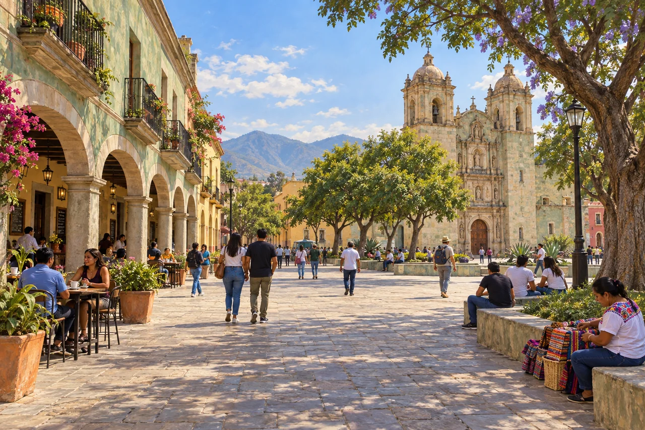
myAudience · original generated illustration · Original generated illustration; interpreted setting, not documentary evidence, current conditions or an authenticated viewpoint.
The World Heritage property pairs Oaxaca de Juárez's historic centre with Monte Albán, an archaeological site outside it. These are distinct places, not two names for one settlement. The city centre presents a colonial grid and public spaces, while Monte Albán shows how an earlier ceremonial and urban landscape was shaped on a hill. Comparing them introduces different relationships between construction, power and terrain.
Oaxaca's central plaza and streets organise a pattern of blocks. A grid can make direction easy to describe, but it does not make every building or social use identical. Arcades, entrances and places of worship create different relationships with the public spaces around them. The centre continues to support cultural, commercial and everyday activity; surviving architecture is not merely a set left behind for visitors.
Monte Albán invites another kind of reading. Terraces and constructed platforms changed the shape of a hill, so buildings must be understood alongside prepared ground and open spaces. UNESCO describes a long history rather than a single moment of construction. An explanation of a platform's purpose requires evidence about its setting and period, not an assumption that every elevated structure in Mesoamerica had the same function.
Our illustration concentrates on a present-day Oaxaca-inspired plaza, not Monte Albán. Compare the shaded arcade with the open area and church-inspired facade. Which kinds of activity might each space support, and what information is missing? Shade and frontage suggest questions about comfort and movement; they do not identify a business, authenticate a ceremony or prove how residents use every part of a real square. The invented layout should never be read as a navigation map.
Learning about heritage also means distinguishing the histories of living communities from a simplified colonial picture. Respect people at work and worship, ask before photographing them and follow site-specific instructions at archaeological places. Our reading makes no claim about current events, access or the structural safety of a pictured building. The comparison begins with two kinds of spatial organisation and continues through evidence that a single attractive city scene cannot provide.
Image: illustration, not a documentary photograph.
Further reading
The World Heritage property combines the historic city of Oaxaca with Monte Albán, but they are not one interchangeable setting. The city is a living urban place shaped in part by colonial organisation; Monte Albán is an archaeological complex on a deliberately prepared hilltop. Treating the pair as separate components helps prevent a plaza photograph from becoming evidence for an ancient ceremonial platform. Their relationship also invites a wider question: how do later urban arrangements sit within a valley whose histories began before colonial planning?
UNESCO describes the historic city's grid and central plaza in relation to its sixteenth-century development. Such geometry organised movement and institutions, but a regular plan does not mean the surrounding valley was previously empty or socially uniform. A map shows spatial arrangement, not every person's access to authority or resources. To explain what the plan meant, connect dated layouts with documented uses and historical context. Architectural regularity is an observation that begins an inquiry; it cannot by itself establish an equal or harmonious society.
At Monte Albán, preparation of the hilltop and terraces made an imposing built setting possible. INAH's account distinguishes the artificially levelled principal space from residential terraces on the slopes. This shows landscape transformation at more than one scale: prominent ceremonial areas and the places where people lived. The evidence can support questions about work, access and organisation without identifying every worker or technique. An explanation should separate observable constructed forms from interpretations about the social arrangements that produced and maintained them.
INAH discusses differences in residential location and links with goods, tribute and exchange. These are ways to investigate variation within a society rather than portray an entire population as one occupation or rank. Material associations need context: a traded object can indicate a connection, but its presence does not prove that every household enjoyed the same exchange or travelled to its origin. Compare where objects were found and the basis of their identification before turning a pattern into a universal account of daily life.
Long occupation and multiple phases make single-cause narratives especially risky. A changing settlement or reduced occupation does not automatically identify one invasion, environmental event or institutional failure. The institution's account supplies selected interpretations, not a complete resolution of every chronological debate. Ask whether the evidence is securely dated and whether it concerns a particular area or the whole complex. This preserves the value of the archaeological record while leaving room for uncertainty, instead of treating uncertainty as permission to invent a dramatic explanation.
Our illustration depicts a city-plaza setting with arcaded frontage, vegetation and people. It is explicitly not Monte Albán, nor an authenticated church, market ceremony or measured colonial plan. It helps compare building edges with open public space and ask what shade, crossing routes and activity contribute to a square. The scene cannot identify a person's community or establish historical continuity from clothing. Connecting it to the reading means explaining its limited spatial lesson, not using the generated scene as archaeological documentation.
Imagine a fictional square refurbishment that keeps an admired façade but removes shade and space previously used for work. A material comparison might find one building edge retained while a use comparison finds important changes. The evaluation needs both, plus accounts from affected users and evidence about the square's significance. An alternative retaining shade and documented activity is not automatically feasible or supported by everyone. Comparing these plans should reveal which criteria are being used and what further evidence could change the judgment.
Transfer question: two maps both contain regular open spaces, so do the colonial city and the ancient hilltop express an identical society with equal access? Answer: no. Similar geometry does not establish the same date, institutions, functions or distribution of power. Locate each plan, distinguish its phases and connect it with appropriate records and material context. The illustration concerns only the city-plaza idea. A justified answer can recognise a useful spatial comparison while refusing to turn resemblance into proof of identical social organisation.