Levuka: a port town follows the land
By Places and their stories · myAudience
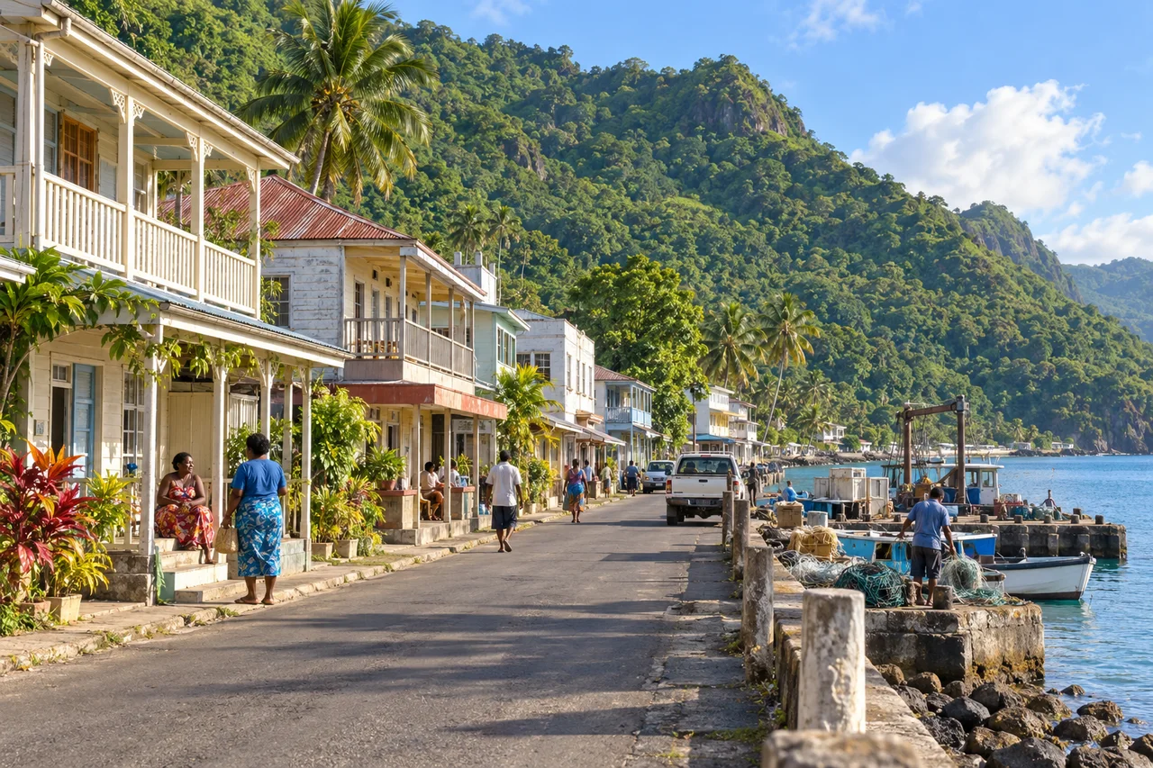
myAudience · original generated illustration · Original generated illustration; interpreted setting, not documentary evidence, current conditions or an authenticated viewpoint.
Levuka lies on Ovalau in Fiji, between the coast and steep wooded slopes. Its low buildings and narrow coastal setting make a different kind of port-city image from a skyline of towers. UNESCO's account places the town within nineteenth-century maritime trade and colonisation, while also describing the influence of Indigenous communities. The story should not begin with the assumption that foreign arrivals created a place without earlier inhabitants.
Beach Street and the routes branching inland reflect the shape of the ground. The town includes commercial, residential, religious and social buildings, many of modest scale. Looking at those uses together helps explain a port as more than a point where ships stop. Goods, labour, homes and institutions connect maritime activity with the lives of people onshore.
Colonial buildings can reveal encounters and unequal systems as well as construction skills. UNESCO's account identifies the town's role in extraction and export and includes the history of labour settlement among its heritage elements. Retaining a veranda or warehouse does not require celebrating every institution associated with it. A fuller reading asks whose work sustained trade and whose account is visible in the surviving record.
The illustration interprets low waterfront buildings, a main street, small vessels and the hillside behind. Notice how little space separates the water from the slopes. What might that imply for routes and expansion? The shape introduces a question, but an answer about a real project would need survey evidence and community perspectives. Buildings, boats and residents here are invented scene details, not an inventory of named monuments or a record of present port operations.
Conservation in a living town involves maintenance, use and its surrounding landscape. An attractive facade alone cannot demonstrate good care, secure livelihoods or resilience to future damage. Give workplaces and private entrances room, ask before photographing people and follow current local guidance. The reading provides background on urban form and history; it makes no claim about current services or permission to enter a building, and leaves space for local people to tell fuller stories.
Image: illustration, not a documentary photograph.
Further reading
Levuka occupies a narrow coastal setting on Ovalau beneath wooded volcanic slopes. UNESCO describes an urban arrangement shaped by this constraint: routes follow the waterfront and adapt to contours inland. Geography therefore helps explain form without determining every historical decision. A limited flat strip can influence how buildings and movement relate to a port, but identifying the actual sequence of expansion still requires records. Read the setting as a relationship between terrain and an inhabited maritime town, not as an empty stage awaiting colonial development.
Indigenous villages and local building traditions are part of the property's account. The nineteenth-century port brought new commercial and institutional relationships into an already inhabited place. This challenges a founding narrative that credits outsiders with creating everything from nothing. Cultural interaction is also not evidence that all participants held equal power. A careful history distinguishes contribution, control and consequence, asking whose records and structures survive and whose experience may be less visible in the account presented to visitors.
Warehouses, homes, institutions and labour-settlement evidence reveal different parts of a maritime economy. UNESCO specifically identifies Baba in relation to indentured labour. That detail prevents the town from being reduced to picturesque buildings or shipping alone. Connecting a building's use with records of labour and movement can reveal how the port depended on people under unequal conditions. The surviving form does not by itself recover their individual experiences; archives and appropriately contextualised accounts are necessary for a fuller interpretation.
Export and colonial administration shaped the port's connections beyond Ovalau. An object or frontage may therefore speak both to local workmanship and to wider commercial or political systems. Neither material mixture nor architectural similarity proves an uncomplicated exchange among equals. Explain which connection the evidence supports and avoid assuming that “influence” means voluntary or balanced participation. This makes the history more demanding, but also more useful: a reader can distinguish the presence of several traditions from an evaluation of the power relations between them.
Authenticity can involve materials, design, workmanship, setting and use, and these aspects do not always change together. A repaired veranda may retain a documented form while replacing some decayed fabric; an untouched exterior may hide a complete change in function. Archive photographs and maintenance records can test those claims. The UNESCO account includes historical management arrangements, which should not become a promise about current regulations or condition. The analytical task is to make the evidence and criterion explicit before comparing conservation choices.
Our low waterfront scene is a composite interpretation rather than a measured street or inventory of named Levuka buildings. It can show the relationship between coast, frontage and rising terrain. The vessels and structures cannot establish present port operations, building condition or an exact historical year. Avoid assigning a generated façade to a known institution simply because it resembles a familiar type. The image introduces the setting; the reading's historical detail comes from the source account, not authenticated visual records in the scene.
A fictional conservation plan restores a veranda but removes records of Indigenous residents and indentured labour from its explanation. Another retains the same material work and includes these histories, with sources and room for affected communities' accounts. The second provides a broader initial interpretation without automatically proving consent or an adequate restoration. Material care and historical representation should be evaluated separately and together: a socially inclusive display does not excuse damaging fabric, while careful repair does not justify an empty-land narrative.
Transfer question: if both plans keep the same veranda, are their historical interpretations equally strong? Answer: not necessarily. The retained material addresses one dimension of conservation; the erased labour and Indigenous histories affect what visitors are taught about the town's formation. Prefer the account that tests and includes these relationships, while checking its evidence rather than assuming every added statement is accurate or agreed. The conclusion concerns the plans as described. It cannot establish a universal community consensus, identify every participant or certify either repair from a picture.