Hong Kong: a longer history in coastal stone
By Places and their stories · myAudience
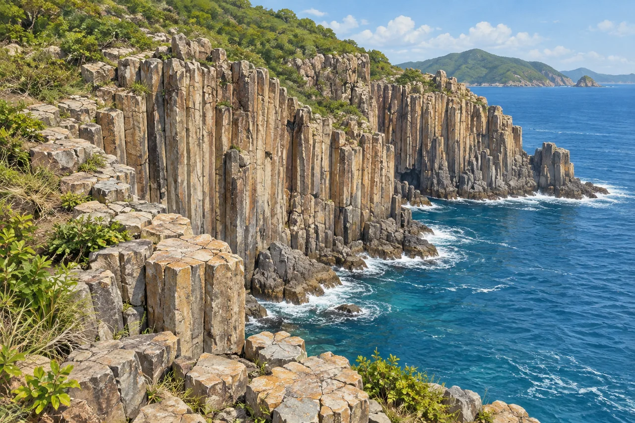
myAudience · original generated illustration · Original generated illustration; interpreted setting, not documentary evidence, current conditions or an authenticated viewpoint.
Hong Kong's landscape includes much more than its dense urban skyline. Its UNESCO Global Geopark brings coastal landforms and geological evidence into a different view of the territory. A geopark is not the same designation as a World Heritage property, and the distinction matters when describing its purpose. The geological record connects present cliffs and islands with environments that changed over very long periods.
UNESCO's account highlights the light-coloured, silica-rich rhyolitic columnar rock of the High Island Formation. Similar-looking columns elsewhere are often made of darker basalt, so an outline alone is not a reliable way to identify a rock. Shape and composition are different kinds of evidence. A proper geological explanation brings observed structure together with material properties and the history inferred from them.
The wider geopark also contains sedimentary rocks and coastal erosion features. Those belong to different parts of the landscape's history; they should not all be described as the product of one volcanic event. Comparing a layered sedimentary exposure with a columnar volcanic one would raise questions about how each formed and what happened afterward. Actual investigation needs field evidence and records, not just the appearance of stone in a picture.
Our interpreted coast shows prismatic joints, fractured tops and waves at a cliff's foot. First describe the visible forms, then ask which further evidence would be needed to explain them. A mineral or chemical analysis could help identify composition; a mapped outcrop could establish relationships beyond the frame. The illustration supplies neither. Its light stone suggests the source account, but cannot authenticate a particular geosite, every polygonal joint or a geological boundary.
Geological heritage is also part of an inhabited landscape. UNESCO's account includes the cultural histories of coastal communities, not only spectacular rock. Follow current official guidance and do not remove material, approach exposed cliff edges or infer a route from this scene. The reading invites observation and comparison without offering tide times, transport services or a judgement about current access. A city's deeper history can be explored without treating every striking formation as something to climb.
Image: illustration, not a documentary photograph.
Further reading
Sai Kung's columns invite a useful puzzle: why does a volcanic coast have such regular sides? Hong Kong's geopark includes a much longer geological record than this formation alone. UNESCO describes environments ranging from river deltas and shallow seas to volcanic terrain. These are chapters in a changing landscape, not different names for one eruption. Reading a coast starts by distinguishing the origin of its rock from the processes that later exposed and reshaped it.
The Hong Kong Geological Survey describes the High Island Formation as a fine-ash volcanic tuff with crystals and extensive columnar joints. Tuff is rock made from volcanic fragmental material; it should not automatically be called a frozen stream of lava. The survey interprets several pyroclastic-flow deposits within the formation, while much of it probably cooled as one unit. A deposit boundary and a cooling-unit boundary can therefore tell different parts of the story.
As a hot rock body cools, contraction can generate fractures. The government's structural-geology account explains that cooling joints commonly develop perpendicular to the cooling surface and can form columns. Think of these joints as divisions within the material, not as seams where builders stacked blocks. Cooling history helps explain geometry, while chemical and mineral evidence identifies the material. Six sides alone cannot distinguish a rhyolitic tuff from basalt, and real joint patterns need not be perfectly regular.
The sequence continues after solidification. Weathering changes exposed rock; waves act along the coast; existing fractures help influence the forms left behind. A column standing above the sea today is thus evidence of both an older rock body and later exposure. The survey's mapped relationships and borehole records go beyond any single view. To test competing formation explanations, geologists compare structures across outcrops and examine the rock, rather than choosing whichever story resembles a familiar photograph.
Elsewhere in the geopark, UNESCO identifies shale at Tung Ping Chau. Shale and the High Island volcanic rocks require different origin explanations. Comparing them teaches a transferable skill: identify which feature is being explained before selecting a process. Layered sedimentary material raises questions about deposition and subsequent change; columnar jointing raises questions about fracturing and cooling. Neither a coastal location nor an attractive polygon is a substitute for that distinction.
These shores are also inhabited places. UNESCO describes Hakka villagers and fishing families, with temples and community traditions connected to the sea. Geological conservation and cultural continuity need not be competing subjects. A heritage account can ask how residents use and care for coastal places, rather than presenting villages as scenery left outside the scientific story. The geological timescale explains the rock; it does not erase the shorter histories of work, worship and settlement.
The existing illustration shows pale prismatic rock, broken tops, vegetation and water at the cliff's foot. It is a good hook for comparing fracture geometry with coastal exposure. It is not a mapped High Island outcrop, a chemical test or a cliff-safety assessment. Its columns should be read with the tuff-and-cooling explanation, not treated as documentary proof that every depicted pillar has six sides or that all columns in the world are basalt.
Try an unfamiliar comparison: two fictional samples both show six-sided columns. Sample A contains volcanic ash fragments and has silica-rich composition; B is identified by laboratory analysis as basalt. A caption calls both basalt because their outlines match. Answer: reject the common rock identification while retaining a possible common process of cooling-related contraction. A's fragmental texture and composition support a different rock account from B. Geometry helps frame a mechanism question, but material evidence decides the identification. Neither sample's dimensions alone establishes a cooling time.