Porto: a city shaped by river, slope and trade
By Places and their stories · myAudience
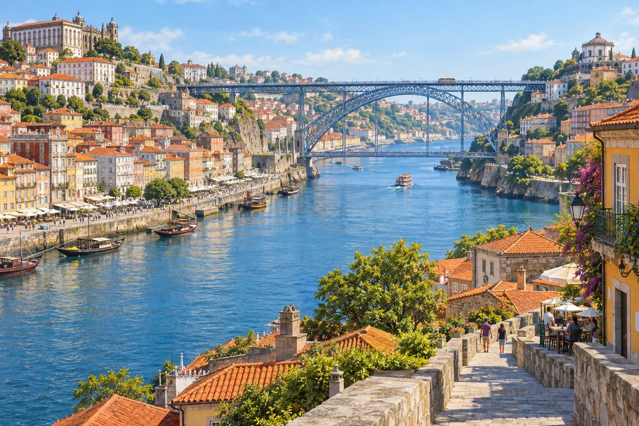
myAudience · original generated illustration · Original generated illustration; interpreted setting, not documentary evidence, current conditions or an authenticated viewpoint.
Porto's historic centre rises above the Douro rather than spreading across a flat waterfront. From the river, roofs, terraces and streets appear stacked against the hillside. The setting helps explain why a view of the city is also a view of movement: between water and land, between lower quays and upper streets, and between local neighbourhoods and distant trading connections.
UNESCO's account connects the city's development with maritime commerce and successive periods of building. A Romanesque cathedral core, later churches, civic buildings and the former stock exchange belong to different chapters. They are not interchangeable decorations from one golden age. Comparing their forms asks how religious, commercial and public institutions chose to represent themselves, and how later additions fitted within inherited streets.
The designated property includes the Luiz I Bridge and the Monastery of Serra do Pilar as well as the historic urban fabric. This encourages attention to relationships across the river, not just a collection of facades on one bank. A crossing joins places but also changes what can be seen between them. Its place in a cityscape does not, on its own, establish the details of its engineering or every alteration over time.
In our interpreted scene, follow the repeated roofs uphill and compare the broad river with the narrow routes between buildings. Which relationships would remain if individual monuments were hidden? You could still discuss slope, density and a waterfront edge. To identify an actual building or evaluate a bridge, however, you would need reliable plans and records. The picture introduces a Porto-inspired arrangement rather than authenticating every depicted structure.
A historic centre is also a place where people live and work. Conservation has to consider ordinary buildings and local needs alongside prominent monuments. Ask how a restored street can support residents as well as visitors, and whose account is missing from a postcard view. Give doorways and everyday routes space; use current official information for arrangements. This reading offers background without turning a bright river scene into a guarantee about present access or conditions.
Image: illustration, not a documentary photograph.
Further reading
Porto's historic centre joins river commerce, hill settlement and routes through a layered urban landscape. Different buildings and connections belong to different periods and activities; the city is not one architectural moment frozen in place. A port needs relationships between movement, storage, work and habitation. Geography helps explain why a connection may be useful, while records establish how particular institutions and projects developed. Reading the centre this way makes the river and slopes part of its history, rather than a scenic backdrop behind famous façades.
The fourteenth-century wall incorporated both the older town and harbour nuclei in UNESCO's account. This makes a defensive boundary evidence of urban change: waterside activity became part of a broader enclosed settlement. It does not mean that every building inside the boundary dates from the wall's construction. Compare the boundary's purpose with the activities it surrounded, then distinguish later changes. A map of documented phases can reveal growth more clearly than describing all the surviving streets as though they emerged simultaneously.
The cathedral's Romanesque core, later public buildings, Palácio da Bolsa and São Bento station belong to different institutional and architectural relationships. Religious activity, commercial organisation and transport do not share one function merely because their buildings are now visited on a short walk. Tracing these distinctions shows how a living city's needs change. It also avoids equating a building's present tourist appeal with its original role. Records and material evidence should explain chronology and use, rather than treating a picturesque collection as a single rebuilding programme.
The river crossings supply a concrete chronological sequence. Official records describe an 1843 suspension predecessor, an 1880 competition for its replacement and the Luiz I bridge associated with the 1886 opening and 1887 predecessor closure. Opening a replacement and closing an older crossing are different events; nearby years are not a contradiction when their roles are stated. The consulted official accounts disagree on more precise opening details, so this reading does not assert an exact day or month. Its chronology rests on the distinctions the evidence can sustain.
The replacement requirement connected lower riverside districts and higher ground on both banks through two levels. A crossing can shorten a useful connection only if its approaches relate to the places people need to reach. This explains why a bridge's urban role includes topography and routes, beyond the span alone. It does not calculate stresses, capacity or current service reliability. Those claims require an engineering assessment or up-to-date operating evidence, not an inference from a historical description of the design requirement.
Project attribution also matters. Official heritage records connect Luiz I with Théophile Seyrig and distinguish it from the separate Maria Pia railway crossing associated with Gustave Eiffel. Calling every prominent iron bridge in the landscape an Eiffel design erases this distinction. A reliable account names the project and the attributed designer together, rather than relying on a general visual association. This is a small but instructive historical correction: related materials or appearance can connect structures without making their authorship or function identical.
The reused river, slope and bridge illustration helps orient these relationships. Its geometry is qualitative, not a survey of deck use, material properties or a live transport service. The chronology and two-level connection requirement come from records rather than generated pixels. Read the foreground and background together to ask how the crossing links different levels of the city. Then consult the appropriate source for the claim being made, keeping an historical explanation distinct from a promise about today's access or service.
Transfer question: Two plans restore identical river-facing façades. One changes residences into visitor-only uses. Are both equivalent, and does the pictured bridge prove their transport arrangements are adequate? Answer: Suppose a conservation proposal retains the river skyline but removes documented connections between working districts and transport routes. A competing proposal evaluates fabric alongside resident access and continuing use. Keeping the same distant view does not make them equivalent. Compare the affected routes, institutions and users, and ask how the changes relate to the site's documented significance. Neither proposal is automatically fair or feasible: maintenance evidence and accounts from affected residents may alter the judgment. The stronger initial argument explains urban relationships, instead of treating the landmark image as the whole city.