Bergen's Bryggen: the history behind the gables
By Places and their stories · myAudience
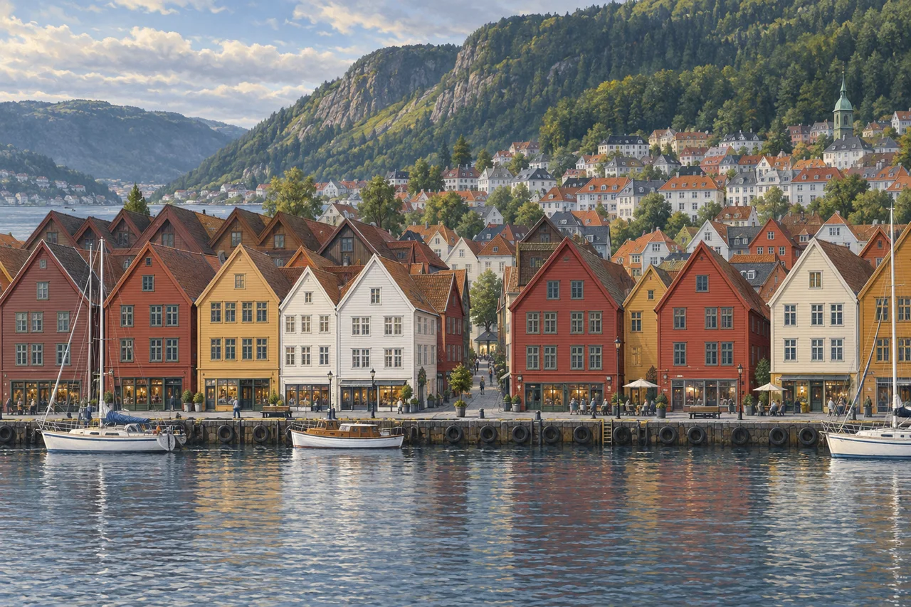
myAudience · original generated illustration · Original generated illustration; interpreted setting, not documentary evidence, current conditions or an authenticated viewpoint.
The timber gables of Bryggen introduce Bergen through its harbour. Their repeated narrow fronts make a memorable pattern, but the pattern becomes more interesting when you look beyond the waterfront. The buildings extend into long plots with passages between them. Thinking about what lay behind a facade changes the view from a row of picturesque houses into a working arrangement of storage, movement and residence.
UNESCO associates the district with the Hanseatic merchants who established a trading office in Bergen in the fourteenth century. Stockfish from northern Norway was central to that commerce. Trading privileges and control mattered alongside vessels and goods, so economic history should ask who could participate and who held authority. The surviving fabric provides evidence of one trading organisation, rather than a complete account of every person connected to the port.
Fire and rebuilding are essential to the story. Bryggen's present appearance largely follows rebuilding after the fire of 1702, with subsequent damage and conservation. Continuity of plot patterns and building methods does not mean every timber is medieval. UNESCO also describes stone storerooms at the back for valuable goods. Contrasting timber structures with fire-resistant storage helps explain why a district's materials and layout deserve to be studied together.
Look for a narrow passage in our interpreted waterfront. What might the facade conceal about the space behind it? A photograph or survey from the actual passage could reveal depth, construction and changes of use that a distant view cannot. Our scene shows a plausible Bryggen-inspired rhythm of gables and harbour activity. It does not reproduce an authenticated building inventory, historic merchant residence or exact surviving fabric.
Care for timber heritage involves patient maintenance as well as dramatic restoration. The buildings remain part of a living city, with present uses that differ from Hanseatic trade. Respect narrow routes and private thresholds, and avoid treating working places as scenery reserved for your picture. An attentive visit can compare what is conserved, what has changed and what evidence supports each account, using current local guidance for actual arrangements.
Image: illustration, not a documentary photograph.
Further reading
Bryggen belongs to a maritime network, not just a colourful waterfront. UNESCO connects Bergen's Hanseatic office established in 1350 with stockfish exchange and an organised merchant quarter. Northern fisheries, shipping and commercial institutions help explain why buildings were used together. The surviving façades introduce that network, but storage and work lie behind the view. Start with these relationships to understand a place where movement of goods and people shaped both the built arrangement and the power of those able to trade.
Crown-granted trading privileges and concentrated merchant control were institutions within this exchange. A trading network can distribute goods while limiting who participates or receives its benefits. Describing it as efficient or international does not establish that it treated all people equally. Ask how the documented privileges structured access and authority, rather than assuming that visible prosperity represents every worker's experience. The source supports this institutional context; individual lives and disputes would need appropriately located records for a fuller social history.
The long, narrow gård arrangement connects waterside offices and dwellings with storage and rear assembly or cooking spaces. Its sequence makes work and residence spatially legible. Frontage was one part of a deeper organisation, so a façade-only conservation account can miss how activities depended on passages and rear spaces. Plans and records help distinguish these functions; one doorway alone cannot identify every room. The useful question is how linked spaces supported the quarter's activities, not simply which front looks oldest or most attractive.
Timber construction and stone storerooms for vulnerable goods responded differently to fire risk. Material choice and separated functions show practical distinctions within a commercial setting. Stone storage does not make the entire quarter noncombustible, nor does an historical protective purpose establish a modern fire rating. Investigate how the materials and spatial arrangement related to particular risks in their historical setting. This avoids two misleading extremes: treating timber as mere decoration, or assuming one more resistant element certified every part of a connected building group.
Repeated fires and rebuilding are central to the chronology. UNESCO associates the present appearance with construction after the 1702 fire while older property layouts were retained. A surviving organisational pattern and surviving original material are different forms of continuity. A reconstructed building can follow an earlier plot without every visible timber having survived from the Middle Ages. This distinction matters to conservation: documenting which fabric changed and which relationships persisted produces a clearer account than claiming that an apparently old street remained untouched.
Later decline and craft or tourism reuse changed everyday economic functions. A building may retain aspects of layout and workmanship while its work changes. Repair practices and compatible materials can preserve physical continuity, but present use also affects workers, residents and access. Assessing those consequences requires their evidence, not only visitor impressions. The historical account explains a sequence of uses; it does not establish that all current benefits or burdens are settled, or that a renewed façade alone guarantees the survival of a craft tradition.
The reused illustration shows waterfront rows and passages as an entry into this spatial story. It does not count all current buildings or authenticate the age of a timber. The sourced front-to-rear arrangement, fire history and reconstruction provide explanation beyond what a broad view can reveal. Follow a passage imaginatively from trade-facing front to storage and rear activity, while remembering that exact room use requires documented evidence. The image supports orientation; chronology and material claims come from the relevant records.
Transfer question: A rebuilt row copies its old gables but removes long passages and rear storage. Does a matching harbour view establish preservation of the whole working district? Answer: No. Removing the long passages and rear storage changes the working arrangement even if the gables and harbour view still match. The documented relationships between trading premises, storage, access and inherited plots are part of the district's significance; a skyline cannot substitute for them. Compare plans and dated records to identify which relationships the proposed rebuilding retains or removes. Post-fire reconstruction also means that continuity of arrangement should not be confused with untouched medieval timber. A justified judgment would consider material fabric, spatial organisation and changing use together. It would reject the matching-view claim without assuming that every later alteration necessarily destroys all significance.