Okavango: a delta that does not reach the sea
By Places and their stories · myAudience
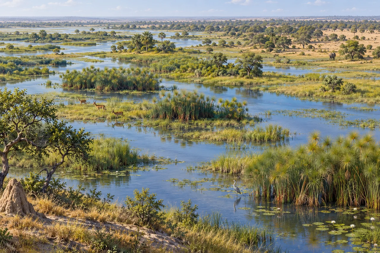
myAudience · original generated illustration · Original generated illustration; interpreted setting, not documentary evidence, current conditions or an authenticated viewpoint.
The Okavango Delta invites a different image of a river's destination. In northwestern Botswana, its water spreads through an inland wetland system rather than reaching an ocean through a coastal mouth. Channels, swamps and seasonally flooded grasslands create a changing mosaic within the Kalahari Basin. The scene makes most sense as a set of connected habitats, rather than one lake with a fixed outline.
UNESCO highlights the arrival of floodwater during Botswana's dry season and the biological rhythms associated with that timing. Rainfall and inundation are therefore not necessarily simultaneous at one place. The relationship encourages a useful question: how can events elsewhere in a river system influence conditions farther downstream? An account of the delta needs connections between climate, water movement and life, not just the amount of water visible in one image.
The delta also changes through the movement of channels and the formation of islands and habitat gradients. Permanent wetland, temporarily flooded ground and drier woodland provide different opportunities for plants and animals. A species list cannot explain all those relationships. To understand an ecological change, you would want observations over time, evidence about where water went and an honest account of what was actually measured.
Follow the waterways and vegetated islands in our interpreted scene. Which areas appear wet, and which might support different conditions? Those are visual starting points, not a surveyed map or a prediction of the next flood. The illustrated animals are not a population sample. You cannot estimate current wildlife abundance, identify every plant or establish water quality from the picture, even when its habitat arrangement is plausible.
The delta belongs within a wider river basin and a human landscape. Conservation questions include upstream decisions, community responsibilities and the effects of visits, rather than assuming that beauty proves a place has no people or pressures. Give wildlife distance and follow current authorised guidance without using this illustration to choose a route. Understanding relationships can deepen appreciation while leaving present conditions and practical arrangements to fresh evidence.
Image: illustration, not a documentary photograph.
Further reading
The Okavango Delta is an inland delta within an endorheic system: the water network does not lead to a sea outlet. That description concerns a system boundary, not an absence of movement. Water can leave one wetland patch through a channel and enter another part of the basin. Keeping local and whole-system accounts separate is the first step towards understanding its shifting mosaic. The delta is a connected landscape of water, land and ecological processes, not a static lake whose every part follows the same pattern.
UNESCO describes floodwater arriving during Botswana's dry winter season. Local rainfall and inundation therefore need not occur together. Upstream events can affect a place even when the rain falls elsewhere or at a different time. This is a mechanism for investigating seasonal ecological relationships, rather than a fixed forecast. The source does not give this exercise a measured travel time for a particular flood. Any claim about an exact lag or today's water level would require dated observations along the relevant river network.
Channels, islands and permanent or seasonal wetland areas create different conditions for organisms. Change in one connection may alter where water reaches without producing the same response in every habitat. Explain which location and process a claim concerns before generalising across the delta. A species that uses one habitat can respond differently from another with different requirements. Mapping connections and observing relevant organisms are complementary tasks; a general landscape description alone cannot establish that every ecological response is beneficial or identical.
Species records and surveys also have methods. Location, observation period and detection affect what a count means. UNESCO's account notes variable monitoring evidence, so an older source list should not be turned into a current population census. Not seeing an organism in one survey is different from demonstrating its absence throughout the property. To compare records, ask whether the effort, season and identification methods match. This makes the interpretation less sweeping but more useful: the observation is evidence with a defined scope, rather than an unrestricted claim.
Decisions upstream can influence connected places, which makes river-basin governance part of the ecological story. Community interests and Indigenous relationships should not be reduced to a technical water-volume question. A sound comparison considers which activities depend on particular connections and who bears costs when they change. Historical descriptions of management or abstraction are not current permissions. Nor does this account establish a universal amount that can be removed without consequence. Such judgments need current evidence, a declared spatial boundary and appropriate participation.
The reused illustration presents a channel mosaic and illustrative wildlife. It invites questions about the links between open water, vegetation and islands, but it is neither a flood survey nor an animal census. Do not estimate discharge or stock from the width of a generated channel. The mechanism in this reading comes from the sourced account and the explicit thought experiment below. The scene helps a reader locate questions in a landscape; measured answers require the relevant observations and methods.
Choose one fictional patch and one accounting period. It starts with 1,000 m³ of stored water, receives 60 m³ upstream and 5 m³ local rain, loses 40 m³ through evaporation and transpiration, and transfers 15 m³ into another channel. With no other flows, change is 60 + 5 − 40 − 15 = 10 m³; final storage is 1,010 m³. The numbers are chosen for arithmetic, not Okavango measurements. The outgoing transfer reduces this patch's storage while remaining inside the broader endorheic basin.
Transfer question: Compute the chosen patch balance; then set rain to 0 while holding other terms fixed. Does 15 m³ local outflow mean the inland delta reaches the ocean? Answer: Would a 15 m³ local transfer disprove the description of a delta without an ocean outlet? No: the chosen boundary surrounds a patch, and its channel leads elsewhere inside the basin. Setting local rain to zero while keeping the other fictional terms unchanged gives final storage 1,005 m³, still above the starting amount. Upstream supply can therefore sustain this chosen local increase without local rain. This does not predict an annual flood or wildlife outcome; it demonstrates why boundary choice and all the specified flows matter to the conclusion.