Blue Mountains: look beyond the blue distance
By Places and their stories · myAudience
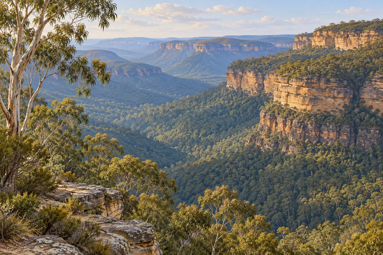
myAudience · original generated illustration · Original generated illustration; interpreted setting, not documentary evidence, current conditions or an authenticated viewpoint.
The Greater Blue Mountains Area introduces a sandstone landscape west of Sydney through plateaux, escarpments and deeply cut gorges. Its distant ridges may first draw the eye, but the forests deserve equal attention. A single view of cliffs cannot represent the whole protected area. Looking closely means connecting rock, changing ground conditions and vegetation rather than treating the forest as one green background.
UNESCO's account emphasises the variety of eucalypt-dominated habitats and their evolutionary significance. Wet and dry forests, heathlands and more localised wetlands are not interchangeable environments. Different conditions support different plant communities. The important idea is diversity within an apparently familiar landscape: an eucalypt canopy is the beginning of a question about habitat, not enough information to identify every species or explain every ecological relationship.
The terrain helps create that variety. Sandstone tablelands and incised valleys influence the settings in which vegetation grows, while water systems and fire are among the processes connected with the area's ecological values. Explaining a particular change would require observations and knowledge of local conditions. A general reading should neither claim that every fire has the same effect nor mistake a quiet-looking forest for an unchanging system.
Compare the horizontal rock beds, steep escarpment and forested gorge in our interpreted view. What information does the scene offer about relief, and what does it leave unknown? It suggests relationships between a plateau edge and lower ground but does not identify a rare plant, map a habitat or establish a walkable route. The painted trees are eucalypt-inspired forms, not a botanical inventory or the location of a protected remnant population.
UNESCO also recognises ongoing Aboriginal custodial relationships with this country. Those connections should be understood alongside its biological values, without reproducing sacred material or treating Indigenous presence as only ancient history. Follow current local guidance, respect restricted places and avoid disturbing plants for a closer picture. The landscape can reward careful observation while leaving actual conditions, access and precise ecological claims to fresh, place-specific evidence.
Image: illustration, not a documentary photograph.
Further reading
The Greater Blue Mountains combine an incised sandstone tableland, plateaux and gorges with eucalypt-dominated ecosystems. A famous outlook is only one part of this wider property. Rock, terrain and living communities relate across different conditions, but no single distant view displays every relationship. Start by asking which part of the landscape a statement concerns. This distinction helps connect physical setting and ecology while avoiding the assumption that similar-looking green slopes constitute one uniform habitat throughout the region.
UNESCO describes wet and dry forests, mallee heathlands and local wetlands among the property's communities. Water availability, terrain and other conditions can support different compositions. Similar canopy colour at a distance does not identify the same organisms or structure underneath. Investigating a habitat requires located observations rather than a palette comparison. This is a useful ecological lesson beyond the site: a broad visual category can orient a reader, while reliable identification and environmental context are needed to explain which community is actually present.
The account values diversity and evolutionary relationships among plants and environments. Evolution is not a ladder ranking one living plant as more advanced than another. Related lineages have histories of divergence and adaptation, and different conditions can favour different traits. Source inventories describe taxa at a stated point in research; they are not a current complete census supplied by this reading. A generated canopy cannot authenticate those taxa. Use the documented diversity to frame questions about relationships, not to invent identifications from distant shapes.
Water systems, understorey, terrain and fire interact, but their effects depend on location, timing and relevant organisms. A single claim that fire always benefits or always harms the whole property misses those distinctions. To investigate a response, specify what changed, when it was observed and which populations or communities were assessed. Similar appearance after an event does not establish identical recovery. The mechanism is conditional and evidence-based, rather than an instruction for managing a real fire or an assurance that every disturbance is harmless.
UNESCO also identifies continuing Aboriginal custodial relationships. Describing several language groups does not mean that every community holds one uniform view or that their knowledge can be published without appropriate context. This reading does not reveal sacred details. Relating the living cultural history to the environmental account challenges the idea of an empty natural landscape. Historical management text should likewise not be promoted into a current access, airport or legal claim; those matters require the relevant up-to-date authority and evidence.
The reused illustration shows sandstone cliffs, a gorge and eucalypt-inspired vegetation. It is not limestone scenery or a botanical survey, and it does not locate a rare Wollemi pine population or certify a named walking route. The scene helps orient the relationship between elevated surfaces and incised terrain. The explanation of community diversity comes from sources and observation methods rather than generated leaf detail. This separation makes the visual useful while keeping rare-species, access and identification claims within their proper evidence boundaries.
Choose two fictional equal-effort plots. Observers identify three taxa in one and five in the other during the same sampling exercise. Observed richness is higher in the second plot, but the result is not a census of the property. Detection, season, location and identification can affect the comparison. Richness counts distinct taxa; it does not by itself describe the number of individuals, their relative abundance or a community's response to disturbance. State those distinctions before assigning a broader ecological judgment to the numerical difference.
Transfer question: Two plots have equal apparent canopy cover; equal-effort sampling detects 3 taxa in A and 5 in B. Are the habitats identical, and is B necessarily more resilient after any fire? Answer: Would equal green canopy cover in two photographs prove identical diversity or resilience? No. The chosen plot counts already show how a similar broad appearance can coexist with different observed richness, and even those counts have sampling limits. Compare identified, repeated and representative observations before extending the claim. Recovery after a disturbance needs relevant measurements over time, not richness alone. A defensible conclusion describes what is observed and what additional evidence would test the broader explanation, without inventing a rare species' location or declaring one community universally better.