Historic Cairo: a living city with many layers
By Places and their stories · myAudience
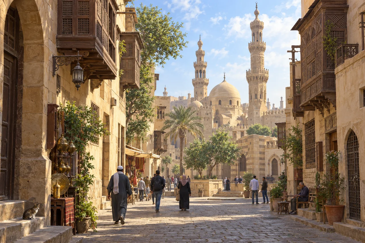
myAudience · original generated illustration · Original generated illustration; interpreted setting, not documentary evidence, current conditions or an authenticated viewpoint.
Historic Cairo offers a view of Egypt that extends beyond the familiar pyramids. Mosques, schools, gates, houses and streets belong within a dense urban landscape whose history continued across successive states. The district is part of a present city, not a separate stage cleared of everyday life. Its buildings become more informative when their relationships with streets, institutions and communities are considered together.
UNESCO describes a Fatimid nucleus established in the tenth century, with later Ayyubid, Mamluk and Ottoman contributions and connections to earlier settlements. This is a sequence of change rather than one generic medieval period. Later rulers and residents worked within inherited spaces while adding their own. Architectural variety can help introduce the sequence, although particular building dates and names need identified evidence.
The city's position connected trade, political authority, scholarship and pilgrimage. A mosque or school can be understood as an institution as well as a monument, while a gate belongs to an arrangement of routes and boundaries. Those functions were not identical across centuries. Learning about a street means asking what happened there, who could use it and how surviving material relates to written accounts.
In our interpreted view, compare an enclosed passage with a more open court, and notice how domes and minarets organise the skyline. What can a view suggest about scale, and what can it not tell you about a building's use? A tower's form alone cannot establish a dynasty, a prayer practice or the meaning of carved marks. Our illustration combines Cairo-inspired masonry and streets without authenticating inscriptions or naming every structure.
Respect working streets and places of worship, including rules about access and photography. Care for an urban heritage area involves homes and livelihoods alongside conservation of prominent buildings. Ask how accounts of the city can include both famous patrons and less visible residents. Current local guidance is needed for an actual visit. The aim here is to start noticing Cairo's layered urban history, without making one picturesque street represent every community or the whole capital.
Image: illustration, not a documentary photograph.
Further reading
A fuller chronology makes Cairo's layers easier to follow. UNESCO dates the Fatimid foundation to 969 and describes its later expansion into an urban fabric that incorporated earlier settlements, including Fustat. Ayyubid, Mamluk and Ottoman developments did not all take the same form. They added institutions and buildings while working within inherited streets and neighbourhoods. This explains why the history cannot be read as a neat set of districts, each containing only one dynasty. New uses could develop beside older ones, and existing structures could be repaired or altered. The city is therefore a useful introduction to historical change through addition, adaptation and continuing occupation, rather than through a complete replacement every time political authority changed.
The Qalawun complex gives that institutional history a named example. Egypt's Ministry of Tourism and Antiquities dates its establishment to 1283–1284 and identifies a mosque, school, burial and hospital among its functions. Those uses connect worship, education, commemoration and care within one architectural ensemble. The combination is more informative than a judgement about how ornate the façade looks. A patron could make authority visible while also supporting institutions used by different groups of people. A complex's effect on the surrounding city depended on those activities as well as its scale. This is a historical example, not a claim that the surviving rooms all retain their original functions or provide particular services to visitors today.
Water provision offers another connection between a building and the street. The Ministry's account of the sabil-kuttab of Abd al-Rahman Katkhuda dates it to 1744 and describes a drinking-water room with windows and exterior basins, with a school above. A passer-by encountered the water-provision function at street level, while teaching occupied a different part of the same structure. That arrangement made two forms of provision visible within a compact urban setting. It also explains why a small monument can carry a story larger than its footprint. Architectural openings were not only decorative: they connected a function inside with people outside. The surviving details help a reader imagine that relationship without reproducing an inscription or guessing what an unverified mark says.
Domestic architecture introduces another scale. The Cairo Governorate's account of Bayt al-Suhaymi identifies an initial building of 1648 and an added section of 1796. It describes rooms and buildings around a courtyard, with projecting wooden lattice windows, or mashrabiyas. The lattice allowed views outward while helping protect privacy. This connects craft directly with a household's relationship to the world beyond it. A wall does not have to be either completely closed or completely open: a patterned screen can mediate that boundary. The house's growth also shows why a historic residence may be an assembly of phases rather than a single design completed on one date. Its spaces need to be understood together with the people and uses they accommodated.
The same official account records wells, a bathing area, a cattle-powered grain mill and a water wheel associated with garden irrigation at the house. These details bring work back into a setting that might otherwise be admired chiefly for carved wood. Water had to be provided, food processed and outdoor space maintained. A mill transforms energy supplied through movement into the work of grinding, while a water wheel addresses the movement of water. The two mechanisms perform different tasks even though both can be described casually as wheels. Their presence helps connect architectural beauty with household provisioning. The point is to notice the practical systems supporting life within the building, not imagine a historic house functioning without labour.
From this perspective, Cairo's streets connect several kinds of institution rather than merely separating monuments. UNESCO describes commercial activities reflected in street and market names, alongside schools, water provision, homes and religious buildings. The route through a neighbourhood therefore gathers different histories at close range. Our interpreted street scene can introduce the contrast between an enclosed passage and a wider opening, but it does not locate the Qalawun complex, Katkhuda sabil or Bayt al-Suhaymi within an authenticated view. Those named examples belong to documented readings rather than invented identifications in the artwork. Together they provide a richer way to approach Historic Cairo: as a continuing city where craft, water, learning, care, worship and everyday movement have shaped the built environment over centuries.