Jaipur: the ideas behind an ordered city
By Places and their stories · myAudience
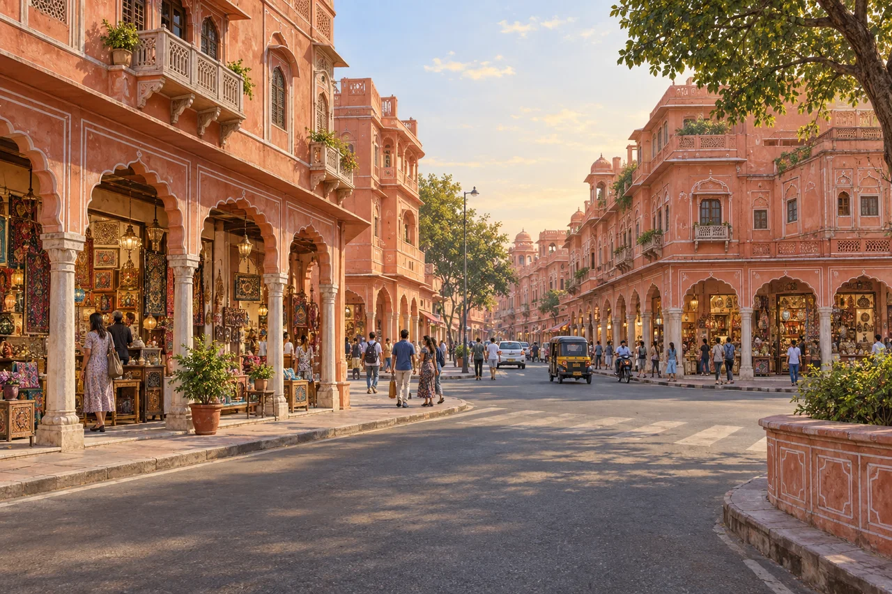
myAudience · original generated illustration · Original generated illustration; interpreted setting, not documentary evidence, current conditions or an authenticated viewpoint.
Jaipur's historic walled city invites you to look beyond a single celebrated facade. Broad streets, repeated shopfronts and public intersections belong to a planned urban arrangement. Founded by Sawai Jai Singh II in 1727, the city was conceived as a commercial capital. Its organisation helps connect architecture with the movement of people, the location of trades and the ambitions of a ruler.
UNESCO describes a grid-based plan informed by traditional Hindu architectural ideas and exchanges with Mughal and Western planning. This is a history of adaptation rather than a choice between a wholly local or wholly imported design. Large intersections known as chaupars create public spaces within the street system. Looking at their relationship with neighbouring routes can explain more than studying a facade in isolation.
Bazaars and craft traditions are central to the account. Repeated street elevations provide visual order while individual workshops and businesses give the streets their uses. Planned sectors also reflected social distinctions, including occupation and caste. An orderly plan therefore does not demonstrate equal opportunity. Understanding its achievements should leave room for questions about who made the city, who worked within it and whose choices were constrained.
In our interpreted scene, compare the rhythm of shaded arcades with the openness of an intersection. How might a continuous frontage influence a pedestrian's experience? That question concerns space rather than a guarantee of comfort in present conditions. The illustration does not reproduce a measured chaupar, authenticate every balcony or identify the workshop behind a doorway. A map and building records would be needed to test a specific claim.
Learning about Jaipur can include the people maintaining and adapting its buildings today. Conservation is also about materials, skilled work and the practical needs of a living commercial city. Ask how a repaired facade relates to the building behind it and to the livelihood it supports. Give working entrances space and use current official information for arrangements. Enjoy the composition while allowing urban history to remain more complex than an attractive colour scheme.
Image: illustration, not a documentary photograph.
Further reading
Jaipur's walled city was conceived as a commercial capital under Sawai Jai Singh II, with its founding in 1727. Its plan connects streets, markets, public intersections and royal spaces. Looking at these relationships explains why urban history is more than the date of a famous facade. A trader needs a reachable shop, a workshop needs connections to customers and supplies, and a public square creates a place where several routes meet.
UNESCO describes a grid arrangement drawing on traditional Hindu planning and exchanges with other architectural traditions. The comparatively level site allowed an organised street system, while surrounding hills still influenced the setting. A grid can clarify routes and repeat building plots, but it does not make geography irrelevant. Nor does its regular appearance mean that every part of the city emerged through the same construction campaign. A plan is a framework within which buildings acquire their own histories.
Large intersections known as chaupars give the street system public spaces rather than merely narrow crossing points. Main avenues were designed as bazaars, placing commercial activity along movement corridors. Repeated elevations create a recognisable street edge while shop entrances connect individual premises with the shared route. To understand this mechanism, compare a continuous wall without openings with a frontage of accessible shops: the outline may remain orderly while its relationship to public activity changes substantially.
Planning also organised social distinctions, including occupation and caste. Recognising that historical feature neither endorses it nor explains every resident's experience. Records about allocation, ownership, labour and access would be needed to investigate who benefited from particular arrangements. The city can demonstrate skilled planning while also raising questions about unequal opportunity. Architectural coherence and social fairness are different claims, so evidence for the former should not automatically be offered as proof of the latter.
A later monument demonstrates why chronology needs more than one landmark. Rajasthan's tourism authority dates Hawa Mahal to 1799 and describes its latticed openings as allowing members of the royal household to observe street life without being seen. That date is later than the founding. Our bazaar illustration does not depict a verified reconstruction of Hawa Mahal. The example instead connects an architectural opening with access, visibility and the social circumstances in which those features were used.
Conservation involves the substance behind the repeated frontage. UNESCO distinguishes largely original lime-and-stone fabric from some later concrete structures that reproduce an older visual vocabulary. Matching an elevation therefore does not establish matching materials or age. Investigate the surface, structure and repair history separately. A functioning commercial street also needs maintenance without reducing residents and businesses to a backdrop. Documentation can explain a repair's relationship to the ensemble without pretending that change never occurred.
The cover presents an interpreted intersection, arcaded shopfronts, balconies and pedestrian activity in a warm-coloured streetscape. It makes route and frontage relationships visible, but does not authenticate a named chaupar, historic workshop or surveyed street width. It supplies no measured ventilation or temperature evidence. Trace where people can enter shops and turn into another street, then ask how a mapped network differs from the single view. The fictional vehicles and visitors do not establish current conditions.
Check: In a fictional redesign, every facade stays in place, but all connecting side streets are closed and deliveries must enter through one distant gate. A caption says the commercial plan is unchanged because the colour and roofline remain identical. Evaluate it. Answer: Appearance preserves only part of the ensemble. Closing connections changes route choice, access and the relationship between shops and supplies. Compare before-and-after route maps and delivery/access evidence, including different users' needs. The new arrangement might have a stated purpose, but visual similarity cannot establish unchanged function or equal effects on everyone.