Tunis and Carthage: two places, many layers
By Places and their stories · myAudience
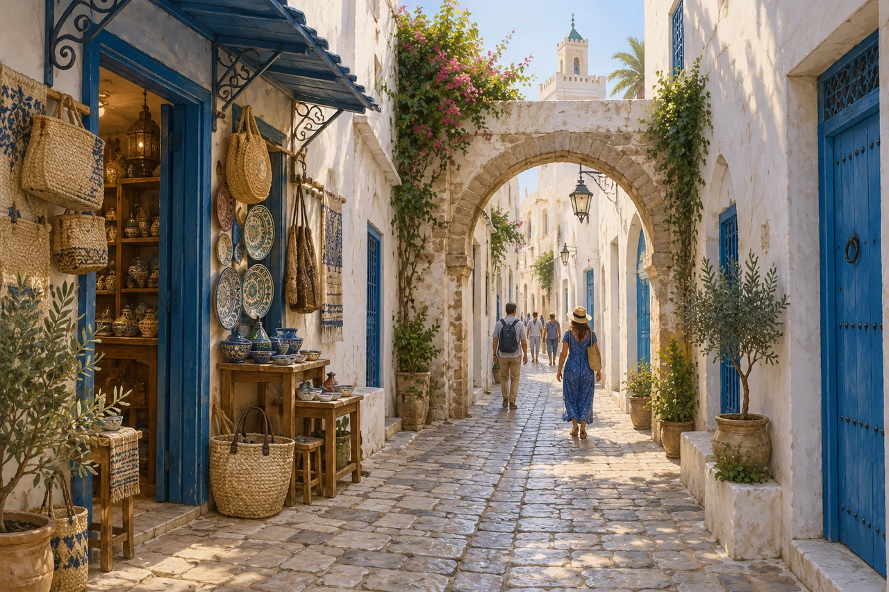
myAudience · original generated illustration · Original generated illustration; interpreted setting, not documentary evidence, current conditions or an authenticated viewpoint.
A shaded lane in Tunis and an archaeological site beside the gulf offer different ways into the region's history. They should not be combined into one imaginary ancient city. Tunis's medina is a living urban ensemble; Carthage includes remains of several earlier societies. Thinking about their different kinds of evidence makes a journey between them more interesting than simply collecting two famous names.
UNESCO describes Tunis's medina through its souqs, residential quarters, mosques, schools, palaces and gates. Its account connects the urban fabric with successive dynasties, including the Hafsids, and with exchange across the Mediterranean and Maghreb. A street's setting matters as much as an individual monument. Compare a commercial route with the quieter approach to a house and ask how the plan accommodated different activities.
Carthage has Phoenician-Punic foundations and later Roman and other layers. The designated archaeological site includes ports, residential remains, baths, cisterns and religious structures. These features did not all belong to one construction period or serve the same population. Archaeologists need contexts and dates to distinguish them. Literary traditions about Dido belong in a different category of evidence from excavated masonry and cannot simply be treated as a verified biography.
Our illustration concentrates on a Tunis-medina-inspired lane, with an arched passage, shaded shopfronts and domestic walls. Carthage is not squeezed into the background as a false neighbouring ruin. Notice the alternation between light and shade and consider what a plan could show about the spaces behind the doors. The image cannot authenticate a named souq, date an arch or identify the origin of an invented decorative pattern.
The most rewarding questions connect buildings with work, learning, trade and everyday life. Who used a space, who maintained it and how did its purpose change? Respect residents, shopkeepers and worshippers, and ask before photographing people or entering private areas. For an actual visit, consult current official arrangements at each site. This reading opens two distinct historical settings while leaving room for further evidence, rather than turning a living medina and a layered archaeological landscape into a single picturesque past.
Image: illustration, not a documentary photograph.
Further reading
Tunis and Carthage offer complementary ways to read urban history near the Gulf of Tunis. The illustrated lane introduces the small-scale experience of a medina: shops, doors, shade and movement within close walls. Carthage opens another scale through archaeological remains, ports and water infrastructure. They are distinct places with different histories, not interchangeable names for one ancient city. Keeping that distinction makes the comparison useful. A living street and an excavated ruin can both reveal how exchange and practical services sustain urban life.
The Medina of Tunis developed as an Arabo-Muslim urban centre, with significant expansion under the Almohads and Hafsids. UNESCO's account treats its street fabric, residential quarters, souqs and gates as part of the heritage alongside monuments such as the Zitouna Mosque. This matters because preserving an impressive facade while breaking the surrounding network changes the experience of the city. A route connects places of work, worship and residence; its bends, widths and thresholds organise encounters. Architectural history includes those relationships, not only the dates of conspicuous buildings.
Think of a lane as a sequence of thresholds. A door marks entry into a private interior, a shopfront negotiates trade with passers-by and an arch frames the route ahead. Narrow space affects the balance between access and occupation: displayed goods can attract customers while reducing room to move. Shade depends on the height and orientation of surrounding walls, not merely on a street being old. These general spatial observations help explain the picture without claiming it depicts a surveyed Tunis street or prescribing a single design for every historic neighbourhood.
Carthage's history includes both a Phoenico-Punic trading city and a Roman refoundation. Rome destroyed its rival in 146 BCE; later Roman construction occupied the site. The UNESCO page contains an inconsistent 'AD' in one passage, so the chronology here follows its correct introductory BCE date. Byrsa, the Punic ports, the Antonine baths and the Maalga cisterns represent different aspects and periods. A harbour ruin and a bath complex should therefore not be presented as a single unchanged Punic ensemble. Reuse and rebuilding are essential parts of the site's evidence.
Tunisia's National Heritage Institute connects the Roman water system with sources at Zaghouan and related branches, an aqueduct and storage at Carthage. Its account explains how water infiltrates limestone, travels through underground openings and emerges at a spring. The impressive arches are only one part of the system: collection, conveyance and storage have distinct jobs. A spring supplies water; a channel carries it; a cistern holds it for later use. Joining those functions helps explain how urban bathing depended on a landscape extending well beyond the bath's own walls.
A gravity channel needs a suitable downhill course, but it need not sit on high arches for its whole length. Supports can maintain its intended level across a depression; elsewhere the terrain may allow a lower or buried section. A fictional profile with a twenty-metre drop over ten kilometres has an average fall of two metres per kilometre, or 0.2 per cent. That ratio explains a gentle overall gradient, not an actual aqueduct survey. Local channel shape, changes of slope and losses would still affect flow, so an average cannot describe every segment's behaviour.
The image is a lane illustration with pale walls, blue doors, an arch and displayed craft goods. It supports a discussion of medina space and thresholds; it does not depict Carthage's ports, baths or aqueduct. At thumbnail size the route and colour contrasts remain readable while the goods' detailed patterns do not. Keeping this visual boundary explicit prevents an inviting image from accidentally assigning Roman infrastructure to a pictured alley or passing a generated shopfront off as documentary evidence of an identified historic street.
Check: A fictional aqueduct falls twenty metres over ten kilometres. Calculate its average percentage gradient. Then explain why a medina lane image cannot verify its route or the date of Carthage's baths. Answer: Ten kilometres is ten thousand metres; twenty divided by ten thousand multiplied by one hundred gives 0.2 per cent. This is a model, not a measured Zaghouan route. The illustration shows neither the water channel nor a dated bath complex. Architectural resemblance and appealing composition do not establish location or chronology; those require mapped and archaeological evidence specific to the structures.