Hanoi at Thang Long: looking below the skyline
By Places and their stories · myAudience
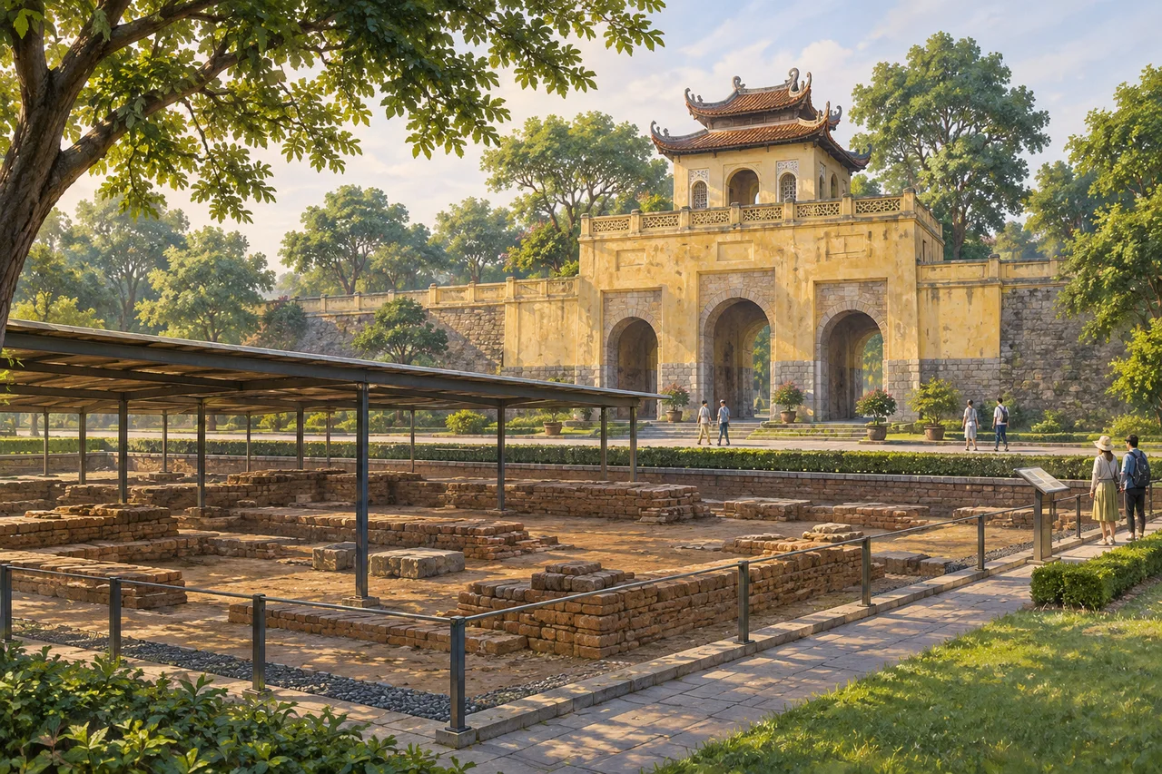
myAudience · original generated illustration · Original generated illustration; interpreted setting, not documentary evidence, current conditions or an authenticated viewpoint.
Hanoi's imperial heritage invites a different kind of looking: some important evidence lies below ground rather than in a spectacular surviving palace. Thang Long's central sector combines archaeological remains and buildings altered across successive periods. A gateway introduces the setting, but the relationship between buried layers and later structures helps explain why an apparently modest surface can hold a much longer history.
UNESCO places the eleventh-century Ly dynasty citadel on earlier fortress remains in the Red River Delta. Its account connects the site's material culture with influences from China and Champa. These encounters did not produce a single timeless style. Distinguishing periods matters because a tile, foundation or architectural feature needs a dated context before it can support a claim about political power or cultural exchange.
The archaeological area at 18 Hoang Dieu is part of the designated central sector. UNESCO also notes that older standing buildings, including Doan Mon Gate, have been restored and modified. The visible ensemble therefore cannot be read as an unchanged eleventh-century palace. A useful comparison asks what survives underground, what was rebuilt above it and which documents or excavation records support the interpretation of each part.
Our interpreted scene puts a modest citadel gateway beside a protected excavation area rather than inventing a complete ancient court. Compare the horizontal layers with the vertical gate. What additional evidence would be needed to connect a buried foundation to a particular building? The illustration cannot date the depicted masonry or reproduce an excavation plan. It offers an entry into the method of reading a layered site.
Archaeology is also a record of careful work: removing soil can reveal evidence while destroying its original position unless it is documented. Treat protected areas and conservation boundaries with respect. Hanoi's everyday life extends far beyond its imperial centre, so one heritage account should not stand for the whole city. Consult current official arrangements for a visit, and let this introduction lead toward the particular histories that a broad skyline view cannot show.
Image: illustration, not a documentary photograph.
Further reading
Hanoi can be read through two kinds of urban space: a political centre whose archaeological levels preserve repeated rebuilding, and streets where trade and domestic life remain visible. The illustration draws attention to a gate and protected excavation. Beyond the picture, the Old Quarter and Hoàn Kiếm Lake show why a city is more than its monuments. Palace authority, craft production and daily gathering occupy different places, but movement and exchange connect them. Exploring those connections gives a fuller account than treating every old-looking building as belonging to one timeless era.
The UNESCO property is specifically the central sector of the Imperial Citadel of Thang Long, including the archaeological site at 18 Hoàng Diệu. The Lý dynasty built its eleventh-century citadel over an earlier fortress on reclaimed, drained ground in the Red River delta. Those locations explain two important distinctions: the city adapted a wet landscape, and successive authorities reused a strategic site. The visible gate is only one layer. Political continuity does not mean that the same structures remained unchanged across all the periods represented underground.
Archaeological layers are relationships, not just a collection of old objects. A wall crossing an earlier floor suggests a sequence of construction, while a drain can reveal how an occupied area dealt with water. An artefact's position may help interpretation, but later disturbance can move it from its original setting. These general methods explain why excavators record context before removing material. A handsome gate can be restored; a buried foundation may preserve a different kind of authenticity. Each provides evidence, and neither should automatically be treated as the more truthful version of the whole city.
The official tourism account connects the Old Quarter's guild streets to trades supplying the royal centre. Hàng Bạc retains associations with silver and jewellery; Hàng Mã is associated with religious goods and festival decorations. Street names preserve occupational memory even where today's shops have changed. Clustering related businesses can help buyers compare work and allow craftspeople to exchange materials or skills. That is an economic interpretation of a street pattern, not proof that every present merchant inherits the same occupation or that the familiar thirty-six-street label counts all streets precisely.
Tube houses provide another way to understand restricted urban plots. The tourism authority describes narrow fronts, deep buildings and interior courtyards. When neighbouring buildings close off side light, an open court can bring daylight into the interior. It also creates a different relationship between street-facing work and private space. This general explanation does not make a courtyard an automatic guarantee of cooling or comfort: orientation, shade, openings and use matter. A plan showing solid rooms interrupted by open courts helps explain how a narrow facade can conceal a much larger domestic arrangement.
Hoàn Kiếm Lake offers an open counterpart to these dense streets. Its surrounding public space supports exercise, conversation and short pauses; the Húc Bridge, Ngọc Sơn Temple and Turtle Tower give the lakeside recognisable landmarks. The tourism account describes gatherings there, but a visitor should not assume every pictured activity or traffic arrangement is available on every day. Urban space has several simultaneous purposes. A lake can organise routes and views while people give its edges social meaning, making it part of ordinary city life as well as a destination.
The picture combines a substantial gate with a sheltered archaeological area, making above-ground architecture and exposed foundations easy to compare. Main and smaller image versions retain those broad relationships; tiny brick details are not dependable at thumbnail scale. The composition is an illustration, not an authenticated record that assigns every wall to a known dynasty. Use it to notice the difference between monument, excavation and visitor circulation. Sources and archaeological records must supply the dating that appearance alone cannot establish.
Check: A caption claims that an eleventh-century citadel means every surviving building is eleventh century. Another claims a street named for silver proves every modern shop is a silversmith. What is wrong with each? Answer: A site can persist while its structures are repaired, replaced or altered; Thang Long's archaeological layers and later buildings record different periods. An occupational street name preserves a historical association while current uses can change. Both errors confuse continuity of place or name with unchanged physical fabric or activity. Dating buildings and identifying present businesses require evidence specific to those claims.