Rio de Janeiro: where the landscape is also a design
By Places and their stories · myAudience
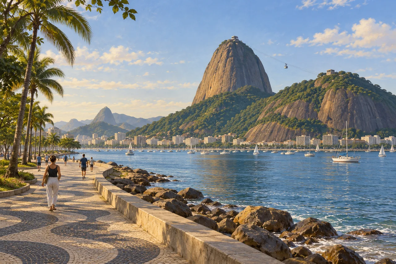
myAudience · original generated illustration · Original generated illustration; interpreted setting, not documentary evidence, current conditions or an authenticated viewpoint.
Rio de Janeiro's mountains, bays and planted public spaces make a powerful composition, but the landscape is not entirely untouched nature around an unrelated city. People have restored forests, planned gardens and designed coastal spaces within the setting. Reading those interventions makes the view more interesting. It turns a familiar skyline into a question about how landform, urban growth and landscape design influence one another.
UNESCO's designated cultural landscape connects the Tijuca mountains and restored Atlantic forest with gardens, coastal parks and the steep hills around the bays. The designation concerns particular landscape components and relationships; it should not be mistaken for an inscription of every building or the whole city. Understanding the boundary is part of understanding what the heritage account is actually trying to explain.
The account identifies designed spaces associated with Roberto Burle Marx, including coastal parks and the Copacabana landscape. Such places introduce questions about planting, paving, movement and public use. A green area can involve substantial design decisions rather than simply being a piece of nature left over. To explain one intervention properly, a dated plan and an account of its development would be more useful than assuming that every visible feature has the same origin.
Our interpreted bay view links a steep green rock mass, water and a restrained planted promenade. Compare the irregular hill form with the clearer lines of the pedestrian edge. What choices make the waterfront usable at human scale? The image does not reproduce an exact Burle Marx plan, authenticate pavement details or measure forest recovery. It presents the city-landscape relationship without certifying present environmental conditions.
A beautiful panorama leaves much of a city's life outside the frame. Further learning should include neighbourhood histories and the differing experiences of residents, alongside the monumental and landscape account. Respect homes, working routes and protected areas, and consult current local arrangements for a visit. This reading makes no promise about water quality, access or personal safety. It offers a route from a memorable view into the human decisions and environmental relationships that make the setting more than a postcard.
Image: illustration, not a documentary photograph.
Further reading
Rio de Janeiro's coast brings steep rock, forested slopes, waterfront paths and dense building strips into one frame. Its recognised landscape is not simply an untouched mountain beside a city: natural forms and deliberate interventions have shaped the relationship. The shoreline is a place for movement and public life, while forests also connect to the city's history of water supply. Following both the designed waterfront and the recovered slopes provides a richer account than treating the hills as scenery that has always existed in exactly its present state.
UNESCO's Carioca landscape property connects Tijuca's mountains and restored Atlantic forest with Corcovado, the Botanical Garden and designed coastal spaces. It recognises a relationship between mountain and sea rather than including every dense urban building in the city. This boundary distinction matters when discussing heritage: a panoramic view can contain elements inside the property, in a buffer zone and beyond both. Visual prominence does not automatically establish formal designation. The important educational theme is how topography, planting, access and urban life interact across the wider setting.
Brazil's National Archive documents the effect of forest clearance and coffee cultivation on Tijuca's slopes and the concern for water sources that helped drive restoration. In 1861, the government created a forest-administration service and began a more organised reforestation programme. The recovered forest therefore has a history of policy, land acquisition and difficult physical work. Its apparent naturalness should not erase that history. A planted or recovering forest can provide ecological functions, but it is also evidence of decisions taken after earlier degradation.
The archive describes Manuel Gomes Archer's administration and the labour of enslaved workers in planting and maintaining the forest. Their work included preparing ground, carrying materials, watering seedlings and replacing losses on steep slopes. Recognising that labour gives the conservation story ethical depth: an achievement should not be credited only to a ruler or administrator while the conditions of those doing the work disappear. The source provides historical evidence about organisation and labour; it does not justify inventing personal testimony or assuming every worker experienced the project in the same way.
Restoration involves more than putting seedlings into the ground. Plants must survive, develop and interact with soil, water and other organisms; early losses may require replacement. Distinguish the number planted from the number alive at a later date, and distinguish tree survival from recovery of a whole ecological community. These are general monitoring principles rather than a current Tijuca census. They explain why a forest's history can require records of repeated care and changing conditions, while a contemporary image gives only a surface impression of its present appearance.
The designed waterfront offers another form of intervention. UNESCO highlights landscape work associated with Roberto Burle Marx at Flamengo and Copacabana, including paving and planting that support outdoor public life. A promenade is both a visual composition and a circulation space. Patterns can be appreciated from close walking scale while the route joins neighbourhoods and waterfront views. Maintenance matters because a design is used repeatedly: planting, surfaces and access can change incrementally even while the large coastal silhouette remains recognisable. A cultural landscape combines those processes with its dramatic setting.
The illustration places a patterned waterfront path opposite steep rock and vegetated slopes, with boats and buildings along the bay. It supports the relationship between public space and topography, but the panorama is not a certified viewpoint or inventory of the World Heritage boundary. The patterned paving should not be treated as an exact reproduction of a named Burle Marx design. At thumbnail size the path, water and hills remain clear; detailed mosaic and plant identification do not. The scene introduces linked histories rather than documenting a restoration result.
Check: In a fictional restoration project, eight hundred seedlings are planted and six hundred remain alive at the first survey. Calculate survival, then explain why the figure alone does not prove complete ecosystem recovery. Answer: Six hundred divided by eight hundred gives seventy-five per cent survival; two hundred seedlings, or twenty-five per cent, were lost. The survey measures one planted cohort at one time. Recovery also concerns growth, species composition, soils, water, other organisms and continuing pressures. These invented counts do not describe Tijuca, and a green panorama cannot replace the records needed to assess such outcomes.