Valparaíso: a port city that climbs
By Places and their stories · myAudience
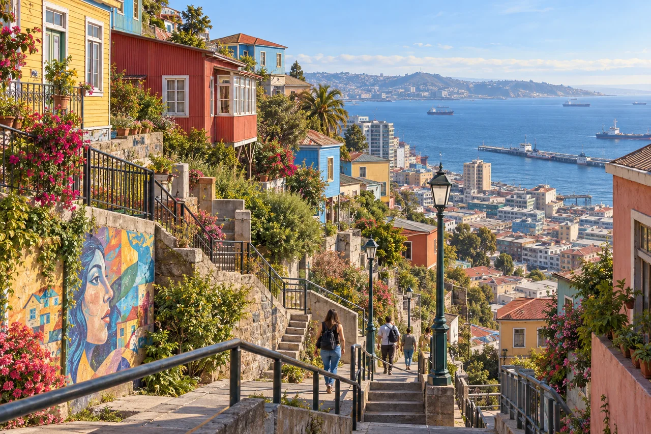
myAudience · original generated illustration · Original generated illustration; interpreted setting, not documentary evidence, current conditions or an authenticated viewpoint.
Valparaíso's streets change character as they move from the coastal plain into steep hills. That shift is one of the most useful things to notice. Port activity, public spaces, houses and routes had to fit a demanding setting rather than a single flat plan. The city's appeal lies partly in the visible effort of making connections between different levels and different kinds of everyday work.
UNESCO describes the historic quarter through its bay, narrow plain, steep hills and ravines. It connects the urban fabric with international maritime trade in the late nineteenth and early twentieth centuries, including routes through the Strait of Magellan. The opening of the Panama Canal in 1914 changed that commercial setting. A port city's fortunes depend on networks beyond its own streets, so a local building can lead into a much wider history.
Stairways, promenades and funicular elevators are part of the heritage account, alongside commercial and residential spaces. They introduce practical questions about movement on a slope. A route that works for goods, a pedestrian or a vehicle may need a different arrangement. The significance of historic transport does not establish that a particular elevator is operating today; current service and access need current local information.
Our interpreted hillside puts modest colourful houses on supported terraces above a distant waterfront. Compare the stepped pedestrian route with the straighter streets near the coast. What would a map reveal about their connections? The image is not an exact survey of a named hill, a structural record or a complete transport diagram. It shows a relationship between terrain and urban form without authenticating an invented building or proving how it was maintained.
A fuller account should make room for residents, port workers and the changing pressures on a living city. Houses are not merely a colourful backdrop, and conservation involves everyday use as well as appearance. Respect private entrances and working routes, and consult current official arrangements for a visit. This reading does not guarantee operating transport or unchanged historic fabric. It invites a closer look at the ingenuity and choices involved in building a city whose shape is inseparable from its hills.
Image: illustration, not a documentary photograph.
Further reading
Valparaíso's steep streets draw the eye from closely packed houses down towards the port. Steps, landings and hillside paths make vertical movement part of ordinary urban space. The city is therefore a useful place to study how a transport problem becomes a distinctive landscape. Its colourful appearance should not conceal the work of reaching homes, carrying goods and maintaining routes. The view joins the hills to the waterfront, but the deeper explanation asks which movements different routes support and how trade, terrain and engineering helped shape their arrangement.
UNESCO connects Valparaíso's historic quarter with the sea trade of the late nineteenth and early twentieth centuries. Routes joining the Atlantic and Pacific through the Strait of Magellan gave the port importance; opening the Panama Canal in 1914 changed that context. This is a history of networks, not simply a story of handsome houses. A port's role can shift when journeys become shorter or follow another passage. The buildings that survive may preserve evidence of an earlier commercial phase even as present activity and transport needs continue to change.
A narrow coastal plain and steep surrounding hills constrain where development and circulation can go. In a general hillside plan, a route following a contour may reduce steepness but increase distance; a direct stair shortens the route while requiring a greater climb. These are different solutions to related needs rather than one universally superior design. Drawing both on the same section reveals the trade-off. It also shows why a flat map alone is incomplete: two points that seem close in plan may be separated by a substantial vertical rise.
UNESCO identifies adapted urban form and industrial transport, including distinctive funicular elevators, among the quarter's important features. Cerro Alegre and Cerro Concepción include stairways, viewpoints and upper stations, while other parts relate more directly to commercial streets and waterfront spaces. These roles belong within a connected system rather than an inventory of isolated attractions. Designating a historic quarter does not mean every house in the larger city shares the same formal status. An actual map and recorded property boundary are needed to distinguish the protected area from a wider panoramic view.
A simplified energy model can explain part of the climb. Raising a fictional one-hundred-kilogram load through fifty metres increases its gravitational potential energy by 49,000 joules when gravitational acceleration is taken as 9.8 metres per second squared. The route shape does not change that ideal height-based result. It does affect practical matters such as friction, travel distance, handling and access. The model excludes counterweights, passengers, motors and other real equipment; it is therefore a lesson in one physical relationship rather than an estimate of an operating Valparaíso elevator's consumption.
Transport heritage remains a question of use and maintenance. A functioning route needs more than a preserved station facade: track or cable systems, inspections, staffing and access arrangements can all matter. These are general requirements, not a claim about the current condition or availability of a particular elevator. A lived city also needs routes for people whose mobility or carrying needs differ. Studying historical solutions is most informative when their everyday purposes remain visible, instead of assuming that a picturesque staircase answers every present travel problem.
The illustration places steps, handrails, colourful hillside houses and a painted wall above a port and bay. It supports the relationship between slope and circulation without showing a verified funicular mechanism or naming the mural's maker. The scene is not a certified viewpoint or property-boundary map. At the smallest size, the steep route towards water remains clear while finer artwork and building detail do not. Use the foreground climb to ask about route choices, and the harbour beyond to investigate the networks that gave the city its industrial and commercial importance.
Check: Calculate the fictional load's gravitational energy increase, then evaluate the claim that a longer contour route must require less ideal lifting energy because it is gentler. Answer: One hundred multiplied by 9.8 multiplied by fifty gives 49,000 joules. For the same load and height, ideal gravitational energy is unchanged by route length. Actual effort and equipment consumption can differ because of friction, losses, carrying methods or counterbalancing. The example does not measure a particular elevator. A good comparison separates elevation from steepness, distance and accessibility rather than treating one route's appearance as a complete performance assessment.