Torres del Paine: the rocks behind the silhouette
By Places and their stories · myAudience
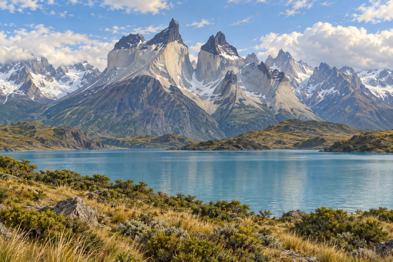
myAudience · original generated illustration · Original generated illustration; interpreted setting, not documentary evidence, current conditions or an authenticated viewpoint.
Torres del Paine's sharp mountain forms make an immediate impression, but their materials tell a story that cannot be read from silhouette alone. Pale rock, darker layers and the surrounding lakes invite different geological questions. Looking closely at those contrasts can turn a beautiful landscape into an introduction to processes beneath the surface, followed by the much later work of erosion.
The Chilean Antarctic Institute's geosite account distinguishes pale granite from darker sedimentary rocks in the massif, including the darker upper rocks of the Cuernos. Granite is an intrusive rock: it formed as magma cooled underground, rather than flowing across the surface as lava. This distinction matters because a dramatic peak does not have to be an active volcanic cone. Exposed rock can reveal material formed in a very different setting.
CONAF describes a landscape of mountains, glaciers, valleys, lakes and varied vegetation. Glacial erosion helped shape the visible forms, but the age of an intrusion should not be used as the date when every glacier carved the present landscape. Different processes have different histories. A geological map, dated samples and deposits would be needed to investigate their sequence more precisely than a general park introduction can.
Our interpreted scene focuses on pale granite peaks with distinguishable darker upper rock over a broad blue-green lake. Compare the material contrasts with the shapes of slopes and water. Which observations suggest a rock difference, and which would require a closer survey? The illustration is not a measured geological section, an exact lake-edge route or a record of current glacier extent. It invites investigation without turning an invented viewpoint into technical evidence.
A mountain landscape deserves care as well as admiration. Protect vegetation, keep wildlife at a respectful distance and follow current park arrangements; attractive terrain is not a promise of easy or safe travel. This reading gives no hiking itinerary, weather forecast or assurance that a circuit is open. It also avoids treating the region as a place without human history. The visual encounter can lead into geology and ecological learning while leaving present conditions and particular histories to the sources best suited to explain them.
Image: illustration, not a documentary photograph.
Further reading
Torres del Paine's pale walls, dark caps and sharply cut valleys make an unusually clear invitation to read a mountain as a sequence of processes. The peaks did not take shape in one operation. Sediment accumulated, magma entered older rock, heat changed adjoining material and erosion exposed the result. Snow and ice then contribute another changing system. The illustration offers these broad contrasts, while the deeper story asks how different evidence can place events in order without treating the colour of a rendered cliff as a complete geological record.
The park's CONAF and University of Lausanne geology leaflet describes older marine sediments and later granite within the massif. The International Union of Geological Sciences identifies the Miocene intrusive complex as an important exposed system built through successive magma additions. Intrusion is different from spreading lava across a land surface: molten material entered rock within the crust and cooled there. Much later exposure lets geologists investigate relationships that were originally concealed. A bare mountain wall can therefore reveal an interior arrangement, rather than representing the surface on which all its rocks first formed.
The order of events can be tested through contact relationships. In a general example, material intruding a pre-existing layer must be younger than that layer at their contact. Heat from magma can alter nearby rock without requiring the whole surrounding formation to melt. The park leaflet describes such contact-altered material around the granite. A diagram can distinguish host rock, intrusion and altered zone, then show erosion removing cover. This original teaching model explains a sequence; it is not a surveyed section or a way to identify every dark patch in the illustration.
The IUGS account explains why substantial exposure matters to research: investigators can examine different parts of the intrusive body and combine field relationships with dating. Several additions can construct what later looks like one mass. Age measurements and mapped contacts therefore contribute information that surface colour alone cannot provide. This encourages a useful scientific habit: compare observations from different methods before committing to one history. A striking photograph can guide questions, but measuring an emplacement interval or identifying a particular pulse requires samples, analysis and published geological records.
Glacial erosion changes what becomes visible without creating the granite itself. The park leaflet connects ice with deep valleys and moraines that record former glacier positions. Moving ice can carry fragments and abrade or pluck rock; deposits and landforms preserve different parts of that activity. Those general mechanisms distinguish rock formation from later shaping. A ridge of debris and a polished rock surface need not record the same event or process. Reading a landscape carefully involves relationships among features rather than assigning every sharp peak to one recent episode of ice movement.
A glacier's present change also needs a budget. National Park Service explanations distinguish accumulation of snow and ice from losses through melting and other processes, while ice can continue flowing downslope even as its end retreats. In a fictional model, twenty units of mass are added and thirty lost over one interval, leaving a net loss of ten. That arithmetic says nothing about a named Patagonian glacier's actual measurements or immediate terminus position. Geometry, flow and timing matter, so a single season's snow or one appealing icy view cannot establish the full trend.
The illustration places pale rock faces beneath darker summits, snow patches, a lake and low vegetation. It introduces contrasts useful for discussing intrusion and erosion, but it is not a mapped outcrop, mineral sample or dated glacier survey. The small variant keeps the mountains and lake relationship while fine bedding or crystals are not legible evidence. No snow patch is automatically identified as a glacier, and colours cannot authenticate particular units. The official geology records provide the relationships and sequence that the composed landscape helps readers begin to imagine.
Check: A fictional glacier gains twenty mass units and loses thirty during one interval. Calculate its balance, then correct a caption saying ice retreat means ice has stopped moving and glaciers formed the granite. Answer: The balance is minus ten units, indicating net mass loss in that model. A retreating end can coexist with ice continuing to flow downslope; end position and ice motion are different quantities. Granite formed through cooling magma, while later ice helped shape and expose the massif. Actual rates and mapped rock units require measurements and records rather than conclusions drawn from rendered snow and colour.