Kakadu: water, stone and a living cultural landscape
By Places and their stories · myAudience
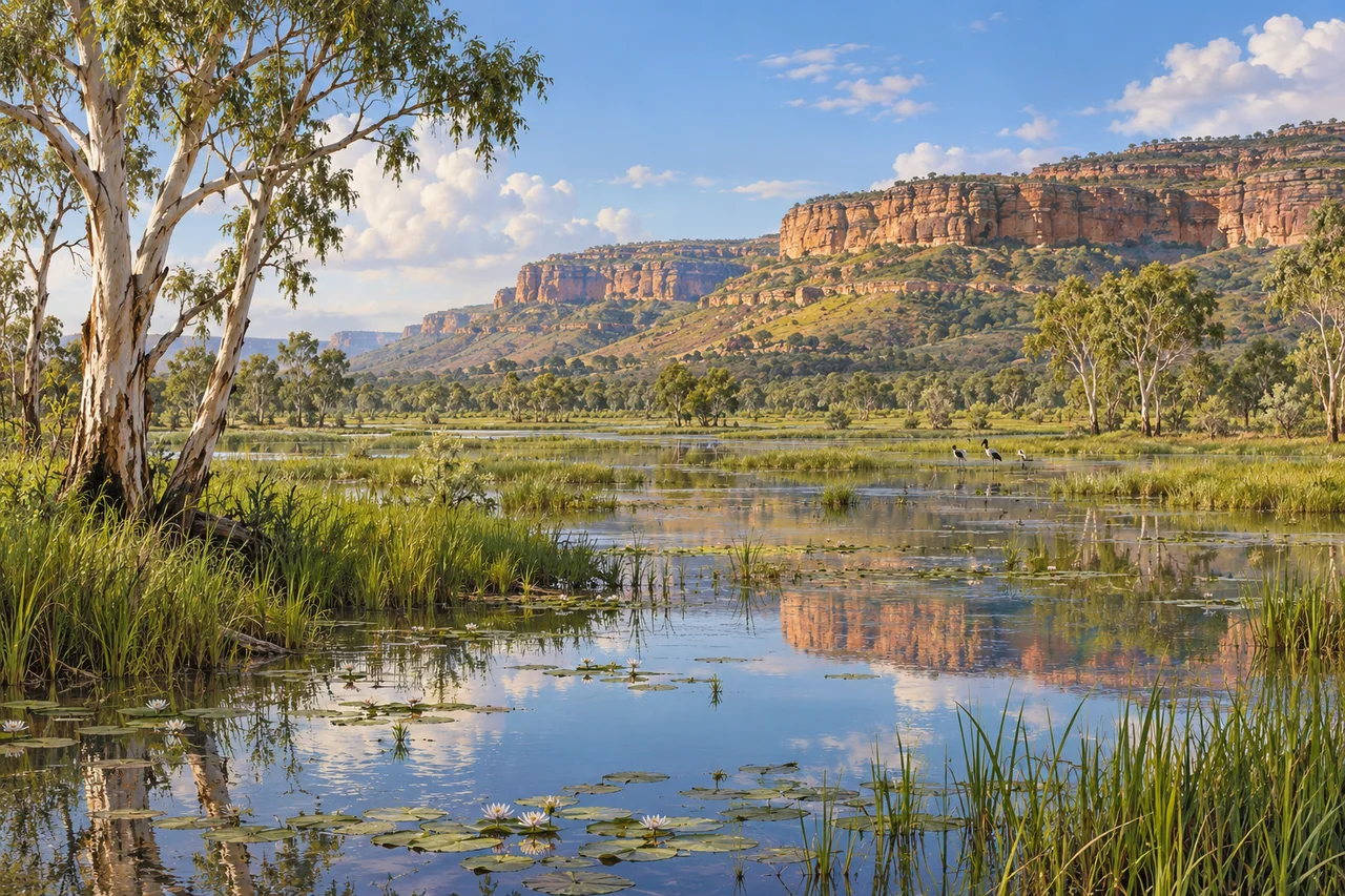
myAudience · original generated illustration · Original generated illustration; interpreted setting, not documentary evidence, current conditions or an authenticated viewpoint.
Kakadu's wetlands and rocky escarpments offer more than a striking contrast of colours. They invite a comparison between environments that respond differently to water and time. A floodplain changes with inundation, while the stone country provides a different setting for plants, animals and human activity. Looking between them is a useful way to begin understanding a landscape whose beauty belongs to relationships rather than one isolated view.
UNESCO describes Kakadu as a living Aboriginal cultural landscape with archaeological sites and extensive rock art. These are not simply remnants of a people who disappeared. Cultural knowledge and connections to Country continue, and interpreting particular sites requires the voices and authority of their custodians. An archaeological date and a living account answer different kinds of questions; neither should be turned into permission to invent the meaning of an image.
The heritage account identifies floodplains, mangroves, woodland and monsoon forest among the contrasting habitats. Seasonal flooding and changes in sea level form part of the explanation of the lowlands, while the escarpment belongs to a much longer geological story. A useful investigation asks where water comes from, where it spreads and which environments it connects. A photograph taken at one time cannot show the full pattern across seasons.
Our interpreted scene brings a shallow wetland, reeds and a distant stone escarpment into one composition. Compare the reflected sky with the broken edges of the rock. What information would repeated photographs, water measurements and a habitat map add? The painting does not reproduce protected rock art, authenticate a sacred site or record a particular flood. It offers a visual question about contrasting environments without pretending to transmit restricted cultural knowledge.
Learning about Kakadu should include its Traditional Owners and the difference between public interpretation and knowledge that is not ours to reproduce. Respect cultural restrictions, keep away from protected surfaces and use current official arrangements for a visit. Water in an attractive image is not an invitation to enter it. This reading provides no swimming, wildlife or route assurance. Its purpose is to make a memorable view more thoughtful by connecting environmental processes with the continuing human relationships that a landscape-only postcard can leave out.
Image: illustration, not a documentary photograph.
Further reading
Kakadu's wetlands beneath a long escarpment invite a view across water, woodland and rock, but a single season cannot stand for this whole living landscape. Flooding and drying alter habitats, routes and the resources available to animals and people. Public accounts from the park's Traditional Owners also make clear that care for Country is part of its continuing history. The useful approach joins ecology with custodianship rather than separating an apparently natural wilderness from the people whose knowledge and work help maintain it.
Parks Australia identifies six broad landform groups, including savanna woodlands, stone country, wetlands and tidal coast. Woodland is therefore as important to the account as the dramatic water and cliff scene. Different places provide different resources, with seasonal water affecting how they are connected. A wetland that spreads widely in one period can contract into more restricted waters later. This means habitat should be described through time as well as on a map: a boundary around one kind of terrain does not guarantee constant conditions within it.
The park's public seasons account explains the six-season system recognised by Traditional Owners through weather, flowering plants, animals and food availability. Kudjewk includes monsoonal rain and flooding; Wurrkeng brings drying creeks and gathering waterbirds around shrinking billabongs. These are contextual descriptions grounded in local knowledge, not six equal blocks that every year follows to the same date. A seasonal indicator can connect several observations, revealing changes that a broad wet-versus-dry label overlooks. Public explanation should acknowledge that knowledge's owners rather than present it as an anonymous tourism invention.
Seasonal contraction also changes how an ecological observation should be interpreted. More birds around a remaining pool could mean concentration from a larger area rather than a sudden rise in the whole population. Increased surface water can allow animals to disperse again. This general mechanism helps explain why repeat surveys need comparable timing and spatial coverage. Water extent, observed abundance and movement are linked but distinct quantities. The calm pool in an illustration cannot establish which point in that seasonal sequence is represented or how many animals inhabit the wider landscape.
The public Caring for Country account describes joint work between Traditional Owners and Parks Australia, including small, relatively cool, patchy cultural burns. These can encourage new growth and reduce continuous fuel available to larger later fires. A patchwork also leaves unburned habitat rather than treating the whole landscape uniformly. This is a description of skilled, place-specific management, not instructions for visitors to start fires or a universal recipe for all environments. Timing, conditions, obligations and knowledge make the practice more than a simple rule that burning grass is beneficial.
UNESCO recognises Kakadu's natural and cultural values together, including archaeological and rock-art evidence within a continuing Aboriginal landscape. Public interpretation is not permission to invent sacred images, copy designs or explain restricted stories. This reading uses only general public landscape and management information supplied by the park. That boundary improves accuracy as well as respect: visual resemblance is not access to a tradition's meaning. A landscape account can explain seasonal processes and custodial care without pretending that every cultural site or body of knowledge is available for reproduction.
The illustration shows water plants, scattered bird-like forms, trees and an escarpment, with no invented rock-art panel or sacred design. It is not an authenticated habitat transect, species identification or view of a named billabong. The small variant preserves the broad water-and-cliff relationship while fine birds and leaves become ambiguous. No safe swimming, access route or absence of crocodiles follows from its peaceful appearance. Use the scene to ask how conditions change and how Country is cared for; actual visits and cultural interpretation require the park's current guidance.
Check: A fictional pool contains twice as many observed birds after nearby flooded ground dries, and a label says the population must have doubled. It also calls a patchy cultural burn an unmanaged wildfire. Explain both errors. Answer: Birds can concentrate in remaining water without equivalent growth in the wider population; comparable surveys must consider movement and area. Cultural burning is purposeful, skilled management with specific timing and conditions, while an uncontrolled wildfire differs in purpose and behaviour. Neither a count at one pool nor the mere presence of fire explains the whole landscape without context and evidence.