Tasmanian Wilderness: landscapes with more than one history
By Places and their stories · myAudience
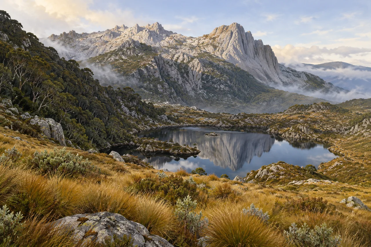
myAudience · original generated illustration · Original generated illustration; interpreted setting, not documentary evidence, current conditions or an authenticated viewpoint.
The Tasmanian Wilderness brings together mountain forms, water, forests and open vegetation in a landscape that resists a single label. A misty lake can look timeless, yet the scene contains evidence of change at very different scales. Rock and ice, changing climate and human use all matter. Following those connections makes the landscape more interesting than treating wilderness as a synonym for a place where nothing ever happened.
UNESCO describes a cultural landscape with a long history of Tasmanian Aboriginal occupation, including evidence from caves and other archaeological sites. Its account also recognises the influence of Aboriginal fire management. These histories challenge the assumption that an apparently remote environment must be untouched by people. Understanding a particular place requires appropriate community knowledge and archaeological evidence rather than imagining a generic prehistoric life from scenery alone.
The property includes glacially shaped landforms, temperate rainforest and alpine or subalpine environments. Its heritage account describes quartzite ranges, tarns and buttongrass moorlands among the varied features. An inviting question is why vegetation changes between a sheltered slope and exposed ground. Terrain, water and climate can contribute to an explanation, but identifying the processes at one site needs observations beyond a broad regional description.
Our interpreted scene places a small mountain lake beneath rugged pale rock, with low golden vegetation and a darker wooded slope. Compare the exposed crest with the more sheltered foreground. Which features suggest differences in growing conditions, and which would need measurements? The painting is not a geological map, a dated reconstruction of ice extent or an authenticated view of a named lake. It cannot establish that a particular patch of vegetation has never been burned or changed.
Respecting the region involves learning its cultural history as well as caring for its environments. Protected archaeological places are not props to explore or reproduce without permission. Current park information is essential for actual access, weather and travel decisions, none of which this reading guarantees. A fuller investigation might combine community-led interpretation, habitat records and a geological account. The reward is a richer way of looking: a beautiful scene becomes evidence to question carefully, rather than an image of empty land outside human history.
Image: illustration, not a documentary photograph.
Further reading
Tasmania's upland landscapes can make geological time feel tangible. A dark pool reflects an irregular ridge, low vegetation crosses a rocky foreground and cloud wraps around the higher ground. The Tasmanian Wilderness World Heritage Area contains a much wider range of environments than this single scene, including forests, mountains and evidence of long human relationships with country. A useful introduction connects those different kinds of history. It asks how a landscape took shape and how people know and care for it, instead of presenting beauty as proof that the place has never been inhabited.
UNESCO recognises the property's natural and cultural significance. Tasmania's Parks and Wildlife Service describes a large protected landscape assembled from national parks and reserves, rather than one uniform habitat. A mountain pool, wet forest and river valley cannot be treated as interchangeable simply because they fall within the same heritage boundary. An explanatory map should distinguish those environments and the scale of the property. Listing protects recognised values, but it does not freeze every surface in time or remove the need for continuing management and community involvement.
A geological account separates the formation of rock from the later shaping of relief. Tasmania's heritage landscape includes varied rocks and landforms, with glacial processes contributing to its upland scenery. A classroom sequence might first show a solid rock mass, then weathering and erosion, and finally a hollow collecting water. Each step asks a different question about materials and processes. That sequence is a general teaching model, not a claim that the illustrated ridge has been identified as a particular dolerite exposure or that its pool has a documented glacial origin.
Water storage can be explored without inventing an actual lake measurement. Imagine a small catchment receiving ten units of water, losing six through evaporation and outflow combined, and retaining four during a chosen period. The balance closes because inflow equals losses plus the storage increase. A second period can produce a different result even if the surrounding rocks look unchanged. The model helps explain why a pool's presence depends on movement and storage as well as the shape of its basin. It leaves out groundwater transfers unless those are explicitly added to the boundary.
Tasmania's Aboriginal cultural heritage account records a relationship with this country extending back tens of thousands of years, expressed through archaeological evidence and continuing culture. Evidence can include occupation places and material traces, but their significance is not limited to what a visitor can easily photograph. Calling a protected landscape untouched can erase those histories. Interpretation should distinguish an evidence-based account from assumptions made because no building appears in a modern view. Cultural knowledge and responsibilities also belong to living people, not only to an archaeological past arranged for tourism.
Some cultural information and places require particular care. The state's account emphasises the protection of Aboriginal heritage, including fragile sites. Learning does not require publishing sensitive locations or reproducing restricted markings. A responsible educational diagram can explain how a record is documented, interpreted and protected without inventing a sacred design or placing it into a decorative landscape. This distinction helps preserve both accuracy and respect: not every source of knowledge is available for unrestricted display, and absence from a public post does not mean that cultural significance is absent from the country.
The rendered scene shows a reflective upland pool, rocky pale ridges, shrubs, grasses and cloud. The main and medium versions offer a clear land-water relationship, while the small version retains the pool and ridge as broad forms. No named mountain, rock unit or cultural site is authenticated here. The vegetation cannot serve as a species list, and the picture contains no reproduced cave art or claimed archaeological reconstruction. It is an illustration of upland scenery intended to introduce environmental and cultural questions, rather than an image of an empty landscape without a human history.
Check: In the fictional catchment, ten units enter, six leave and four remain as additional storage. Verify the balance and assess the claim that the absence of buildings proves no human history. Answer: Six plus four equals ten, so the stated account balances under its deliberately simplified boundary. It does not measure a real Tasmanian pool or include unstated groundwater flows. Visible buildings are only one possible kind of evidence. Tasmania's documented Aboriginal cultural heritage and continuing relationships with country cannot be erased by a scenic rendering; specific cultural places require appropriate evidence, protection and custodial care.