Abel Tasman coast: the history beneath the golden beach
By Places and their stories · myAudience
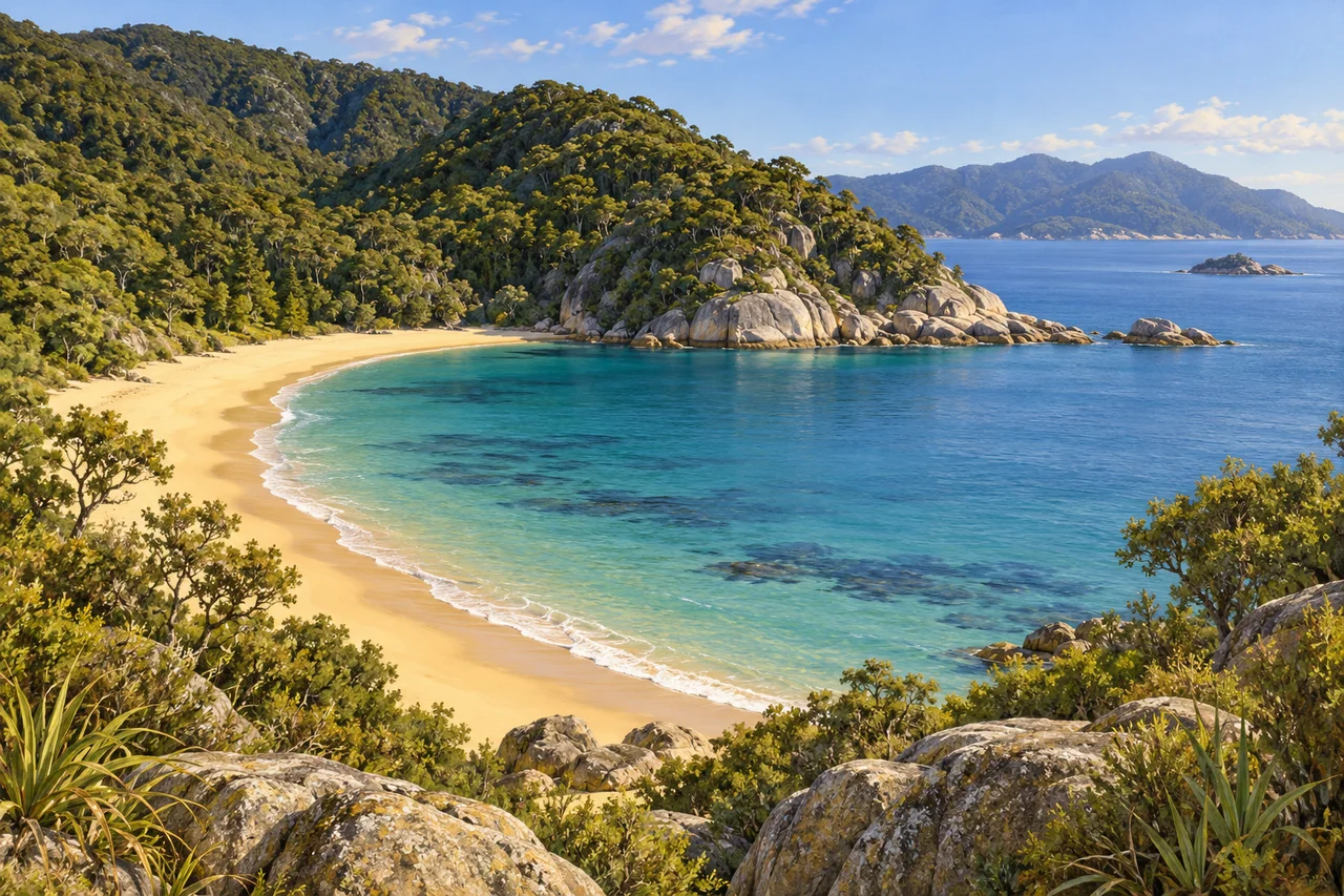
myAudience · original generated illustration · Original generated illustration; interpreted setting, not documentary evidence, current conditions or an authenticated viewpoint.
The Abel Tasman coast's golden beaches and granite headlands make an inviting composition, but the coast is not only a place to admire sand and water. Its forests, estuaries and histories of use add layers to the scene. Looking from a beach toward the slopes behind it raises a useful question: how did the land become what we see, and which changes are easy to overlook in a beautiful view?
New Zealand's Department of Conservation identifies Separation Point Granite as the bedrock and explains its influence on beach colour, soils and vegetation. The coast therefore offers a connection between geology and ecology rather than two unrelated subjects. Materials can help shape growing conditions, while shelter and moisture also matter. A general description starts the explanation; observations from a particular bay would be needed to test how those influences combine there.
The Department's history records Māori use of the coast before European arrival and later activities including logging, shipbuilding, granite quarrying and clearing for pasture. Concern about further logging contributed to the establishment of the national park in 1942. Its name commemorates a European visitor, but that name is not the beginning of the coast's human history. Conservation also belongs within a story of previous use, loss and changing decisions.
Our interpreted bay places rounded granite beside warm-coloured sand, with forested slopes above sheltered-looking water. Compare the open beach with the darker gullies. The Department's nature account discusses forest regeneration following milling, which helps challenge the assumption that every wooded slope is unchanged old forest. The painting does not identify a particular stand's age, reproduce a named bay or prove that a tidal crossing is passable. It is a starting point for questions, not a navigation aid.
A fuller encounter should respect Māori histories, protected habitats and the practical limits of visiting a changing coast. Consult current official information on tides, weather and access rather than treating a calm image as a safe itinerary. Avoid disturbing wildlife or carrying unwanted organisms between places. This reading promises no transport service, wildlife sighting or open route. Its invitation is simpler: notice the relationship between rock, vegetation and human choices, and let the appealing beach lead into a more careful understanding of the landscape around it.
Image: illustration, not a documentary photograph.
Further reading
Abel Tasman's coastal scenery joins golden beaches, rounded rock and forest beside sheltered-looking water. The attractive boundary between land and sea is also a meeting place of materials, organisms and human histories. A deeper account asks why beaches and rocky headlands alternate, what allows woodland to recover and who maintains that recovery. The image can encourage those questions without identifying a particular bay or promising conditions for a visit. A calm composition is a starting point for learning, not a guarantee that tides, weather or access are always simple.
The Department of Conservation identifies granite as the source of the park's golden sandy beaches. Material can move from a solid rock through weathering, fragmentation and transport into a beach deposit. Think of these as connected stages rather than assuming that sand appears where it is ultimately seen. In a general sediment model, waves can redistribute grains while a rocky headland remains a different kind of boundary. This does not identify the minerals in the rendered foreground or quantify erosion at any real bay; those claims would require observations of actual material.
DOC records Māori occupation and resource use before European settlement, while also describing later logging, quarrying and the creation of the national park in 1942. The named national park is therefore a modern institution within a much longer history. Its present forest cannot automatically be called a remnant untouched by people. A useful timeline separates occupation, extractive activities, protection and restoration, rather than making the park's establishment stand for the beginning of everything important. Names and dates help orient a reader, but living mana whenua relationships also deserve attention beyond a single entry on a timeline.
Restoration gives that history a continuing chapter. Project Janszoon began in 2012 as a partnership working on pests, weeds, forest recovery and the return of native birds. Its current account states that in July 2026 it entrusted its work to DOC, mana whenua and the Abel Tasman Birdsong Trust for long-term management under the Tomorrow Accord. This is a transition of stewardship, not proof that conservation has become unnecessary. Earlier publicity anticipated a handover; the current account records what happened. Keeping those stages distinct prevents an old plan from being mistaken for a completed event.
Predator control and habitat recovery address different parts of a biological relationship. Providing vegetation may improve shelter or food, while reducing harmful introduced predators can change survival prospects. An original classroom model could imagine twenty nesting pairs in suitable habitat but only ten successful nests under one set of conditions. A later record of fifteen successful nests would invite investigation of several causes; it would not prove which action produced the improvement. Monitoring should define success, timing and the organisms counted, rather than use a general claim of greener scenery as a biological outcome.
Biosecurity extends care beyond a project boundary. DOC asks visitors to check and clean gear when visiting pest-free islands, showing how an otherwise enjoyable trip can accidentally move unwanted organisms. The general lesson is about pathways: equipment, soil or seeds can carry something from one setting into another. A simple diagram can trace origin, transport and arrival before considering where prevention is possible. This educational model is not an exhaustive island access guide. Current local requirements and mana whenua responsibilities still matter, and a park photograph supplies no permission to ignore them.
The illustration presents a curving sandy beach, rounded rock, dense coastal woodland and distant hills across blue water. All three versions keep the headland-beach relationship legible; the smallest cannot support botanical identification. The scene does not certify a named cove, granite sample, water quality reading or a population of restored birds. No specific iwi practice is staged in the composition. Use the contrast of sand, rock and vegetation to explore material movement and ecological care, while reserving particular historical and restoration claims for the identified sources that explain them.
Check: A fictional monitoring record changes from ten to fifteen successful nests among twenty observed pairs. Calculate the proportions and explain why this does not prove a single restoration action caused the change. Answer: Success rises from fifty per cent to seventy-five per cent, an increase of twenty-five percentage points, or fifty per cent relative to the original ten successes. The records alone do not isolate predator control, habitat, weather or differences in observation. Restoration needs continuing evidence and care after a stewardship handover. A scenic illustration can introduce the coast, but it cannot document that biological result or a particular bay's present conditions.