GNSS: solving for position and a clock
By How things work · myAudience
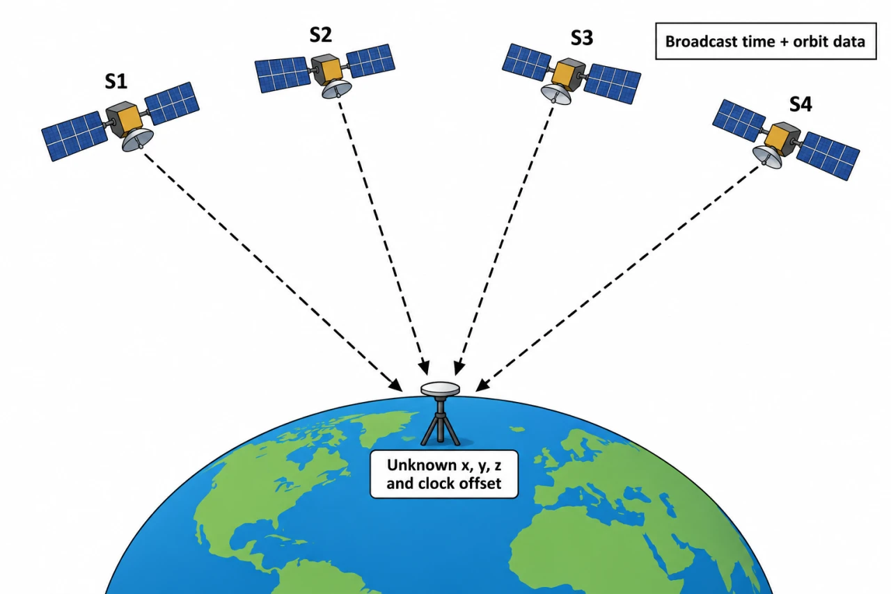
myAudience original imagegen teaching illustration; illustration, not a documentary photograph. · Original generated illustration; scientific and publication acceptance pending independent review.
GNSS: solving for position and a clock
Navigation satellites broadcast timing signals and orbit information. A receiver identifies a code and estimates how late it arrives relative to its local clock. Multiplying apparent travel time by c gives a pseudorange, not yet a geometric distance, because the receiver clock is not perfectly synchronized.
In the ideal three-dimensional model, each observation satisfies ρi = distance from receiver to satellite i + c b, where b is receiver clock offset in seconds. Unknown x, y, z and b require at least four independent useful observations. Satellite geometry matters: four nearly redundant directions do not provide the same precision as a well-spread set.
The receiver listens; a normal GNSS position solution does not require it to send a ranging request back to the satellite. Satellite clock/orbit corrections, atmosphere, multipath and receiver noise complicate the model. Additional signals support estimation and consistency tests, rather than magically canceling all errors.
A timing bias of 1 µs corresponds to 300 m of pseudorange using c = 3.00 × 10⁸ m/s. That is not automatically a 300 m error in every position coordinate: a common clock term is estimated alongside position. Signal-specific residual errors and geometry determine the resulting positional uncertainty.
Four inward dashed arrows run from separate satellites to a receiver; no ranging request is drawn going back up. The four unknowns label distinguishes three position coordinates from receiver clock offset. The picture is not a scaled orbit geometry or a four-satellite accuracy certificate; the worked one-dimensional analogy uses different coordinates explicitly.
For discussion, navigation benefits can be separated from persistent tracking. What location retention and sharing should an application justify, and how can a user challenge a misleading position? A receiver’s ability to compute location does not require publishing that location or treating it as perfectly accurate.
Image: illustration, not a documentary photograph.
Worked example: Use an invented one-dimensional two-satellite analogy. Satellites are at x = 0 and 30,000 km; receiver lies between them. Pseudoranges are 12,000.3 km and 18,000.3 km. Find receiver x and common clock offset.
ρ1 = x + cb; ρ2 = 30,000 − x + cb, with all lengths in km.
Add: 30,000.6 = 30,000 + 2cb, so cb = 0.3 km = 300 m and b = 1 µs.
Subtract: ρ1 − ρ2 = 2x − 30,000 = −6000 km; x = 12,000 km.
Answer: x = 12,000 km; receiver clock is ahead by 1 µs under the declared positive-bias convention. This is an algebra analogy, not an Earth navigation algorithm.
Check your understanding: 1: Add 0.6 km to both pseudoranges; what changes? 2: Instead add 0.6 km to only the first; solve both unknowns and explain why four satellites in 3D are not a blanket accuracy guarantee.
Answer: Common addition leaves x unchanged and raises cb to 0.9 km (3 µs). First-only addition gives x = 12,000.3 km and cb = 0.6 km (2 µs). Independent errors can leak into both position and clock; real 3D geometry and correction errors still matter.
Why: Credit requires simultaneous equations and an explicit sign convention; treating all pseudorange bias as coordinate error misses the clock unknown.